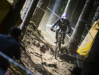
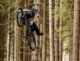
The Straight One
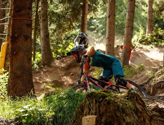
A fast and technical downhill track!
Severe Mountain Biking
- Distance
- 3 km
- Ascent
- 0 m
- Descent
- 521 m

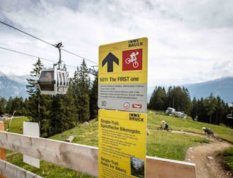
Explore Muttereralm – Mutters/Götzens with curated guides of the best mountain bike trails, and more. With over 25 3D trail maps in FATMAP, you can easily discover and navigate the best trails in Muttereralm – Mutters/Götzens.
No matter what your next adventure has in store, you can find a guide on FATMAP to help you plan your next epic trip.
Get a top trail recommendation in Muttereralm – Mutters/Götzens from one of our 8 guidebooks, or get inspired by the 25 local adventures uploaded by the FATMAP community. Start exploring now!

A fast and technical downhill track!
Severe Mountain Biking
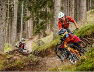
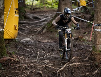
An exciting varied and natural trail in the woods.
Difficult Mountain Biking
Downhill fun for the whole family!
Easy Mountain Biking
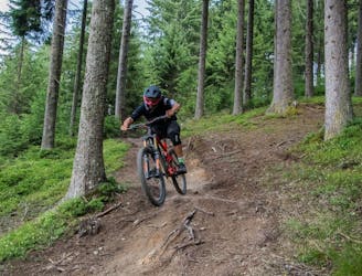
Natural technical singletrack.
Severe Mountain Biking
Fast, playful, winding trail.
Difficult Mountain Biking
Competition Track of deuter Downhill presented by Raiffeisen Club 2021
Extreme Mountain Biking
A medium difficulty, circular route on the southern side of the Inn Valley. The elevation gain is just under 900m, but all the uphill is covered in the first half, allowing for an easy finish after lunch!
Moderate Mountain Biking
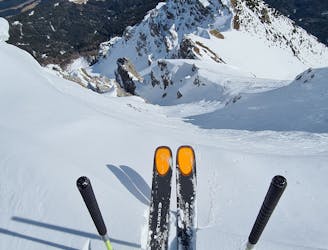
An exciting ski line which is visible from virtually all of Innsbruck city centre.
Severe Ski Touring

A short off piste line which provides some nice skiing but is mainly used as a way to access the Götzens ski area.
Easy Freeride Skiing

https://www.runskitirol.com/skimo/fotscher-express
Difficult Ski Touring
Our highlight for advanced riders. The jumpline lets you fly 14x high. The tables, shark fins, road gaps and even more play freedoms make the hearts of all airtime lovers beat faster.
Difficult Mountain Biking
Nice and complete line easy to access above innsbruck
Difficult Ski Touring
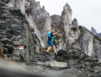
Directly in the backyard of Innsbruck you’ll find a Skyrace route which gives you everything you can wish for! Starting at the Muttereralm Talstation, where you also can get easily with public transport, you head up straight through the forest. Reaching Mutteralm you can refresh with water and keep on going up direction next hut, which is Birgitzköpflhaus. Conquering this route, also make sure, that the weather is stable and no thunderstorm is approaching, cause the next kilometers are slow, challenging and exposed. But definitely worth it! Still going up you already can imagine where the peak of Saile is, but you never really can see the summit cross on your way up. The last vertical meters getting a bit flatter and you’ll finally see the peak of Saile, which is one of the favorites of Innsbrucks inhabitants and especially students who are spending nights up there. The downhill back to the starting point is pretty rough and challenging but Skyrunners will love it. On the way down you also will collect a few more vertical meters, but the hard part is done and you can enjoy flying back to the valley.
Difficult Trail Running

Single trail variant of The Chainless top section.
Moderate Mountain Biking

The last push - from Muttereralm to the peak!
Difficult Ski Touring
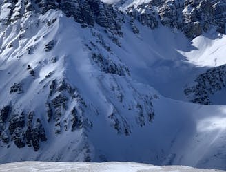
Technically easy loop mostly piste with nice off-piste descent at Mairrinne Nockspitze.
Severe Ski Touring