
The Best Hiking Trails in Trentino-Alto Adige
Explore Hiking TrailsTop 15 hiking trails in Trentino-Alto Adige
Page 1 of 1
1


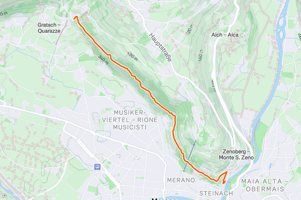
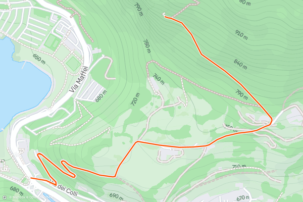
Tappeiner Promenade
The Tappeinerweg or Tappeiner Promonade is probably the most popular walk in Merano. It's more of a tourist walk than a hike but is popular with local runners. The path crosses a couple of hundred metres above the city and goes from one end of it to the other....
2


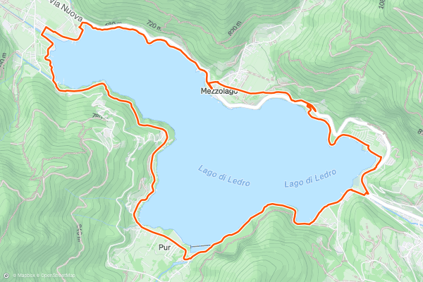
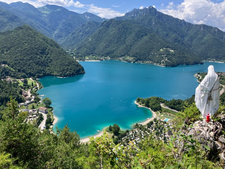
The Tour of Lago di Ledro
This hike is about as easy as they come but the rewards for your minimal effort in doing it are extremely high. Being circular the route can be started and finished anywhere you choose, but it's drawn here starting from Molina because that is the first point you reach when driving up from Lake Garda, the place from where most people arrive at Lago di Ledro....
3


Stubaital to the Sulzenauhütte
The Sulzenauhütte is spectacularly perched high above the Stubai Valley and visiting it is a popular day hike. However, the hut is also the launchpad for a huge 3 day adventure across the highest peaks of the Stubai region - the crossing of the Wilder Freiger, the Wild Pfaff and finally the Zuckerhütl....
4


Madonna di Besta
Hikes don't come with a much better effort:reward ratio than this! The hike up to Madonna di Besta is not well signposted and seems relatively unknown despite its ease and proximity to civilisation....
5


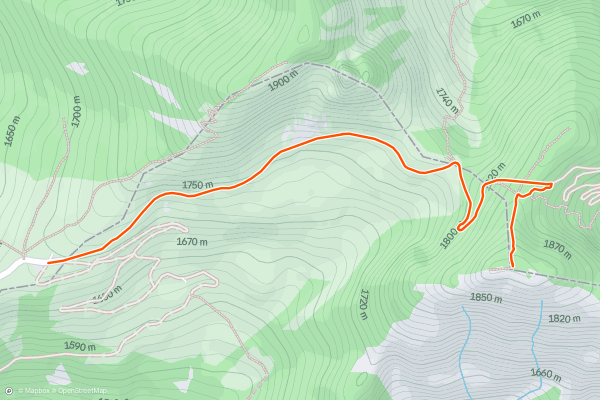
Corno della Marogna
If you only have a couple of hours and want to see what the fuss around the Tremalzo Pass is all about, this little hike will clear things up. Park at the pass and follow the clear, bumpy jeep track north-east underneath Monte Tremalzo....
6


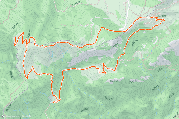
Tremalzo Tour and Cima Avèz
In a strong field, this is likely the best multi hour hike that can be done from the Tremalzo Pass. The views throughout are spectacular and even in the height of summer the trail is generally quiet and peaceful....
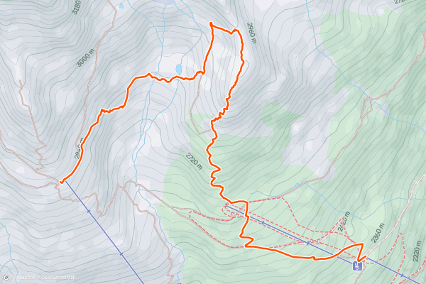
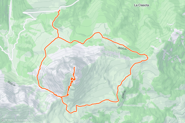
7


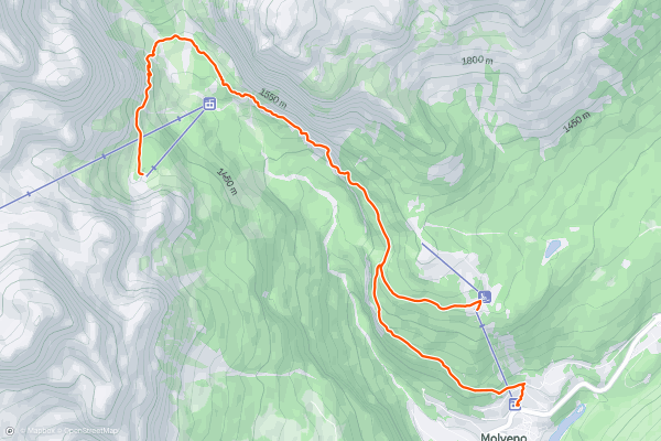
Pradèl - Rif. Selvata - Molveno
The Dolomites are well known for their beauty on a sunny summer day as well as dressed up in white. This small portion of the Dolomites is located in Trentino - known as Brenta Dolomites - and will keep your eyes busy for a while....
8


Vent to the Breslauer Hütte via the Wildes Mannle
The impressive Wildspitze (3772m) is the highest peak in Tirol, and the second highest in Austria, second only to the mighty Großglockner, so a great tick on any mountaineer’s list.
The recommended and most enjoyable route up, as described here, is easily achieved in 2 days, with an extra 3000m peak en route, and an overnight stop at the Breslauer Hütte....
9


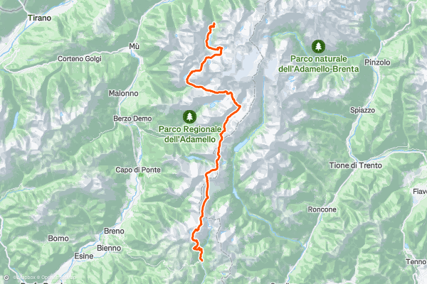
Alta Via dell'Adamello
Cross the Adamello Nature Park in the heart of the Rhaetian Alps on this high alpine trail. From start to finish you barely brush past signs of modern civilisation, hopping from remote mountain hut to remote mountain hut where you can enjoy traditional hearty Italian alpine cuisine at the end of each day’s long hike....
10


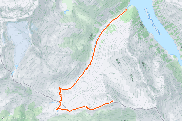
Rotbachlspitze
This is a classic hike to a summit which feels wild and remote despite being climbable in one (big) day. It is accessed from the Schlegeisspeicher lake which can be reached by bike, bus or car (via a €14 toll road) and is incredibly beautiful....
11


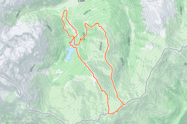
Hoher Lorenzenberg via Koatnerberg
12


Peitlerkofel / Sass de Putia
Ever so slightly detached from the various other massifs that make up the Dolomites, the Peitlerkofel/Sass de Putia (like most mountains in the Dolomites it has a German and an Italian name) is a wonderful peak which can be climbed and circumnavigated in one day, and what a day it is!
Park up on the Würzjoch/Passo della Erbe col, next to the Ütia de Börz hotel....
13


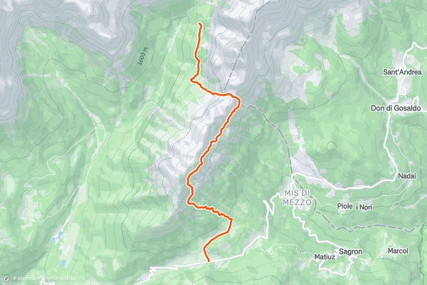
Alta Via 2 - Rifugio Treviso to Passo Cereda
Starting Location: Rifugio Treviso
Ending Location: Passo Cereda
Optional Routes: (A) To avoid the massive traverse to Passo Cereda
Regional Map: Tabacco Map 022
Path Numbers: 718
Places to eat/drink on route: None
After the night at Rifugio Treviso, the path enters some wild terrain for the day....
14


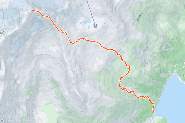
Olperer
Start your day at the parking lot next to the Schlegeisspeicher and follow the road southwestwards along the reservoir lake crossing the Riepenbach stream.
You will encounter a pathway directing you northwesterly through the forest and then in switchbacks through mountain pine fields upwards near the stream....
15


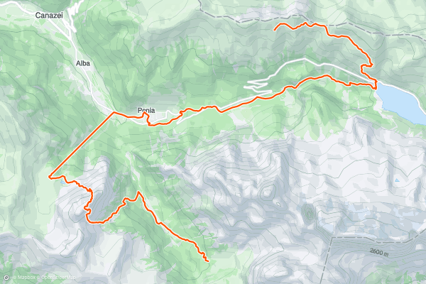
Alta Via 2 – Rifugio Viel dal Pan to Rifugio Contrin including Monte Colac (2,715m) Summit via Dei Finanzien Via Ferrata
Starting Location: Rifugio Viel dal Pan
Ending Location: Rifugio Contrin
Optional Routes: (A) Take path 602A to avoid via ferrata and follow signs for Rif. Contrin
Regional Map: Tabacco Map 07
Path Numbers: 601, 605, Alba – Ciampac Gondola, 646, 602
Places to eat/drink on route: Rifugio Castiglioni, Penia
Another big day on the AV2 and another via ferrata that gets the arms pumping....
Page 1 of 1
Top regions for hiking trails on Strava
- Alpe Devero
- Aoste
- Ascoli Piceno
- Belluno
- Bormio
- Bozen
- Bressanone
- Campo Imperatore
- Champoluc
- Civetta
- Colletta
- Cortina d'Ampezzo
- Courmayeur
- Cuneo
- Dolomites
- Dolomiti Paganella
- Drei Zinnen Dolomiten
- Finale Ligure
- Forni di Sopra
- Genova
- Gran Paradiso
- Imperia
- L'Aquila
- Livigno
- Massa-Carrara
- Riserva Bianca – Limone Piemonte
- S. Martino di Castrozza / Passo Rolle
- San Pellegrino
- Sappada
- Savona
- Siena
- Sondrio
- Trentino-Alto Adige
- Trento
- Turin
- Udine
- Verbano-Cusio-Ossola
- Vercelli
- Via Lattea
- Viterbo