6 km away
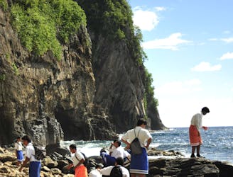
Tuafanua Trail
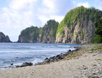
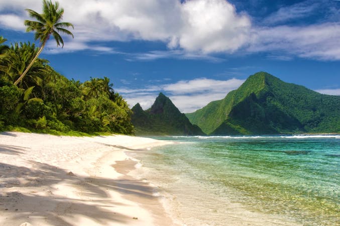
Scramble up and down through thick rainforest to find a truly isolated, cliff-lined beach.
Severe Hiking
- Distance
- 2 km
- Ascent
- 94 m
- Descent
- 94 m
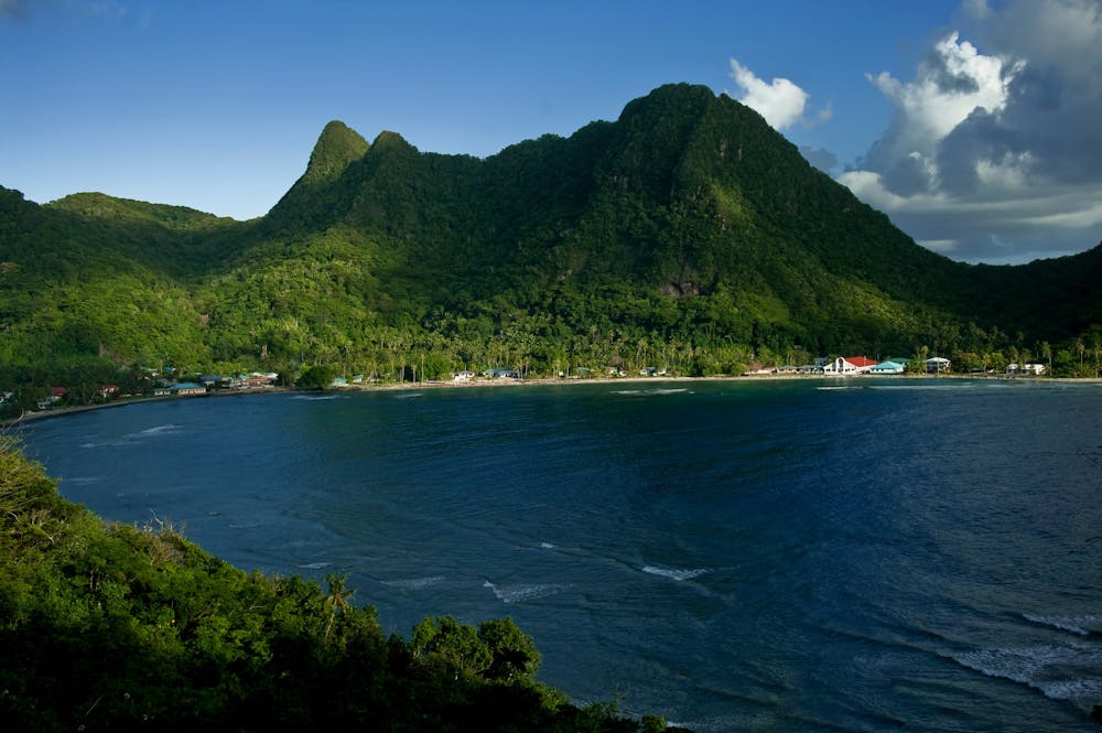
One of American Samoa’s must-do hikes, this wide trail through the jungle leads to panoramic views atop the island’s central mountain.
Hiking Moderate

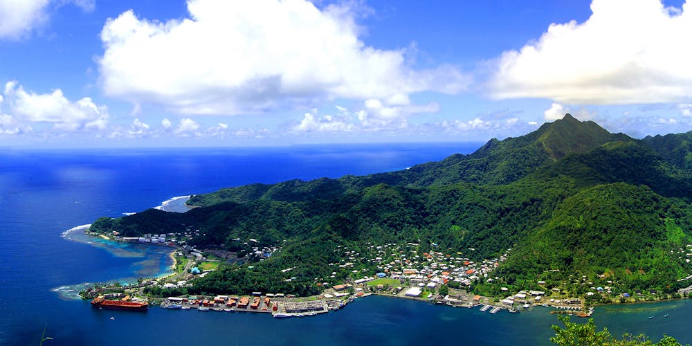
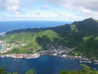
Mount Alava is the second highest mountain of American Samoa and forms the steep backdrop of the capital city Pago Pago. There is more than one way to reach its summit, but this trail, called simply the Mount Alava Trail, is the simplest and most popular. It begins from the road at Fagasa Pass, with a small parking area and signed trailhead. From there, it climbs the long west ridge of the mountain through lush rainforest with occasional ocean views.
The trail is actually a 4-wheel drive road, so it’s wide and grassy and never too steep, but it may still be overgrown or muddy in places. The mowed track makes a corridor through dense jungle, with hundreds of plant species for the keen eye to identify. Look among the greenery for splashes of color in flowers, fruits, insects, and birds. You might even see Samoa’s giant fruit bats, with better chances later in the day. The national park has added a handful of interpretive signs along the trail, so you can learn more about the surrounding flora and fauna.
The path reaches a grassy clearing near the top, then a metal staircase leads to the summit, where a panoramic view awaits. You’ll look down on Pago Pago Harbor and the village, and over rolling green ridges across the island. On a clear day, you can see across the ocean to other islands of Samoa. Also at the top of the stairs are some dilapidated structures from the old tramway. From there, you can continue on a path around the signal towers to find a fale (circular shelter), which makes a nice spot for a summit picnic.
Sources: https://www.nps.gov/npsa/planyourvisit/upload/Day-Hikes-SBNPSAhigh-res.pdf https://chasingabandon.com/hiking-the-national-park-of-american-samoa/ https://youtu.be/3-HRspqVNuQ
Moderate
Hiking along trails with some uneven terrain and small hills. Small rocks and roots may be present.

The trail contains some obstacles such as outcroppings and rock which could cause injury.
Away from help but easily accessed.
6 km away
Scramble up and down through thick rainforest to find a truly isolated, cliff-lined beach.
Severe Hiking
6.5 km away
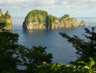
Short walk to the sea cliffs at the tip of Tutuila Island and a view of Pola Island.
Easy Hiking
6.7 km away
One-of-a-kind adventure in the national park, scaling many ropes and ladders through thick jungle to reach the top of Mount Alava.
Severe Hiking
6.8 km away
Interpretive trail through lush rainforest to a coastal panorama, with the option to scramble down the rocks and swim in deep tide pools.
Moderate Hiking
7 routes · Hiking

63 routes · Alpine Climbing · Hiking