1.2 km away
Porters Pass and Colliers Causeway, Blackheath

A beautiful loop that manages to avoid the crowds drawn to Blackheath and offers beautiful views for locals and visitors alike.
Moderate Hiking
- Distance
- 4.6 km
- Ascent
- 246 m
- Descent
- 246 m
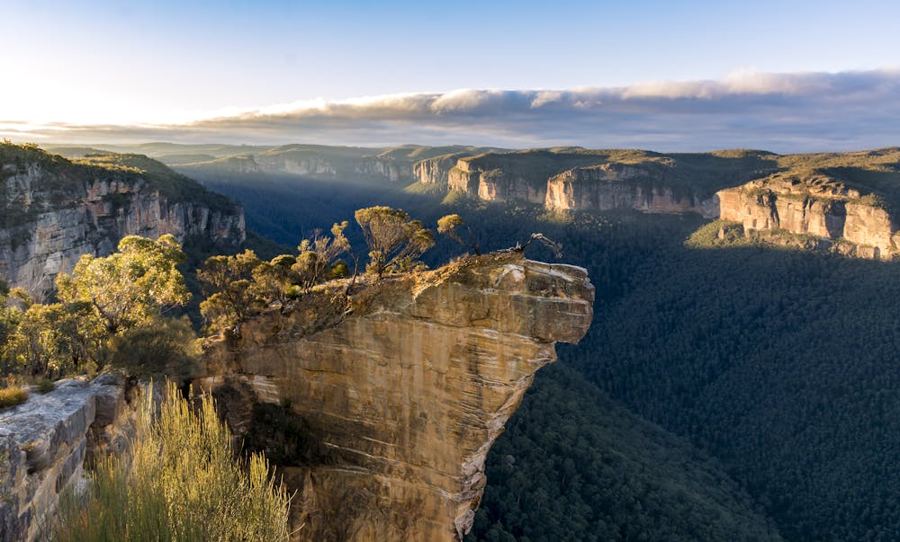
While this easy out-and-back trail might not be the most beautiful in the Blue Mountains, the views out over Hanging Rock are well worth it.
Hiking Easy

Easily accessed, the Burramoko Fire Trail is a popular 8km (1-2 hour) hike through heathland and open forest. And while the trail itself is (comparatively) unimpressive, it is a haven for local wildlife and some spectacular plants.
But wildlife spotting isn't the real reason people head out on this hike: they come for the view. At the end of the trail is Hanging Rock - a dramatic rocky bluff with spectacular views over the Blue Mountains.
Having enjoyed the vista, follow the same trail back to the start / end point at Blackheath.
Hiking conditions in the Blue Mountains are variable and have been affected by recent bush fires and heavy rainfall. Check the NPWS website to confirm conditions before setting out.
Easy
Walking along a well-kept trail that’s mostly flat. No obstacles are present.

Close to help in case of emergency.
1.2 km away
A beautiful loop that manages to avoid the crowds drawn to Blackheath and offers beautiful views for locals and visitors alike.
Moderate Hiking