1.7 km away
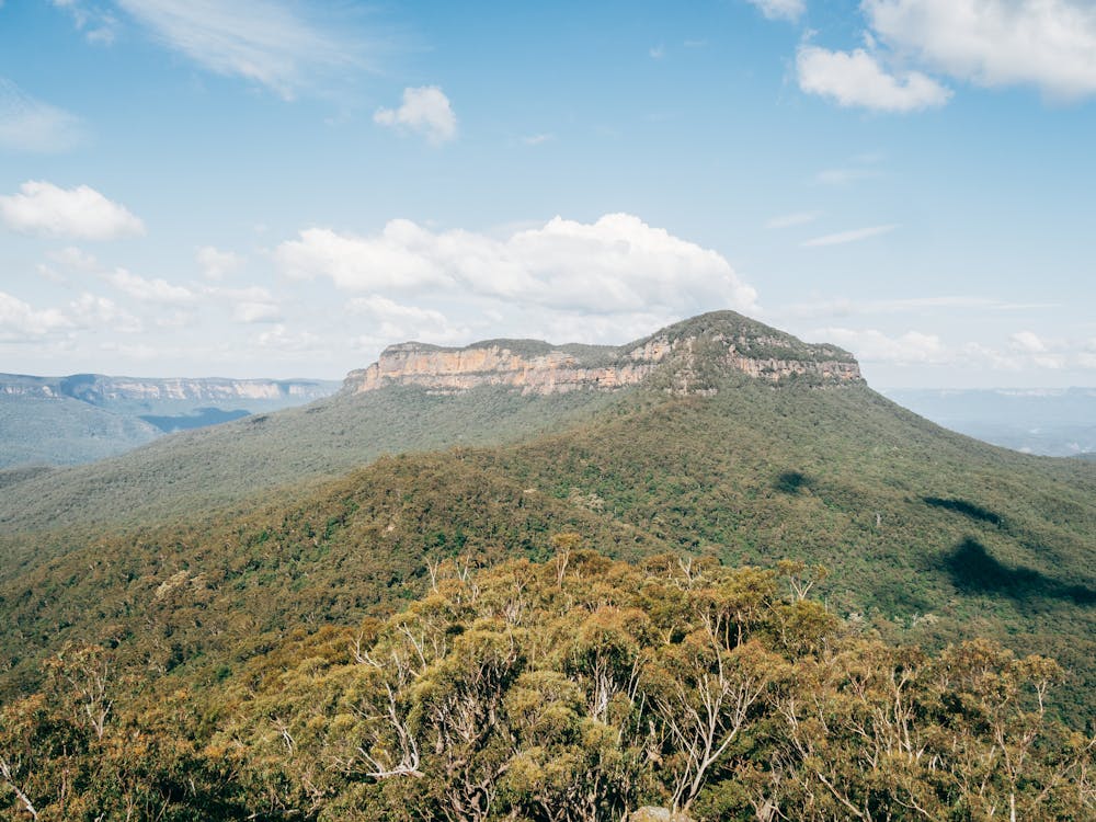
Lindeman Pass, Blue Mountains

Exposed, hard to follow, not for the faint-hearted, but for those who tackle Lindeman Pass, the adventure is worth it.
Severe Hiking
- Distance
- 9.2 km
- Ascent
- 1.4 km
- Descent
- 1.4 km
A challenging, multi-day hike boasting spectacular views, bush camping and a variety of native forests.
Hiking Extreme

One of the most challenging hikes in the Blue Mountains, the Mount Solitary track loops through cool temperate rainforest and tall Eucalyptus forests on its way through some spectacular landscape. Either done as an overnight hike, or over three days, it is a challenging and remote track that rewards experienced bushwalkers.
Starting out at Katoomba Falls, hikers descend the Furber Steps to Federal Pass and follow the relatively easy track towards Ruined Castle. A 7km hike, this is the stopping point for those tackling the track over three days.
If you are attempting to complete the route in two days, there are basic campsites along the route.
Hiking up the Korowal Knife Edge, there are a series of spectacular viewpoints as you head towards Mount Solitary. After summiting the mountain (950m), begin the descent to the Kedumba River.
Beyond the river the trail forks - take the Sublime Point Trail that heads back towards Katoomba. Skirting the river, and passing by a series of waterfalls, the trail winds its way back up to Katoomba, with a variety of alternative routes available as you near the town.
Hiking conditions in the Blue Mountains are variable and have been affected by recent bush fires and heavy rainfall. Check the NPWS website to confirm conditions before setting out.
Extreme
Scrambling up mountains and along technical trails with moderate fall exposure. Handholds are necessary to navigate the trail in its entirety, although they are not necessary at all times. Some obstacles can be very large and difficult to navigate, and the grades can often be near-vertical. The challenge of the trail and the steepness of the grade results in very strenuous hiking. Hikes of this difficulty blur the lines between "hiking" and "climbing".

The path is on completely flat land and potential injury is limited to falling over.

In the high mountains or remote conditions, all individuals must be completely autonomous in every situation.
1.7 km away
Exposed, hard to follow, not for the faint-hearted, but for those who tackle Lindeman Pass, the adventure is worth it.
Severe Hiking
5.6 km away
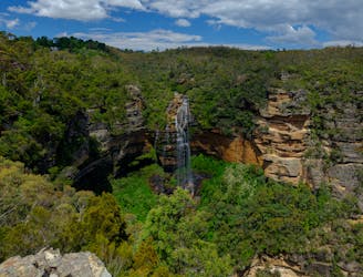
Moderately challenging, this 6.2km loop showcases the best of the Blue Mountains scenery, not to mention waterfalls... lots of waterfalls.
Moderate Hiking