6.5 km away
Niederer Rumpler
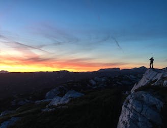
Hike to an exposed point above the Gjald Alm Hut.
Severe Hiking
- Distance
- 4.3 km
- Ascent
- 283 m
- Descent
- 283 m
A hiking tour like no other. As you walk around the Hohen Sarstein, situated between the Aussee region and the Inner Salzkammergut, there are thousands of years of history to be experienced. The route is 45.5 km long and is sign-posted throughout. There are many points of interest along the way.
Hiking Difficult

The five stages of the "Salzkammer Trail" lead you through a fascinating landscape which has been declared a UNESCO World Heritage site. First of all the "Route through the wilderness" "leads you from the Koppenrast inn at Obertraun along the Koppentraun to the Sommerbergersee (lake). This stretch takes around 4 hours. Then we begin the "Historic Salt Trail" to the remote woodland graves near Altaussee (1 hour). Continuing now along the "Römerweg" we reach the Kriemoos in 2 hours. This is situated on the "Goiserer Almweg" and brings us to Au near Bad Goisern (1 hour). The final section of our walk takes us along a stretch which has been declared part of our"World Heritage" along the eastern shore of Lake Hallstatt to Obertraun (about 3 hours). Final stopping off point is the Koppenrast (1 hour) which was our starting point. Mountain rescue:140
Difficult
Hiking trails where obstacles such as rocks or roots are prevalent. Some obstacles can require care to step over or around. At times, the trail can be worn and eroded. The grade of the trail is generally quite steep, and can often lead to strenuous hiking.

The trail contains some obstacles such as outcroppings and rock which could cause injury.
Away from help but easily accessed.
6.5 km away
Hike to an exposed point above the Gjald Alm Hut.
Severe Hiking