Rund um den Gosaukamm
Dachstein Salzkammergut
Dolomite magic in the Salzkammergut!
Hiking Difficult
- Distance
- 21 km
- Ascent
- 1.5 km
- Descent
- 1.5 km
- Duration
- 6-7 hrs
- Low Point
- 932 m
- High Point
- 2 km
- Gradient
- 18˚
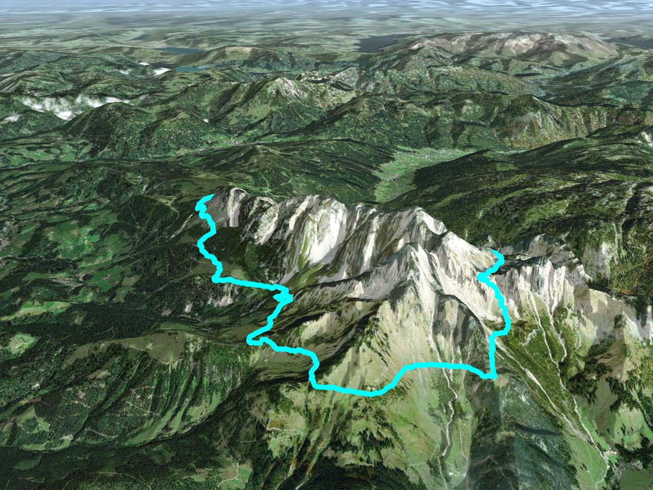
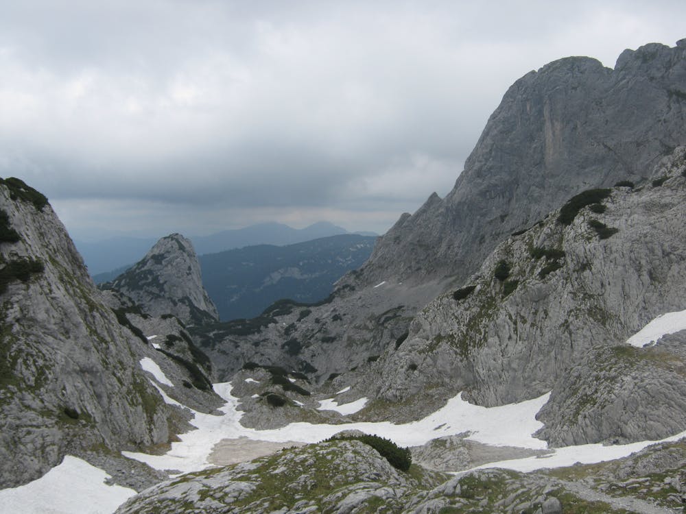
Landscape uniquely beautiful two-day tour around a wildly rugged mountain range. Well laid out, but in places rocky and exposed paths, some of which are secured by short passages, the circuit around the Gosaukamm is a "classic" among the alpine high-altitude trails. Gentle and rough are here often only a stone's throw away from each other. The probably most beautiful place of this tour can be reached on the Steiglpass, where one comes quite close to the strikingly shaped Bischofsmütze. Since 1993, the highest mountain of the Gosaukamm has been poorer around large parts of its south and east wall - the yellow demolition area, which reminds us of this century landslide, still sends rockfall salvos into the depths. We first hike from the cable car station to the nearby Gablonzer Hütte and on to the path division in the Unteren Törlecksattel. On the Austria trail leading down to the right through rocky grass slopes and a piece of forest to the Stuhlalm (the nearby Theodor-Körner hut is hidden in the forest). Over the grass ridge above the alp (Mooseben) into the mountain pine covered grubach under the chair hole and through a narrow gorge made passable with wooden steps and steel rope ("passage") up to the Jöchl. Then almost level under the rocky foothills of the Bischofsmütze (steel cables) to the Mahdalmriegel, there to the left and through the wide grass and scree slopes above the Sulzkar and Retteneggalm to the Hofpürglhütte, already visible from afar. Continue on the Linzer Weg (No. 612 or 601) into the huge rubble basin under the Bischofsmütze. Turn left there, through the slope to the foot of the wall and over exposed rock bands secured with steel ropes onto the Steiglpass. On the north side, the footpath leads through stepped karst terrain down into the rocky high valley between the Großwand and the Kopfwand. Through the ice pit into the Ahornkar covered with mountain pines and - passing under the Weitgries - to the Hintere Scharwandalm (memorial site). Over a steeper forest slope we arrive at a historic hunting lodge and through the outlet of the giant chamois filled with rubble to the Scharwandhütte below. On the inclined forest ramp above the Vorderen Scharwand downhill, at the following division to the right and through the rubble field below the Strichkogel to the Seeklausalm at the Vorderen Gosausee. To the right over the dam wall to the guesthouse or the valley station of the cable car. "Order hiking maps to the Dachstein Salzkammergut region ... https://www.dachstein-panorama.at/?s=pano68545&utmsource=tourdata&utmmedium=textlink&utmcampaign=tourdata360tour" https://www.dachstein-panorama.at/?s=pano68545&utmsource=tourdata&utmmedium=textlink&utmcampaign=tourdata360tour "To the 360° panorama tour through the Gosau valley ....http://dachstein.salzkammergut.at/kartenbestellung: "Mountain rescue: 140
Difficulty
Difficult
Hiking trails where obstacles such as rocks or roots are prevalent. Some obstacles can require care to step over or around. At times, the trail can be worn and eroded. The grade of the trail is generally quite steep, and can often lead to strenuous hiking.