3.8 km away
Blue Line
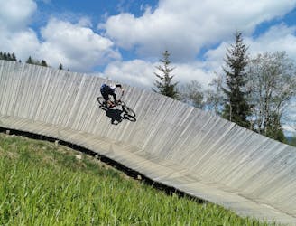
An easy trail to start with in Hinterglamm area!
Difficult Mountain Biking
- Distance
- 2.8 km
- Ascent
- 0 m
- Descent
- 428 m
The perfect MTB tour
Also in Tirol, Austria
Mountain Biking Extreme

This trail offers a beautiful natural tour & enduro track, embedded in extraordinary mountain scenery. It comprises of a delightful blend of small cross-country trails, water crossings, light roots and stone fields. The trail ends at the end of the valley from where you can comfortably cycle back to Saalbach Hinterglemm or continue to the Ossmannalm Trail, should your legs still be up for it.
Extreme
Very steep, difficult, narrow singletrack with widely variable and unpredictable trail conditions. Unavoidable obstacles could be 15in/38cm tall or greater, and unavoidable obstacles with serious consequences are likely to be present. Obstacles could include big rocks, difficult root sections, drops, jumps, sharp switchbacks, and more. Ideal for expert-level riders.
3.8 km away
An easy trail to start with in Hinterglamm area!
Difficult Mountain Biking
8.8 km away

A route top to bottom, connecting two amazing flow trails!
Moderate Mountain Biking