4.6 km away
Niederer Rumpler
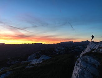
Hike to an exposed point above the Gjald Alm Hut.
Severe Hiking
- Distance
- 4.3 km
- Ascent
- 283 m
- Descent
- 283 m
Easy hiking tour in a beautiful landscape!
Hiking Difficult

From the railway station Obertraun we firstly walk on the east shore footpath by the lake Hallstatt. Soon we turn right-under the railway up a narrow path to the Lichtstein. Then we take the Höhenweg till we reach the Koppenstreet which we follow till the railway station Obertraun Koppenbrüllerhöhlen. On the right across the bridge there is one of the best culinary addresses in the Salzkammergut Gasthaus Koppenrast. Don't forget to visit the Koppenbrueller Caves! It's worth it! Behind the Koppenrast we follow the way to the Koppenwinkelalm over Koppenwinkellacke. We turn right-cross the Bühlerbach and turn again right. Now we follow the way to the Gasthaus Dachsteinhof. Finally we turn right again-over the bridge to the Höll-Karl-Weg. Then left to get back to the railway station. Mountain rescue:140
Difficult
Hiking trails where obstacles such as rocks or roots are prevalent. Some obstacles can require care to step over or around. At times, the trail can be worn and eroded. The grade of the trail is generally quite steep, and can often lead to strenuous hiking.

The trail contains some obstacles such as outcroppings and rock which could cause injury.

Close to help in case of emergency.
4.6 km away
Hike to an exposed point above the Gjald Alm Hut.
Severe Hiking