
9 routes · Alpine Climbing · Hiking
The best line on Austria's highest mountain
Alpine Climbing Difficult

This is a fabulous mid-grade route which any mountain-lover will enjoy. It's a serious proposition and is often underestimated but if you're skilled and experienced enough - and get a bit of luck with conditions - this is about as good Austrian mountaineering gets. The route is littered with fixed protection but bring half a dozen wires/nuts along, in addition to slings and 7 or 8 quickdraws of varying lengths.
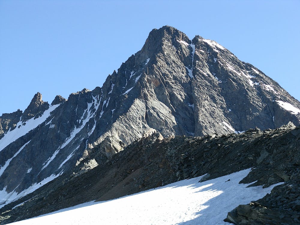
To begin the route head north from the Stüdlhütte and get onto the Teischnitzkees Glacier. Head up the righthand side of this to the foot of the Stüdlgrat ridge. The route itself begins just to the left of the ridge's toe.
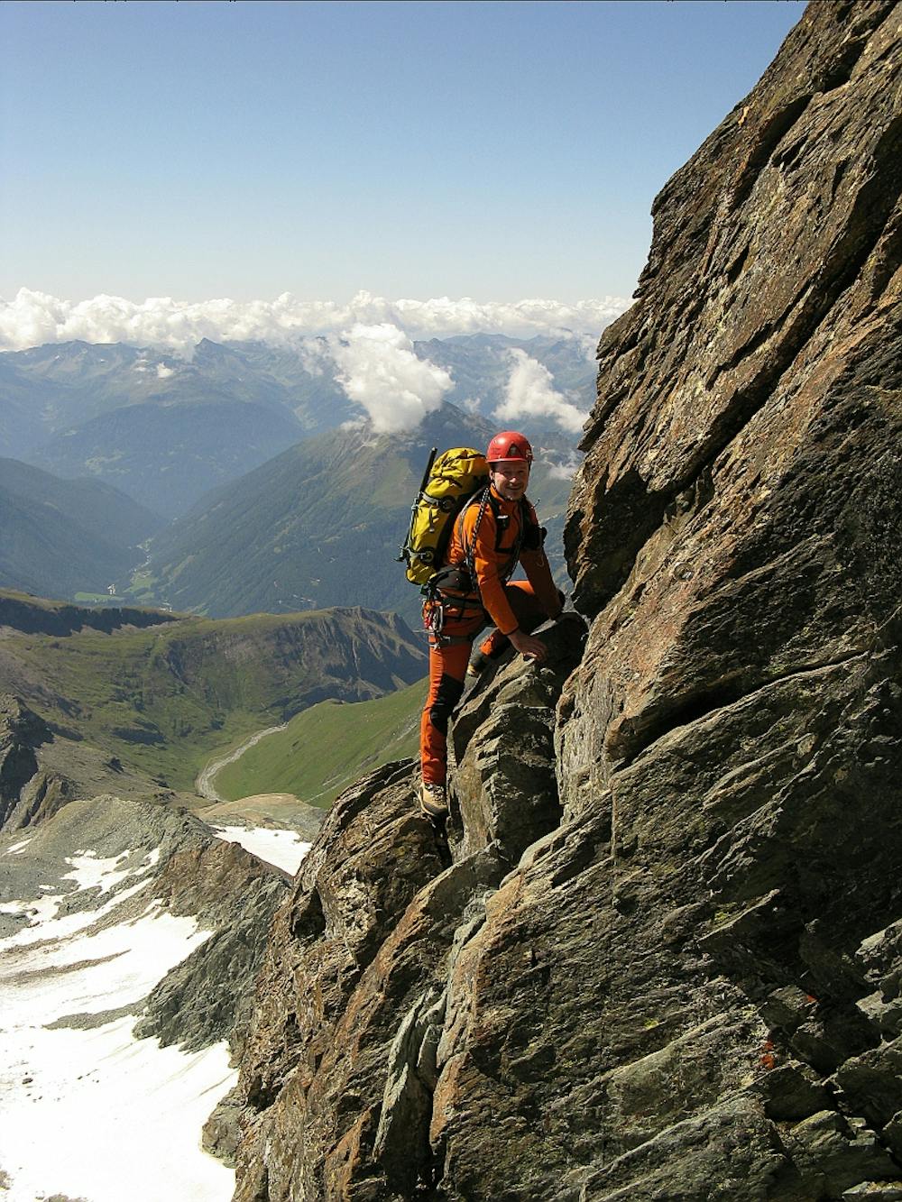
Scramble up boulder-y terrain to reach a chimney and then climb this (UIAA 2+) to reach blocky terrain just left of the ridge crest. Follow a natural line onto to the ridge crest and shortly after reaching it you'll find a yellow board right on the ridge crest, which marks the start of the real difficulties.
Climb up a leftwards leaning ramp and continue up to 2 towers - bypass them both on the western side of the ridge, using a fixed cable (UIAA 3+) to get around the second one. After the second tower there's a flat spot on the ridge which makes a good place to stop for a quick pause ahead of a steep step which marks the start of more difficulties.
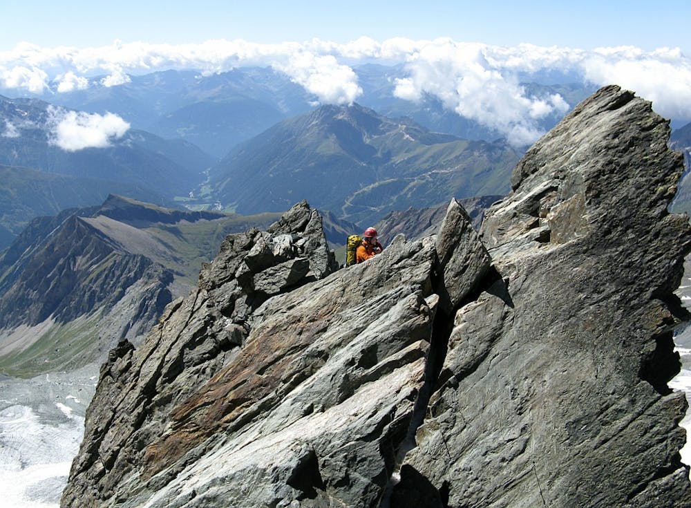
Scramble up just to the left of the ridge crest (UIAA 3) then drop off right before returning to the crest and climbing up to a slab (UIAA 3). Drop left off the ridge again before returning to the crest and then tackling a slab equipped with a cable (UIAA 3+) which leads rightwards and then comes back left to the crest. Climb the crest all the way to the summit via a series of ramps (UIAA 2) which are well equipped with various fixed gear.
Once on the summit, hand yourself a well deserved pat on the back, but remember that the descent is still to come, and it's no pushover.
Descend down south-east to the Glocknerscharte Col via some tricky and exposed down-climbing (UIAA 2) which is protected by fixed gear. From here, climb up via a fixed cable to the Kleinglockner and then continue south-east down that peak's summit ridge via some steep (40 degree) snow/ice/rock (depending on conditions) to the Kleinglocknerkees Glacier. Descend this down some steep terrain and then swing around to the Erzherzog-Johann-Hütte.
Descend down an easy via ferrata that leads southwards from the hut, cross a short section of glacier and then head down another bit of via ferrata to reach the Ködnitzkees Glacier. Descend this (using our line as a vague guide rather than a definite route) and get onto moraine and then a path which leads down the valley back to the Lucknerhütte and, soon after, the Alpengasthof Lucknerhaus.
Difficult
The beginning of truly technical terrain which might involve pitched climbing on rock and/or ice, exposed terrain and complex route finding in ascent and descent. Equivalent to AD, AD+

The route features some exposed and/or difficult to protect sections.

Little chance of being seen or helped in case of an accident.
9 routes · Alpine Climbing · Hiking