6 routes · Alpine Climbing
A multi sport day culminating in a long ridge climb up a beautifully positioned peak
Alpine Climbing Severe

This route is shown here as a mountaineering route but in many ways, it's much more than that. The day involves mountain biking, hiking and climbing, all in wonderful scenery.
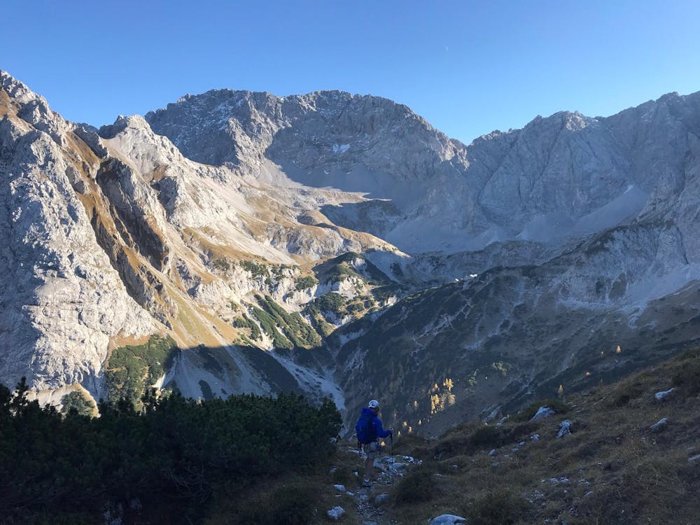
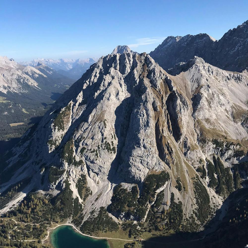
Start out by riding the Ehrwalder Almbahn lift and then bike along the jeep track to the south-east of the lift station. The jeep track climbs and descends twice and then climbs a third time up to the beautiful Seebensee lake. Leave your bikes in the trees/bushes just north of the lake and then hike around the lake and up to the Coburger Hut. Take some time to savour the stunning location of the hut and, if it's open, grab a quick drink on the terrace.
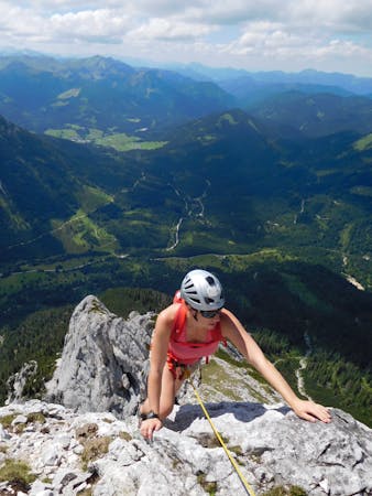
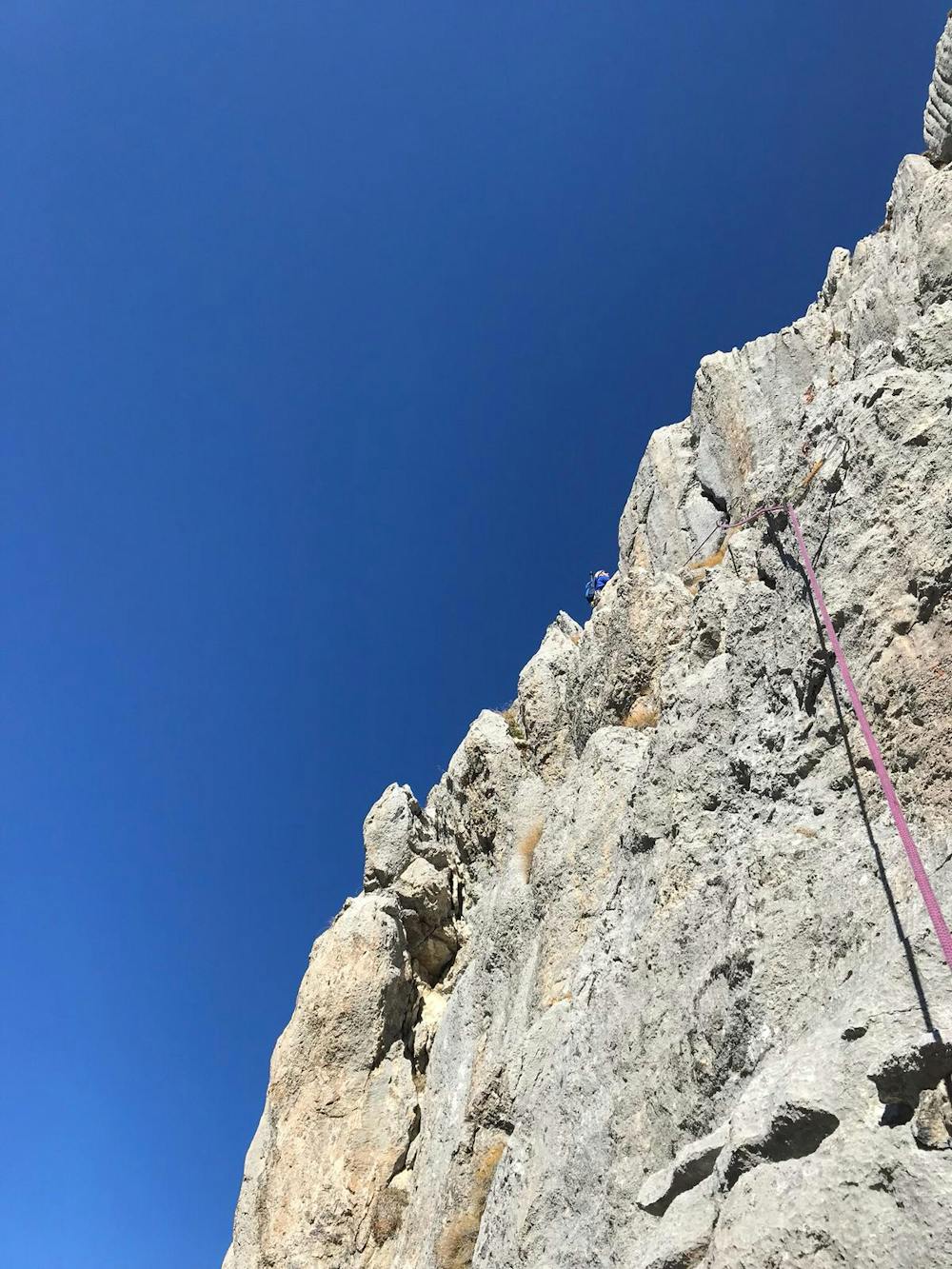
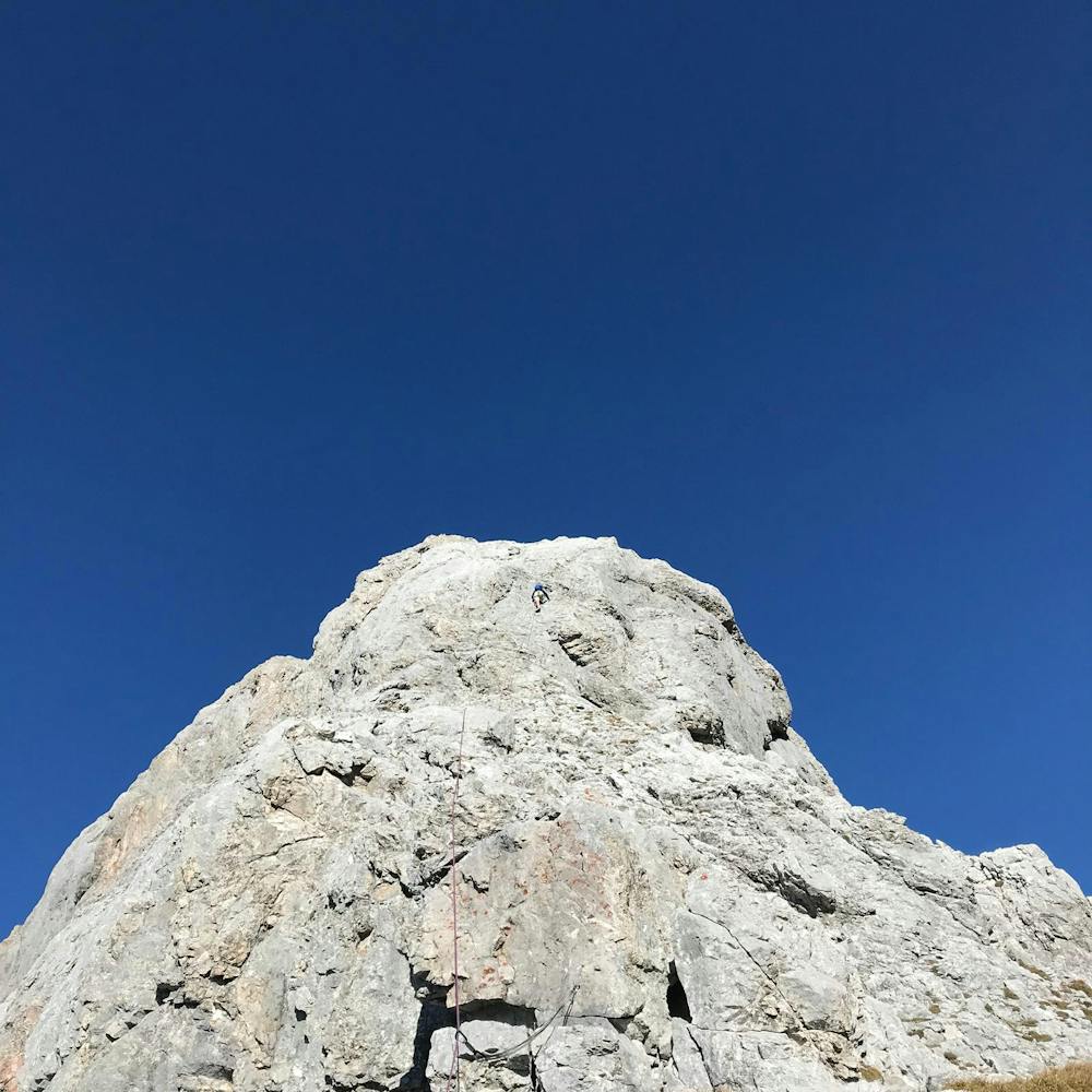
Head west on a good path that climbs up to the narrow col at the foot of the Sonnenspitze's south ridge. Make a short but very steep 10 minute hike up to the rocky foot of the ridge proper, where the climbing starts. You'll need quickdraws for the route, and a small selection of wires and cams, as well as a 50 metre rope.
The start of the first pitch is marked by a bolt and there are 2 more bolts on the blunt arete above. Climb the arete via some tricky 5b rock moves (the first of which is below the first bolt, so don't fall off it!) to a rocky ledge. Go up and left along the ledge to the far left end of a rock wall, where there is another bolt. Clip this with a longer extender quickdraw (so as to avoid rope drag) and then launch up and slightly rightwards through the grooves and cracks above (5b), clipping a couple of bolts en route, to a belay ledge. This pitch is comfortably the toughest section of the route, so once you've done it you can breathe a slight sigh of relief!
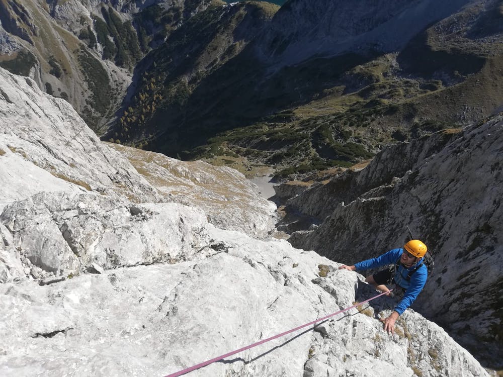
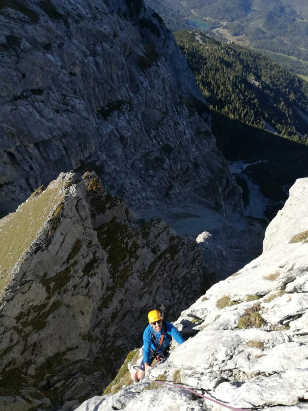
Scramble up a few hundred metres of easy grass and rock to reach a steep wall. Climb 2 x 4c pitches up this to more easy terrain. Scramble up the easy terrain for 100 metres to a third steep wall, which is climbed in one excellent 5a pitch.
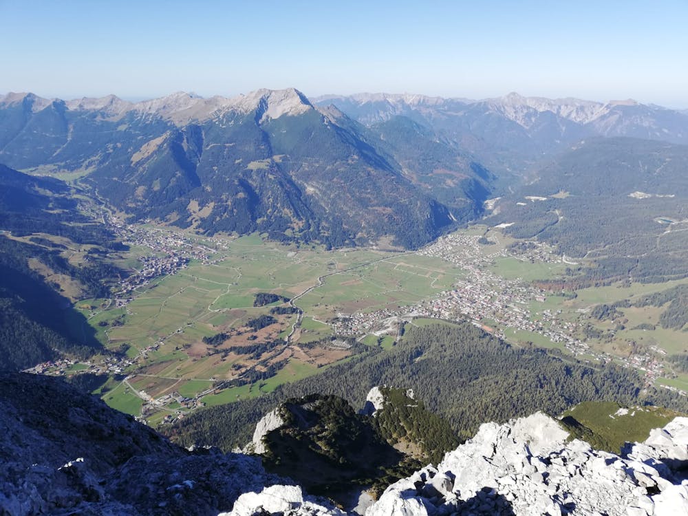
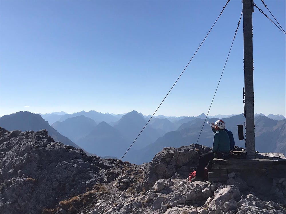
Another 100 metres of easy terrain just to the right of the ridge crest leads to a final technical pitch, which is 4b and is protected by 3 bolts. Above this, another section of fun scrambling leads onto the summit. Award yourself a pat on the back and take in the incredible vista across the mountains of Bavaria and Tirol.
The descent can be tricky to find but the key is to go north and slightly looker's left off the summit. There is a vague ridge north-northwest of the summit and this is where the descent path starts. Follow the path as it drops steeply and gradually swings around to the east. Stick with it as it drops down to Seebensee, at which point you will be reunited with your bikes. Reverse the trip to the top of the lift and then rip down the tarmac road which leads down to the carpark.
Severe
Steep, sustained and serious terrain on rock/ice. Routes will be long, exposed and possibly committing. D, D+

Much of the route is difficult to protect and a fall could be disastrous at certain points.

In the high mountains or remote conditions, all individuals must be completely autonomous in every situation.
6 routes · Alpine Climbing