1.5 km away
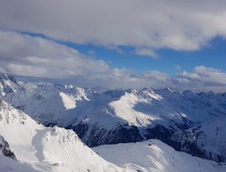
Pfannenkopf

An enjoyable south facing run over St.Christoph.
Moderate Freeride Skiing
- Distance
- 3.1 km
- Ascent
- 29 m
- Descent
- 617 m

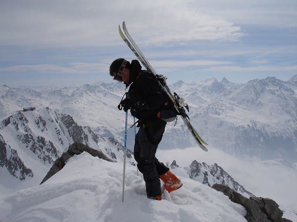
This is a popular freeride skiing route which is generally considered to be severe. It's not remote, it features medium exposure (e2) and is typically done between January and April. From a low point of 2 km to the maximum altitude of 2.6 km, the route covers 1.5 km, 8 vertical metres of ascent and 623 vertical metres of descent.
Nice steep couloir skiing in the top and a wide southface under the Schindler gondola
Severe
Steep skiing at 38-45 degrees. This requires very good technique and the risk of falling has serious consequences.

As well as the slope itself, there are some obstacles (such as rock outcrops) which could aggravate injury.

Close to help in case of emergency.
1.5 km away
An enjoyable south facing run over St.Christoph.
Moderate Freeride Skiing
2.8 km away

Superb long run with often deep powder.
Difficult Freeride Skiing
3.1 km away

Challenging terrain for the experienced on leeside slopes.
Severe Freeride Skiing
3.1 km away
Freeride tour for skiers & split-boarders
Difficult Freeride Skiing
5.3 km away

A classic Albona long wide open run finishing in the town of Stuben.
Moderate Freeride Skiing
5.4 km away

An Arlberg classic run for experienced skiers and riders.
Difficult Freeride Skiing
6 km away

Wide slopes and not too challeging in the Zurs front country.
Easy Freeride Skiing
6.2 km away

A great run in powder and spring snow.
Difficult Freeride Skiing
6.7 km away

A superb wide open run with great views. A classic Zurs freeride.
Difficult Freeride Skiing
6.7 km away

A good run for dry powder in the Zurs front country.
Moderate Freeride Skiing
10 routes · Freeride Skiing