
25 routes · Hiking
A classic high mountain hike above a gorgeous lake.
Hiking Difficult

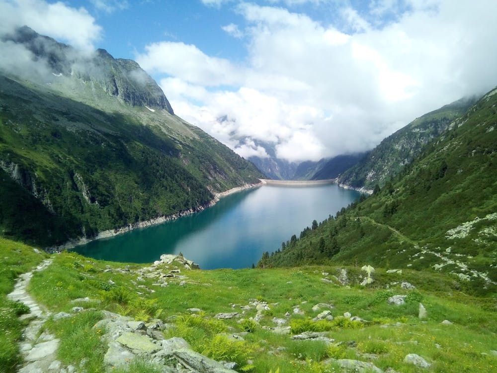
This is about as good as mountain hikes get, with 2 charming mountain huts, lake views and a high mountain ambience (including panoramas across some spectacular glaciers) all featuring.
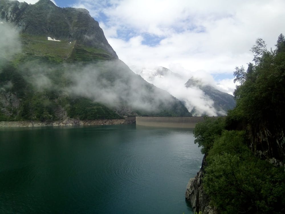
The hike begins at the Einkehr zum Adlerblick resaurant, at the northern end of the dam which holds the Speicher Zillergründl lake in place. There are 3 ways of reaching the restaurant - driving from Mayrhofen (via an €8 toll road) to Bärenbad and then riding the bus, taking the bus all the way from Mayrhofen or - for those who are super keen - cycling all the way up to the restaurant from Mayrhofen. The road biking route up to the restaurant is described in FATMAP so check it out and see if you fancy it! With this hike still to come, most people opt for the bus or bus/car option. Details of the buses (in German) can be found at -
https://www.zillertalbahn.at/page.cfm?vpath=bus/linienverkehr/linienbus-fahrplaene
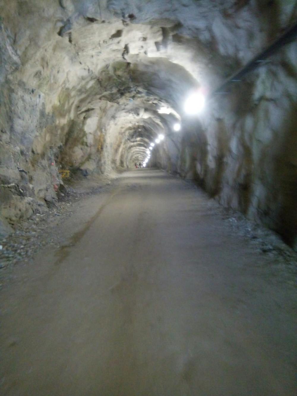
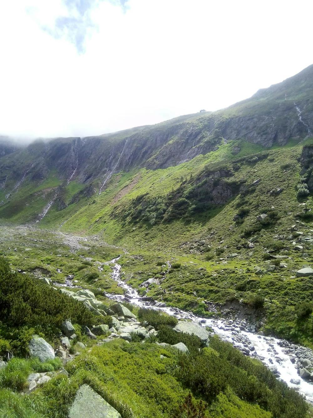
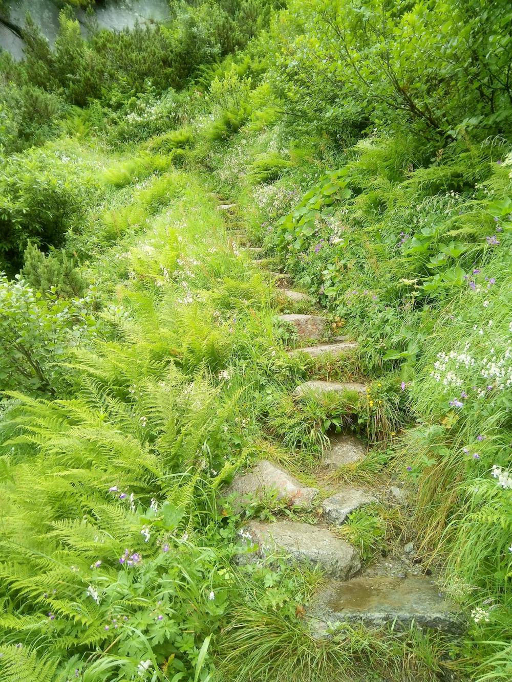
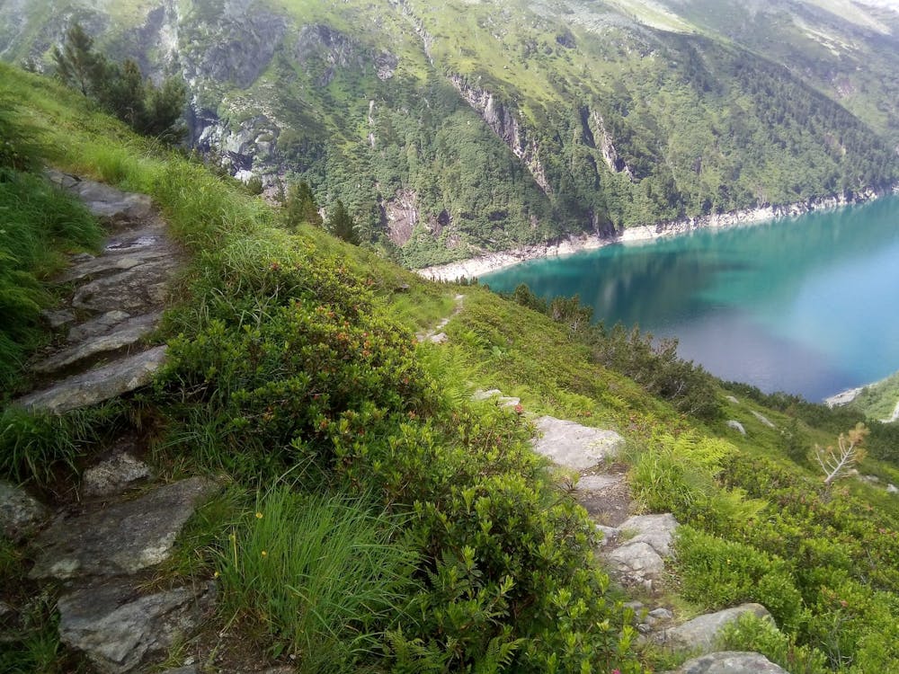
However you reach the dam, leave it and immediately enter a long tunnel on the north of the lake. Walk through this and emerge on the far side to a fabulous viewpoint. Keep hiking in the same direction and then, 20 minutes or so from dam, branch off left on a good - albeit steep - path signposted for the Plauener Hut. The path is narrow, rocky and windy; a real mountain path, in other words.
The path takes you into a subsidiary valley which you cross and then zig zag up to the hut. There are some lovely river crossing en route which take you over some old fashioned wooden bridges.
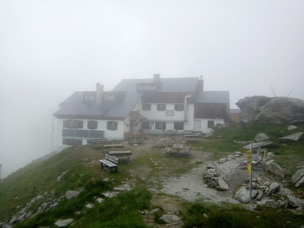
Upon arriving at the hut, which is run by the German Alpine Club, the views are epic. The hut is perched overlooking the dam, and the mountains opposite such as the Südlicher Magnerkopf. Grab some food, enjoy the excellent hospitality for a while and then continue hiking.
Head south-east out of the hut and follow a gorgeous undulating path as it traverses the hillside beneath the Hohenaukees Glacier, opposite the peaks of Rauhkofel and Kleinspitze. As the path nears the head of the valley it descends and then swings back around towards the Speicher Zillergründl lake. Stroll back towards the lake and stop for a drink at the charming Klein Tibet - Hohenaualm; a lovely little mountain hut which is home to some very un-traditional Austrian hut owners and a wide array of animals.
Having enjoyed the hospitality and views for a while, head back to the lake and then on to the dam.
Difficult
Hiking trails where obstacles such as rocks or roots are prevalent. Some obstacles can require care to step over or around. At times, the trail can be worn and eroded. The grade of the trail is generally quite steep, and can often lead to strenuous hiking.

The path is on completely flat land and potential injury is limited to falling over.

Little chance of being seen or helped in case of an accident.
25 routes · Hiking