20 m away
Glungezer Summit
A fun tour to a mountain hut and a spectacular view.
Moderate Ski Touring
- Distance
- 3.5 km
- Ascent
- 464 m
- Descent
- 464 m
A short and mellow tour close to Innsbruck served by lifts.
Ski Touring Easy

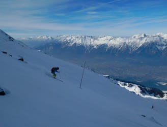
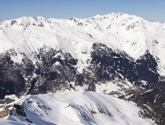
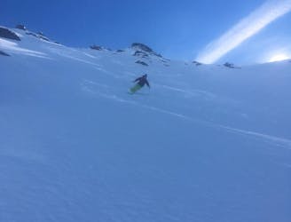
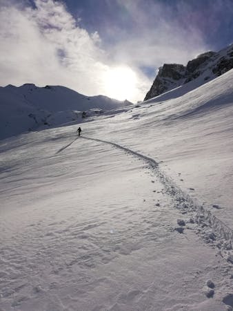
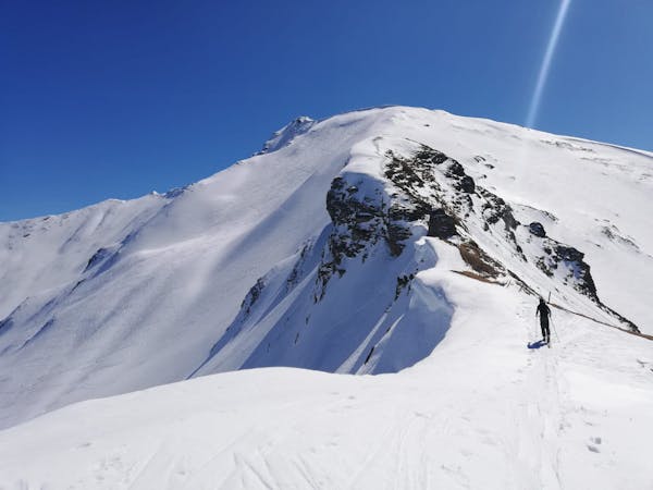
Going for a tour in the wilderness surrounded by empty valleys it is always a good choice and it never gets boring, but sometimes time is not enough to drive that far from town and - let’s be honest: it doesn’t happen everywhere of being able to go for a ski tour and still being that close to a city. Switching from wild landscapes to a rather big city as a background will for sure leave you breathless too. With this route you will indeed start from the Inntal, driving only a few kilometers toward east from Innsbruck downtown and - also thanks to the lifts of Glungezerbahn - you will reach the peak of Glungezer, a rather mellow mountain which is checking on Innsbruck from above. Thanks to a perspective game, from town it looks like Patscherkofel holds the scene, but Glungezer peak - which is located only a little bit to looker’s left and a bit far in the back - is actually higher than Patscherkofel and has to offer a wider variety of ski tours.
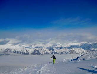
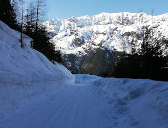
This precise route is meant to be accessible to beginners too: using first the gondola and then the chairlift from Glungezerbahn resort, the climb to the peak will be rather short from here and never really technical. It is a very common ski route - also due to the presence of a hut just a few meters below the summit, where you could enjoy some hot drinks or a typical tirolean meal - always a good idea on cold days! From the peak just follow the tracks from your way up to get back down to the groomers for then going straight back to the gondola middle station and heading down to the parking lot again.
Now that you feel satisfied about your experience, you can now head back to town and enjoy a little bit of city life too - you are experiencing Innsbruck at its best!
Easy
Wide gentle slopes at around 20 degrees or less.

Exposure is limited to that of the slope itself. Getting hurt is still likely if the slope is steep and/or the snow is hard.
Close to help in case of emergency.
20 m away
A fun tour to a mountain hut and a spectacular view.
Moderate Ski Touring
6.3 km away
A short, safe and beautiful ski tour high above the Inn Valley and Innsbruck city.
Moderate Ski Touring
6.8 km away
An incredible, long circuit around some of the Tirol's most wild peaks.
Moderate Ski Touring
8.6 km away
A mellow, sunny ski tour in wild surroundings.
Moderate Ski Touring
9.1 km away
The classic of classics in the Navis valley!
Difficult Ski Touring
9.7 km away
A stunning tour and a fabulous ski descent through some of the finest terrain in Tirol.
Severe Ski Touring
5 routes · Ski Touring

50 routes · Freeride Skiing · Ski Touring
3 routes · Ski Touring

25 routes · Ski Touring