2.1 km away
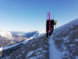
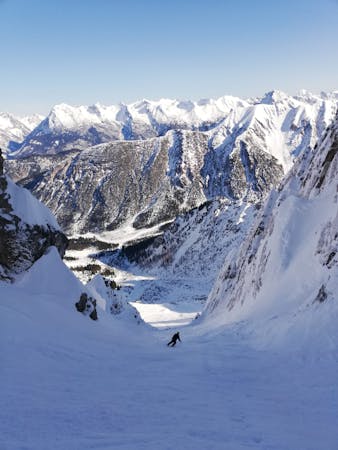
Reither Spitze West Rinne
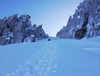
A serious but fun and varied half day journey through the Seefeld mountains.
Severe Ski Touring
- Distance
- 5.2 km
- Ascent
- 606 m
- Descent
- 1.3 km
Skitour from Valley to Seefelder Joch
Ski Touring Difficult

This is a popular ski touring route which is generally considered to be difficult. It's not remote, it features low exposure (e1) and is typically done between November and April. From a low point of 1.2 km to the maximum altitude of 2.1 km, the route covers 5.1 km, 851 vertical metres of ascent and 30 vertical metres of descent. It's graded 4.1 and Labande grade 5.
Skitour from the parking space of Rosshütte Bergbahnen to Rosshütte. The first half can be walked on the touring trail when enough snow. If not, the whole tour can be walked on slope Nr. 4 and 2/3 (left blue slope).
Difficult
Serious gradient of 30-38 degrees where a real risk of slipping exists.

Exposure is limited to that of the slope itself. Getting hurt is still likely if the slope is steep and/or the snow is hard.
Close to help in case of emergency.
2.1 km away
A serious but fun and varied half day journey through the Seefeld mountains.
Severe Ski Touring
2.1 km away
An exciting and varied tour from the Seefeld lift system
Severe Ski Touring
5 routes · Freeride Skiing · Ski Touring

25 routes · Ski Touring