1.6 km away
Bergisel Panorama
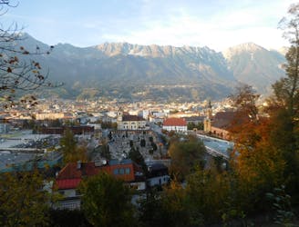
A great little hit of wilderness which is easily reached from the city.
Moderate Trail Running
- Distance
- 2.8 km
- Ascent
- 122 m
- Descent
- 119 m
[HILLS] 100 - route 2020
Trail Running Extreme
![[HILLS]100 Map](https://fatmap-adventure-screenshots.imgix.net/routes/2680181-blank.png?auto=compress%2Cformat)
This is a popular trail running route which is generally considered to be extreme. It's remote, it features medium exposure and is typically done between June and October. From a low point of 558 m to the maximum altitude of 2.6 km, the route covers 142 km, 9787 vertical metres of ascent and 9787 vertical metres of descent.
![[HILLS] 100](https://fatmap-digitiser-assets.imgix.net/4946e35f-f2e6-4d0a-ac3b-89225bda0278?w=1000&fit=crop&auto=compress%2Cformat)
HILLS 100 - Route 2020 - 10 People relay
Extreme

The trail contains some obstacles such as outcroppings and rock which could cause injury.
Away from help but easily accessed.
1.6 km away
A great little hit of wilderness which is easily reached from the city.
Moderate Trail Running