1.8 km away
Bergisel Panorama
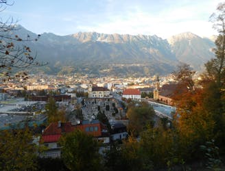
A great little hit of wilderness which is easily reached from the city.
Moderate Trail Running
- Distance
- 2.8 km
- Ascent
- 122 m
- Descent
- 119 m
Hearty scenic adventure
Trail Running Severe

This is a popular trail running route which is generally considered to be severe. It's remote, it features high exposure and is typically done between August and September. From a low point of 638 m to the maximum altitude of 2.8 km, the route covers 49 km, 4432 vertical metres of ascent and 3425 vertical metres of descent.
Beautiful adventure from Innsbruck to the Kemater Alm, passing through the kalkögel and other stunning terrain around Axams...but a hearty trail run/hike with over 5k of elevation gains, and some technical climbing (some may feel more comfortable with proper via ferrata gear)
Severe

Some trail sections have exposed ledges or steep ascents/descents where falling could cause serious injury.

Away from help but easily accessed.
1.8 km away
A great little hit of wilderness which is easily reached from the city.
Moderate Trail Running