8.5 km away
Troppberg Strecke I
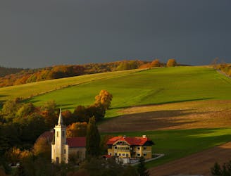
Remote forest and peaceful countryside, with serene nature and sublime views.
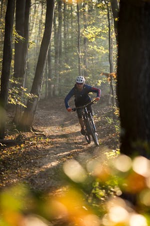
Moderate Mountain Biking
- Distance
- 32 km
- Ascent
- 849 m
- Descent
- 849 m
A concise loop at the edge of the Vienna Woods, with options for leisurely or challenging riding.
Mountain Biking Moderate

Beginning from Schwarzenbergpark in Neuwaldegg, this route enters the Vienna Woods almost right away and climbs gradually before making a quick and exciting descent into a countryside village, where you’ll find a guesthouse ready for your mid-ride refueling.
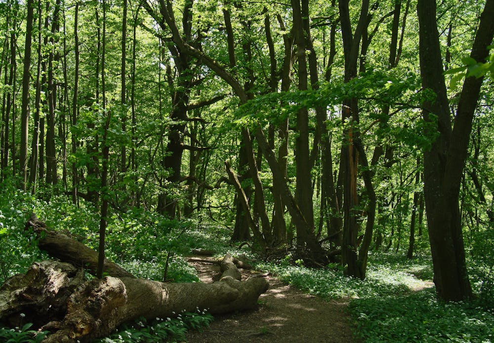
From there, a dirt road continues down a forested valley, then joins briefly with city streets before re-entering the wood and making a leg-burning climb up to Schottenhof. The trail then descends the other side of the hill to complete the loop. The entire route follows wide dirt paths and roads that are suitable for most skill levels, but experienced riders can find singletrack variations with obstacles to make things more challenging.
Sources: https://www.wien.gv.at/verkehr/radfahren/mobil/mountainbike.html https://www.wienerwald.info/a-schottenhof-strecke
Moderate
Mostly stable trail tread with some variability, with unavoidable obstacles 8in/20cm tall or less. Other obstacles such as rock gullies and steep sections may exist. Ideal for lower intermediate riders.

The trail contains some obstacles such as outcroppings and rock which could cause injury.

Close to help in case of emergency.
8.5 km away
Remote forest and peaceful countryside, with serene nature and sublime views.
Moderate Mountain Biking
2 routes · Mountain Biking