Rundle Traverse
Banff National Park
Canmore
An iconic mountain range where you traverse to one of the most photographed mountains in Banff National Park.
Alpine Climbing Severe
- Distance
- 20 km
- Ascent
- 2.3 km
- Descent
- 2.6 km
- Low Point
- 1.4 km
- High Point
- 3 km
- Gradient
- 30˚

You will need to be picked up or drop a car off in Banff. We started at 4:30am to get a good head start on the day and the heat.
Description
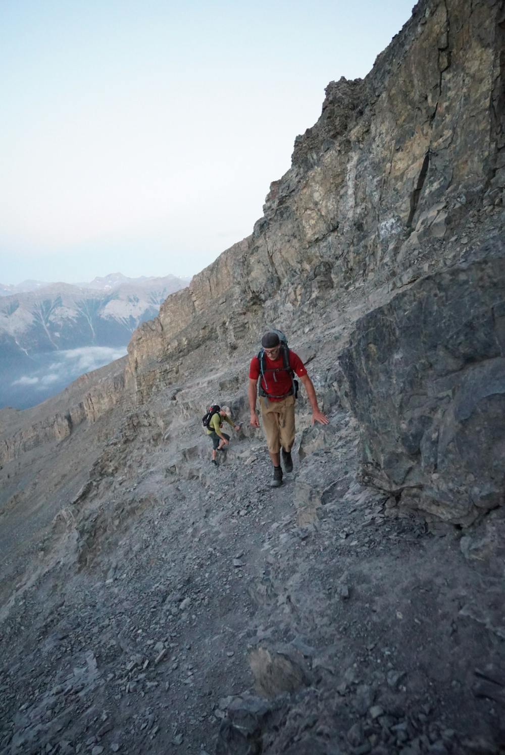
The East End of Rundle is a scramble with some trail braiding. It has loose rocks and some sections that have the potential for rock debris falling on you.
Once you are up EEOR, you can see the ridge you will be following for the rest of the day. You will cross 11 peaks with lots of climbing and descending. You can do up to 7 rappels if you want. There is always the option to avoid every rappel, but you will lose substantial elevation each time you do this.
This route is iconic, and if you choose the rappel sections, you get more of the experience along the ridges. There are even more rappel options than described. If you keep your eyes out, you will see some rappel sections that will help keep you moving steadily and safely. There's a mix of bolted anchors and some slings around rocks.
As you make your way to peak 7, you will start your harder route finding, challenging scrambling, and climbing.
All the rappels are straight forward, but there is one section where you come to a fairly big rappel which is going to require you to transition from your 5 m rappel to another rappel station to then do a 27m rappel. This is where having some gear to anchor yourself while you transition is key. Getting into this crack is challenging and unique as well. I would recommend groups of 2-3 max and if the group is larger, bring two ropes. We had three big men, and it gets tight transitioning. I would also carry enough stuff to build anchors and rappel in case the gear that is previously set up is damaged or not safe to use.
As you head to navigate the final peak, you can choose two options, one being a climbers route and more exposed. We chose the safer option, which was to climb over to a chimney and climb up that. It had snow which was great because at this point, we stopped and refilled our water and drank a bunch of fluids.
You climb to the final peak to enjoy an amazing view, where you can see all of Banff.
Getting down from here is a grind and longer than you expect as you see the Banff Springs Hotel, but it seems to never get closer. The trail switchbacks forever, and you lose elevation slowly.
Note that there is minor water on this route, limited shade, and serious route finding is required.
Difficulty
Severe
Steep, sustained and serious terrain on rock/ice. Routes will be long, exposed and possibly committing. D, D+
Extreme Exposure

The majority of the route is "no fall" terrain.
Remoteness
In the high mountains or remote conditions, all individuals must be completely autonomous in every situation.
Best time to visit
Equipment required
- Quickdraws
- Wires and Friends