4.7 km away
Geraldine Lakes
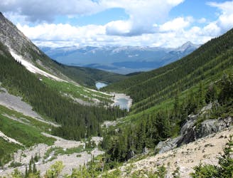
Long day hike or backpacking trip in one of Jasper's lesser-visited valleys.
Difficult Hiking
- Distance
- 12 km
- Ascent
- 591 m
- Descent
- 591 m
Short walk to a very photogenic waterfall
Hiking Easy

This is not really a hike, just a short walk on a paved path to see the waterfall. Athabasca Falls is a classic stop along the Icefields Parkway, though, and you'd be missing out if you didn't see it. Here, the huge river squeezes through a few slots and tumbles briefly through a tight gorge. You'll cross a bridge over the cleft and find several fantastic photo spots.
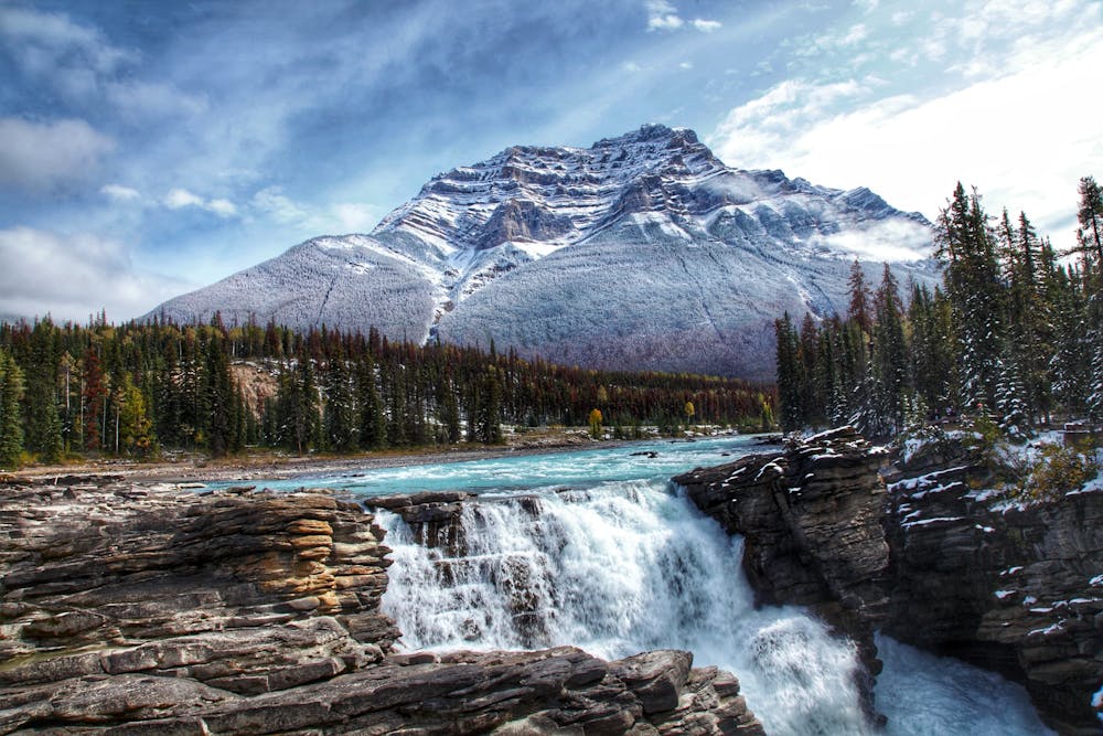
There is more to the hike than just seeing the waterfall, though. A side trail, which is also paved but has several stairs, leads down through a narrow hallway of rock, and ends at a viewpoint where the river emerges and widens again. If you are interested in the geology and ecology, you'll also enjoy the numerous interpretive signs all along the trail.
Easy
Walking along a well-kept trail that’s mostly flat. No obstacles are present.

The path is on completely flat land and potential injury is limited to falling over.
Close to help in case of emergency.
4.7 km away
Long day hike or backpacking trip in one of Jasper's lesser-visited valleys.
Difficult Hiking
5 routes · Hiking