9 routes · Alpine Climbing · Mountain Biking · Gravel Biking · Hiking · Kayaking
Unmaintained trail along a creek to a very remote alpine cirque.
Hiking Difficult

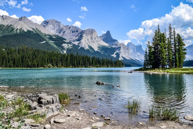
The best option for a hike out of Coronet Creek Campground on Maligne lake is simply up the creek. You can get far into the backcountry, even without any official trails. There is a primitive backcountry campsite up the creek, however, so you can make it an overnight trip.
Coronet Creek is an unmaintained trail, and in most places not much of a trail at all, but a route up the gravel banks of the creek. In places, the creek enters small canyons (with lovely waterfalls), which are impassable, where a faint trail detours into the forest. Route finding is not too difficult because you more or less just follow the creek, but you’ll need to pay attention to find the best way around obstacles such as these.
The campground is approximately 6km up, to the east side of the creek. It’s called Henry MacLeod campground, but it’s unmaintained and unmarked on most official maps. Ask the Reservation Service about permits if you want to camp there.
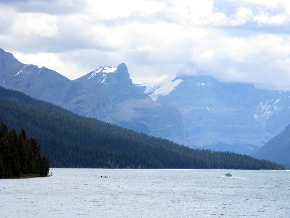
Beyond the campground, hiking in the creek becomes more difficult because it’s quite braided, with repetitive ankle to knee-deep crossings. If you continue on, however, in approximately two more kilometers you’ll reach the moraines below Coronet Glacier and an impressive cirque of peaks. It is, of course, possible to hike farther than this as well, onto the moraines to reach higher points in the cirque.
Sources: https://www.pc.gc.ca/en/pn-np/ab/jasper/activ/passez-stay/arrierepays-backcountry/sugg-sentierstrip-ideas/Maligne https://trailpeak.com/trails/henry-macleod-trail-near-jasper-ab-1589
Difficult
Hiking trails where obstacles such as rocks or roots are prevalent. Some obstacles can require care to step over or around. At times, the trail can be worn and eroded. The grade of the trail is generally quite steep, and can often lead to strenuous hiking.

The trail contains some obstacles such as outcroppings and rock which could cause injury.

Little chance of being seen or helped in case of an accident.
9 routes · Alpine Climbing · Mountain Biking · Gravel Biking · Hiking · Kayaking