8.7 km away
Geraldine Lakes
Long day hike or backpacking trip in one of Jasper's lesser-visited valleys.
Difficult Hiking
- Distance
- 12 km
- Ascent
- 591 m
- Descent
- 591 m
Backpacking through a steep valley crowned with imposing peaks.
Hiking Difficult

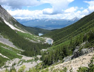
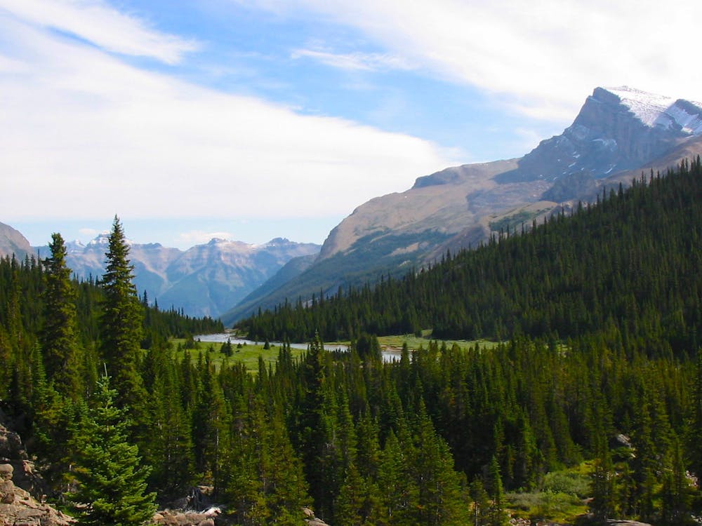
One of Jasper’s best 2-3 day backpacking trips, Fryatt Valley is a picture-perfect Rocky Mountain glacial valley: a U-shaped basin quilted in green, with a sparkling lake in the bottom and glacier-clad peaks above. Among countless glacial valleys in Jasper National Park, Fryatt is especially photogenic. Even the view from your campsite will be hard to beat, but you’ll find rival vistas all along the trek.

Mapped here is the round trip in the valley itself, starting at Lower Fryatt campground. To get there, you’ll have to hike or bike 11.6 kilometers on the Fryatt Valley Fire Road. Lower Fryatt is the first option for camping, and Brussels campground is the second. Brussels is the best campground, so stay there if you can. It makes a great base camp for hiking higher in the valley as a day trip. Alternatively, you can spend a night at the 3rd campground, Headwall, or book a night at the ACC hut, which is even higher in the valley. Regardless of where you camp, you should definitely hike at least as far as Headwall camp (9.5 km from Lower Fryatt Camp) in order to see the Headwall Waterfall.
The entire trail is somewhat strenuous, with steep sections, water crossings, and mud, but the toughest section is the final kilometer, which climbs the headwall through talus and boulders. Keep a close eye on the yellow markings to avoid losing the trail. When you make it up the headwall, you’ll find the ACC hut and astounding views over the entire valley. It’s possible to hike even farther, beyond the extent mapped here, to a milky lake beneath the glaciers.
Source: https://www.pc.gc.ca/en/pn-np/ab/jasper/activ/passez-stay/arrierepays-backcountry
Difficult
Hiking trails where obstacles such as rocks or roots are prevalent. Some obstacles can require care to step over or around. At times, the trail can be worn and eroded. The grade of the trail is generally quite steep, and can often lead to strenuous hiking.

The trail contains some obstacles such as outcroppings and rock which could cause injury.

Little chance of being seen or helped in case of an accident.
8.7 km away
Long day hike or backpacking trip in one of Jasper's lesser-visited valleys.
Difficult Hiking
5 routes · Hiking
9 routes · Alpine Climbing · Mountain Biking · Gravel Biking · Hiking · Kayaking