3.6 km away
East Ridge of Alpha
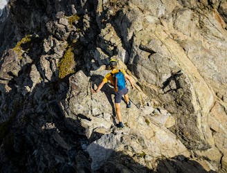
A classic introductory alpine climbing route in the Tantalus Range.
Difficult Alpine Climbing
- Distance
- 5 km
- Ascent
- 1.1 km
- Descent
- 1.1 km
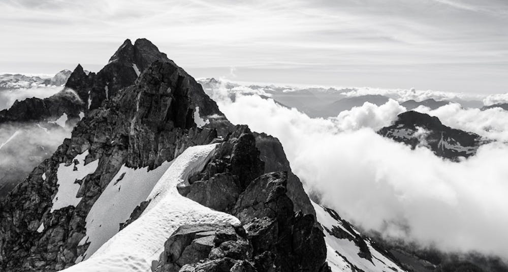
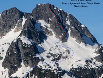
A traverse of 9 of the 10 named peaks surrounding Lake Lovely Water in the Tantalus Range.
Alpine Climbing Extreme

The culmination of a multi-year project to complete the route in a day. This combines some of the best alpine climbing the Tantalus Range has to offer with a big climb up from the Squamish River (sea-level). It's unique in that other than the approach trail up and down from the lake, it's almost entirely on technical terrain (4th/5th class rock or steep snow/glacier). Our hands were destroyed after nearly 20km of touching granite! Cruxes were climbing to 5.6 at several points in the traverse and ~10 rappels.
It’s been a solid month so far. After the COVID enforced downtime this spring, I definitely had some pent-up mountain energy and a decent base of running. At the start of July, I headed out to Canmore to join Adam Campbell for our own variation of the Canmore Quad via technical routes. He wrote an excellent recap over on his profile. The day was pretty crushing but was a really good signpost that my fitness was in a good place.
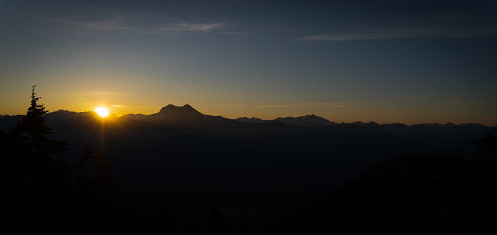
A week later, a high pressure system finally started to build and blast the remnants of our wet spring away. I could see that alpine conditions were good and the weather window would be solid and Leif was planning a trip out to play on the Coast. I’ve spent a handful of years now exploring the Tantalus Range and a circumnavigation of the peaks surrounding Lake Lovely Water has always intrigued me. It’s got a TON of technical terrain packed into a very small space and a lot of it is really high quality.
Andrew Rennie linked all 10 named peaks in a massive 37-hour push 15 years ago, calling it the Kingdom Come Traverse. His effort was incredible, with a significant amount on-sighting terrain and is well written up in the Canadian Alpine Journal. I wasn’t ready to commit to his solo style but I did want to see what I was capable.
Leif arrived in Squamish and we did a quick lap of Sky Pilot to shake his legs out from the drive and spent the next day rock climbing and getting ready for the traverse. A critical part of our plan was using paddle boards to cross the river so we drove out to try a test crossing - it was surprisingly easy! We sorted gear, ate as much as we could, and got in evening recon flight with David at Sea to Sky Air - actually taking photos of a few of the parties we’d encounter the next day!
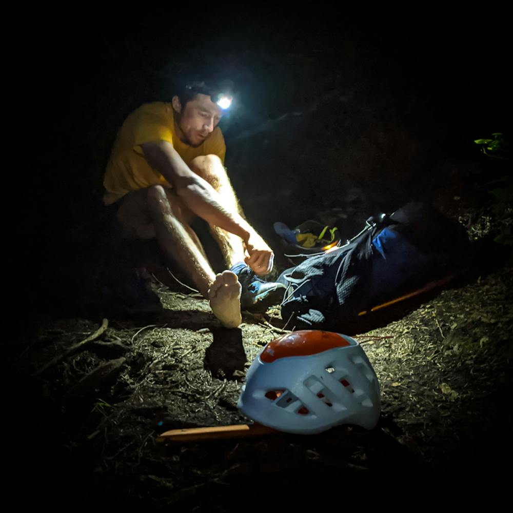
Our 2 am alarms came too soon as always and after eating as much as possible again, we were on our way down the Squamish Valley Road to the trailhead. With wolves(?) howling somewhere nearby in the valley, we slipped the boards into the water and used each others headlamps as reference while we ferried across. On the other side, we stashed the gear and started our watches.
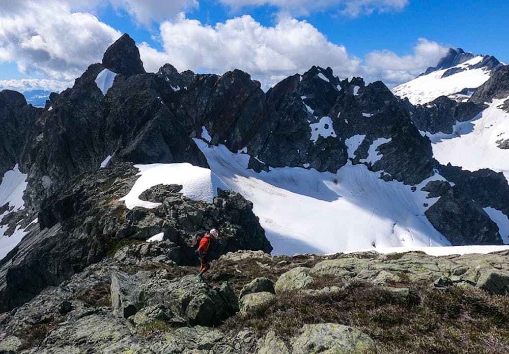
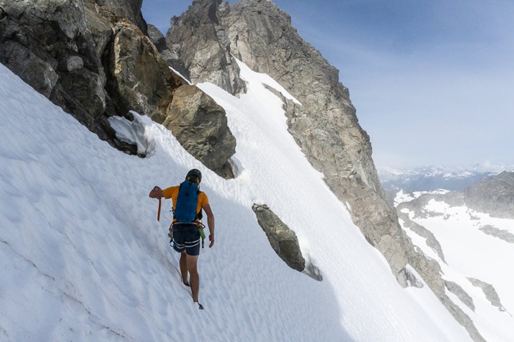
The climb up the trail was a bit of a blur of headlamp beam focus while chatting to avoid getting sleepy and we arrived at the hut just after turning our headlamps off. The approach trail to Alpha’s East Ridge is always a grunt but we found our way up and we gained quite a bit of energy as we arrived at the rib and met another party. We made good time up the glacier with no crevasses and arrived at the crux pitch quickly, then used the 4th class bypass to skip the 5.7 climbing. The rest of the ridge is great and passed by really quickly. As we ran down the West Face, we could see a party climbing the North Face of Serratus so we decided to try to race them.
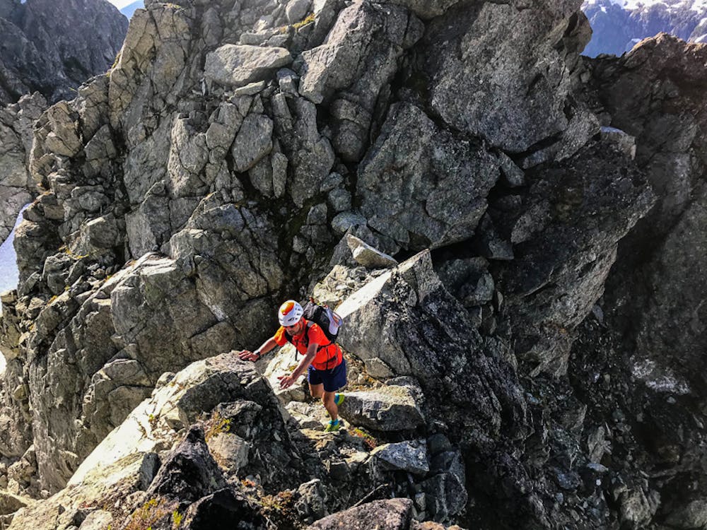
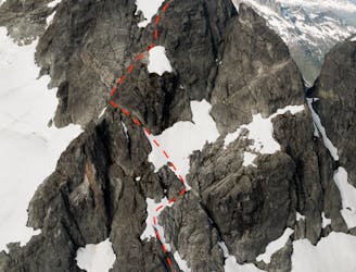
The East Ridge of Serratus has a bit of a reputation as being difficult and loose though with good route finding, it’s really excellent. It’s so much 4th class terrain and just goes on and on. I can see how a party pitching it out would find it incredibly time consuming. We managed to make minimal route finding errors with the mantra of “it should be 4th class”. Any time we looked up at 5.10+ climbing, we would reminder ourselves to keep looking and the route would appear. We made one 30m rappel off a gendarme and did a lot of sneaking in moats between snow and rock but generally stayed directly on the crest. Tower after tower went by before we topped out on the summit slopes along with another party who had come from the West Rib.
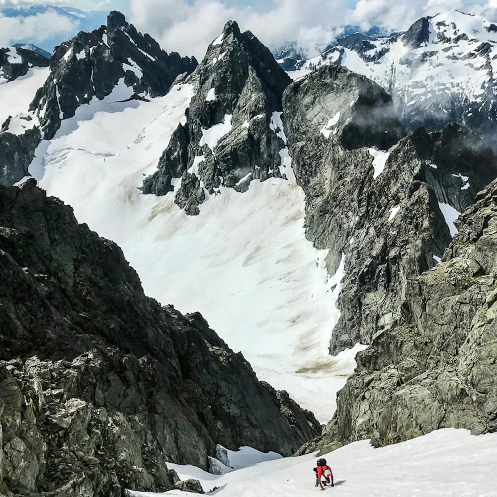
Our plan was to descend the SW Couloir on Serratus to get to the Crescent Glacier but after dropping in, we found it was still early enough in the day that the sun hadn’t hit and it was quite firm! Crampons on and we were forced to down climb much slower than we preferred. In hindsight, descending the W Rib may have been a better option. We refilled water on the Crescent Glacier and could see that the NE Buttress of Ionia had quite a bit of snow remaining on it. We were lagging behind our schedule and decided that we’d just take the glacier up to the Ionia-Panderous Col and do a quick out and back on the S Ridge of Ionia. It’s got fun scrambling AND loose rock so that kept it exciting. At a notch, we had to rappel in, and left our rope in place to belay as we climbed back out.
From the summit of Ionia, we could see our friends from Arc’teryx just topping out on Lydia. We whooped back and forth and despite being quite close, knew we wouldn’t catch them. Back at the I-P Col, we got a good look at Red Tusk. We could see what looked like the ramp Klemen Mali described to access the upper tower but it looked difficult with snow and loose rock. We tagged the awesomely precarious summit of Panderous and coming back down to the col, decided Red Tusk was both too scary and would likely delay us several hours, enough to benight us.
I’ve descended south from the Red Tusk-Panderous Col before but it’s big slopes and not terribly straightforward. We down climbed steep and loose scree and then came onto better rock and continued down. We did a bit of wandering to find a rappel anchor until we came across a good horn and then that took us to another that had a bit of tat (maybe from the last time I was there?) that we backed up with a pin we had bootied earlier. A second rappel took us over a giant, precariously perched snow plug and onto the glacier. Feeling like the most stressful parts were over, we crossed the glacier to the N Ridge of Lydia and climbed more steep snow to gain the col where some easy rock took us out of the moat. A loose move out of the notch onto some wet slabs seemed worthwhile to use the rope so that was our second belayed pitch of the day.
We continued up to the summit of Lydia and then started following our friends footprints down. Lydia’s South Ridge is LONG, fairly bushy (hard on the sunburnt legs), and somewhat convoluted. There are walk/climb around options to every tricky step but at one point we made a rappel to avoid having to retrace our steps.
Finally at the Lydia-Niobe Col, we gorged on water and started the grind up the Niobe snow slopes. The sun was already getting low in the sky and we knew we would be racing daylight to get off Omega. Pelops and Iota went by relatively quickly and we got a bit complacent with our scrambling, rarely bothering to put away our poles. Finally we made it to the base of Omega with the sun dipping behind Serratus. This was our biggest route finding error of the day - we tackled Omega a bit too directly and found ourselves in climbing terrain. Frustrated, we back tracked and got onto the easy 3rd class route to the summit and kept running over the top to the North Ridge descent. We made one 30m rappel off an existing station past loose 4th class rock and heather. Then we motored down the ridge as fast as we could with daylight disappearing just as we made the last rappel. We turned on our emergency headlamps and continued through the forest towards the lake, finally breaking out at the trail and picking up our big headlamps stashed for the hike down.
The descent down the trail was surprisingly pleasant, with almost no actual running to that point aside from a few flat glacier portions, our legs felt pretty good and we made decent time. It’s still a grind however and took an hour or so. We stopped our watches at 20hrs just as we arrived at the trailhead and could see headlamps on the far side of the river. We jumped on the paddle boards and found that a low lying fog on the river made it a lot harder to tell what direction we were going. The headlamps guided us in though and we found Paul and Justin waiting for us on the bank with pizza and pop. Just like that, a long day, with lots of stress, effort, sun, excitement, and fun was done. It was nice to sit in the sand and breathe for a few minutes - not able to really give justice to what we did while talking to Paul and Justin. It’s really meaningful though to have friends there at the end of an effort like that.
I had quite a bit of time to think about the decision to skip the Red Tusk. It’s certainly disappointing to leave an open question there but in hindsight, I’m glad I didn’t exceed my risk tolerance. We were certainly getting tired and a long delay would have made us even more so. Mistakes would have been a possibility. I’m glad we skipped it - we still managed to circumnavigate the lake and if anything, skipping it kept the consistency of good rock throughout the day.
It’s important to acknowledge how much background work and external help went into this. I’ve been exploring these peaks with this goal in the back of my mind for the past five years. I’ve had a bunch of very rad partners to follow around while doing so including Nick, Jim, Paul, Carl, Brendan, Rowan, Ross, Tony, Stano, and probably a few others I’m not thinking of. I was able to talk to a handful of others including Klemen and reading Andrew’s CAJ article. The recon flight gave us confidence in snow conditions. The support of the Arc’teryx crew that was keeping an eye on us while we were out there (Justin, Adam, Paul M, Em, Bradford) was good piece of mind, as well as Paul G watching from his clinic making sure we were on track. We had super dialled equipment from Arc’teryx, UD, Blue Ice, and Petzl. I’ve gained a bunch of confidence on the paddle board getting out with Chris and Corey. Andrea kept us well fuelled going into it. Basically, there’s a village behind the effort for sure. Finally, that Leif was psyched to drop in from Canmore and go along with my plan was incredibly appreciated. He basically did everything in the Lake Lovely Water basin sight unseen. Having such technically solid and fit partners to rely on is awesome. Leif has got a big career in mountain running ahead of him so I’m glad to have gotten the chance to partner up before he gets even stronger!
With a few days rest, the worst part of our bodies are certainly our hands - grabbing nearly 20km of granite will rough them up pretty bad; followed in a close second by our sunburns. Luckily it looks like a bit of rain in the forecast so that will be good for resting as well. Leif is already talking about the next big adventure so rest is key!
Gear for the LLW Circumnav -Twin Ropes -Arc light jackets & clothing -Small rack -BI race harnesses -Alu crampons and Gully hammer -UD SCRAM -1.5L water
Extreme
Long, committing and complex routes with difficult and sustained climbing on rock/ice and challenging route finding throughout. TD upwards.

The majority of the route is "no fall" terrain.

Away from help but easily accessed.
3.6 km away
A classic introductory alpine climbing route in the Tantalus Range.
Difficult Alpine Climbing
3.7 km away
One of the most exciting and aesthetic moderate routes in the Tantalus.
Moderate Alpine Climbing
7.9 km away
One of the top alpine climbs in the Tantalus Range!
Difficult Alpine Climbing
5 routes · Alpine Climbing · Hiking
10 routes · Alpine Climbing · Hiking · Trail Running