5 routes · Hiking
A plethora of views and a backcountry feel, packed into a concise but challenging loop from the highway.
Hiking Difficult

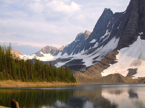
This may be the best day-hike loop in Kootenay National Park. It combines two parallel valleys linked by a high pass. The valleys are striped with avalanche paths that burst with berries and flowers. Tall and shady forests give way to larch groves and meadows on the ridgelines. The col is a treeless, grassy and rocky spine between two summits, either of which can be scrambled for a bonus adventure. Views are of impressively tall and snowy mountains in every direction.
Most hikers choose to go clockwise, starting at Kindersley Pass Trailhead and finishing at Sinclair Creek Trailhead. This way, the ascent is more gradual and the descent more direct. Both trailheads are along Highway 93, only about a kilometre apart, so walking the road or setting a shuttle completes the loop.
The distance is quite manageable as a day hike, but it’s not a quick jaunt. The elevation gain is significant. The trail is infrequently maintained and quite rough in sections. Expect mud, dense growth, downed trees, and other obstacles. The higher elevations may have snow. Another consideration is that the area is notable for grizzly bear activity. For much of the summer, the national park requires that hikers stay in groups of four or more for safety on these trails. Even when not mandatory, it’s a good guideline to follow. Check Kootenay’s Trail Conditions page for updates.
Sources: https://www.pc.gc.ca/en/pn-np/bc/kootenay/activ/randonnee-hike/jour-day http://bobspirko.ca/OtherScrambles/BC/KindersleyPass/KindersleySouth.html http://jordsblogg.blogspot.com/2019/09/kindersley-sinclair-col.html
Difficult
Hiking trails where obstacles such as rocks or roots are prevalent. Some obstacles can require care to step over or around. At times, the trail can be worn and eroded. The grade of the trail is generally quite steep, and can often lead to strenuous hiking.

Little chance of being seen or helped in case of an accident.
5 routes · Hiking