18 routes · Hiking
A short hike to a popular viewpoint overlooking Seton Lake near Lillooet.
Hiking Easy

This short and easy hike leads to a commanding viewpoint of Seton Lake, it's dam, and a scenic section of the Sea to Sky Highway. The trailhead, a roadside pull-off with views of its own, is just a short drive from Lillooet and it's a hike that is sure to impress everyone in the family - including the dog!
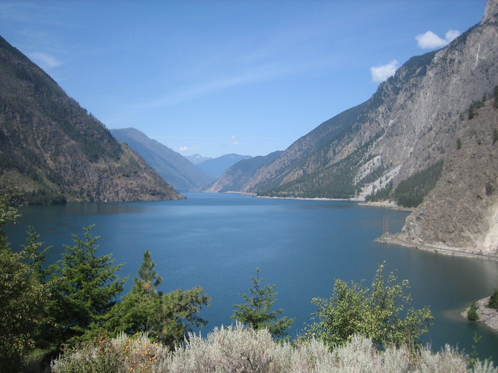
The trail is relatively flat with only a few gentle grades and tricky sections to navigate, but its short length makes for the perfect roadside stop if traveling through the area.
Source: vancouvertrails.com
Easy
Walking along a well-kept trail that’s mostly flat. No obstacles are present.

The path is on completely flat land and potential injury is limited to falling over.
Close to help in case of emergency.
18 routes · Hiking