7 km away
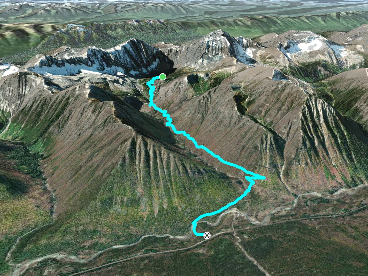
The Rockwall: Numa Creek to Floe Lake
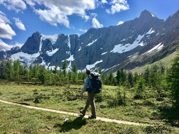
Up and over Numa Pass, the highpoint of the Rockwall Trek.
Difficult Hiking
- Distance
- 9.4 km
- Ascent
- 811 m
- Descent
- 318 m
The southern terminus of the Rockwall trek, or an excellent overnight backpacking trip with a lakeside campground.
Hiking Difficult
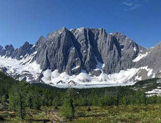
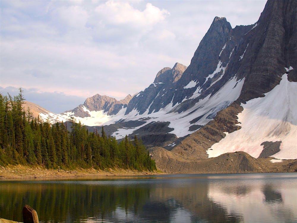
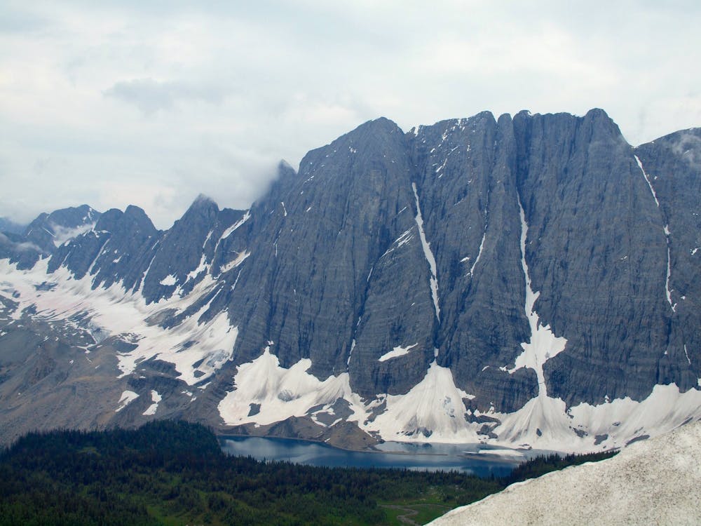
A blue lake at the base of a toothy peak in the Rockwall, Floe Lake is one of the most photogenic spots in all of Kootenay National Park, and the backcountry campground on its shore is among the park’s best. Floe Lake is located along the 3-5 day Rockwall trek, but it’s also popular as a standalone day hike or overnight trip. The track mapped here is one-way from Floe Lake down, as the final segment of the Rockwall. Therefore, a return trip from Floe Lake trailhead would be double the distance.
Those who hike the Rockwall north-south can enjoy their final night on the lake’s scenic shore, then a downhill jaunt to the trailhead. Those who hike south-north, beginning at Floe Lake, however, have an intense uphill to reach the lake, followed by even more uphill to reach Numa Pass after that.
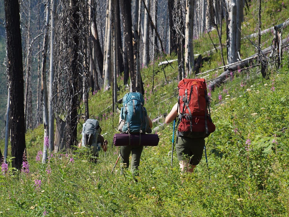
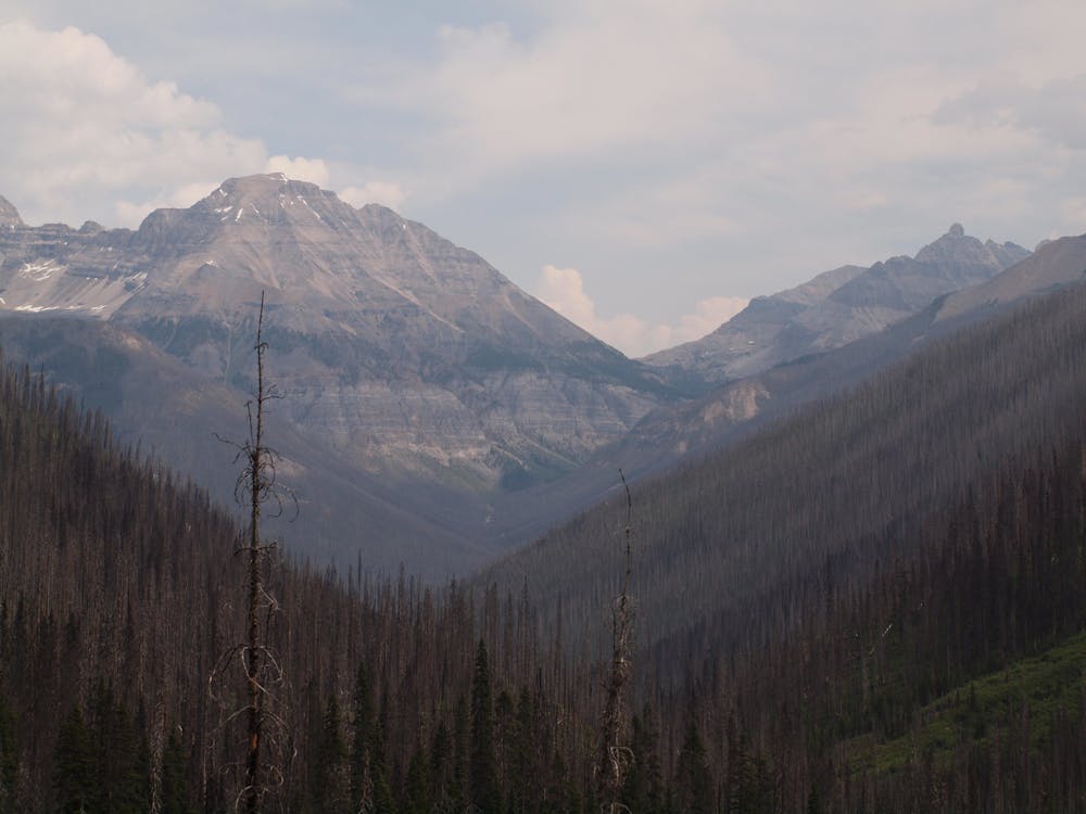
From Floe Lake toward the trailhead, the trail leads gently upward through open forest and crosses a ridge, then plunges downward. It takes many switchbacks into the drainage of Floe Creek, which is extensively burned. If starting from the Floe Lake trailhead, these switchbacks are, of course, in the uphill direction instead.
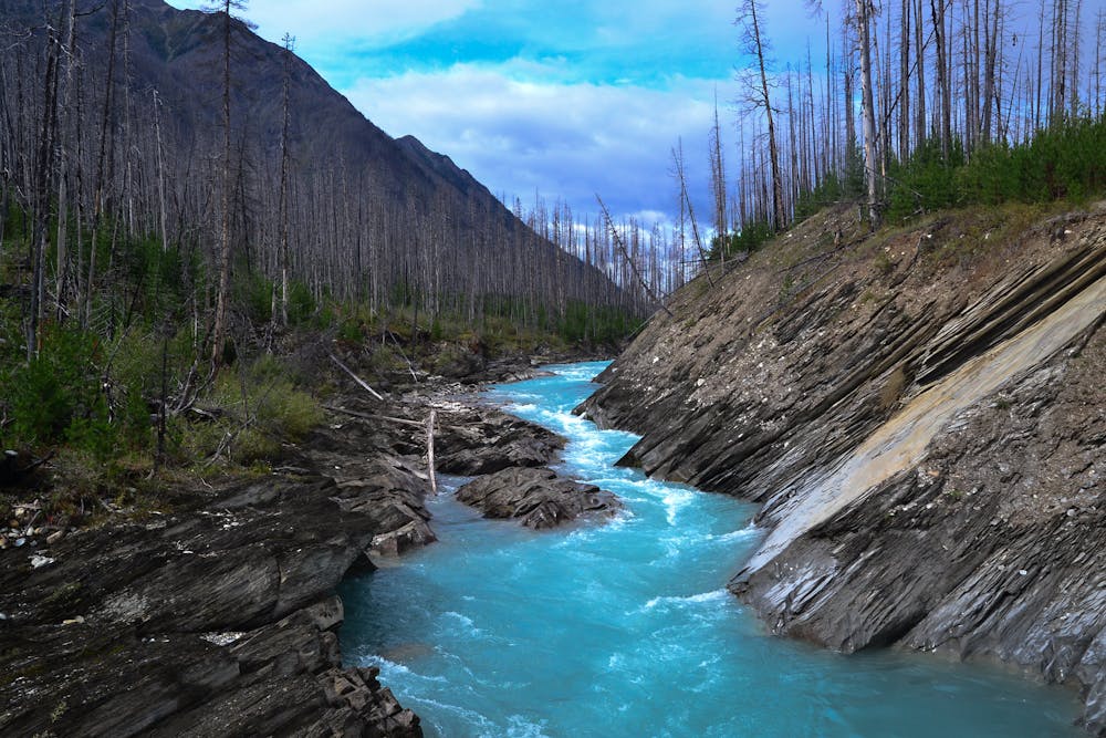
Below the switchbacks, the gradient mellows, and the trail traverses above the creek. Among regenerating growth and skeleton trees, views throughout the valley are quite good on a clear day. Closer to the trailhead, a bridge crosses the Kootenay River, in a striking miniature gorge where turquoise water slides between tilted rock layers. Here the trail re-enters mature forest, providing shade for the final, flat stretch to the parking area.
Note that day hiking to Floe Lake does not require any permit, but camping there requires a wilderness pass, which should be reserved in advance.
Sources: https://www.pc.gc.ca/en/pn-np/bc/kootenay/activ/arrierepays-backcountry https://www.jennexplores.com/canada/british-columbia-canada/floe-lake-hike-kootenay-national-park/ https://travelwiththesmile.com/blog/floe-lake-kootenay-national-park/
Difficult
Hiking trails where obstacles such as rocks or roots are prevalent. Some obstacles can require care to step over or around. At times, the trail can be worn and eroded. The grade of the trail is generally quite steep, and can often lead to strenuous hiking.

The trail contains some obstacles such as outcroppings and rock which could cause injury.
Away from help but easily accessed.
7 km away
Up and over Numa Pass, the highpoint of the Rockwall Trek.
Difficult Hiking
6 routes · Hiking

5 routes · Hiking