4.9 km away
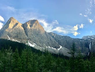
The Rockwall: Tumbling Creek to Numa Creek
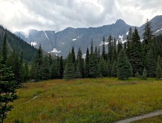
Between Tumbling and Numa Creek camps you’ll cross steep avalanche slopes and a high pass with breathtaking views of the Rockwall.
Difficult Hiking
- Distance
- 7.5 km
- Ascent
- 379 m
- Descent
- 729 m
Up and over Numa Pass, the highpoint of the Rockwall Trek.
Hiking Difficult

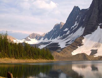
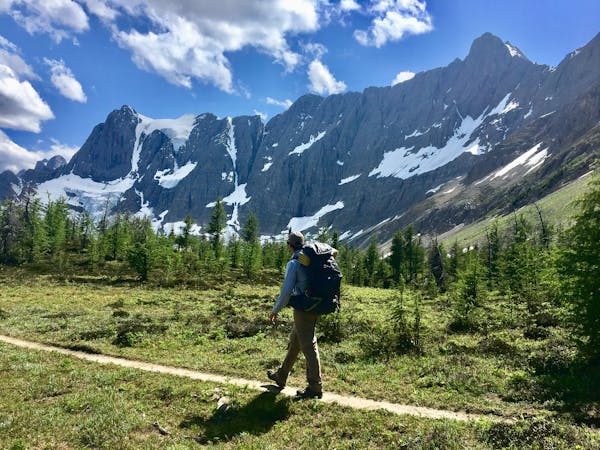
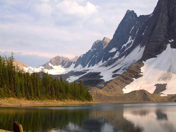
Numa Pass is the highest point on the Rockwall Trek, at over 2300 metres. This segment also has the greatest elevation gain/loss, boasting more than 800m change between Numa Creek and Numa Pass. If hiking north to south, this will be all uphill, but you’ll hopefully be conditioned by crossing two other passes in the days before.
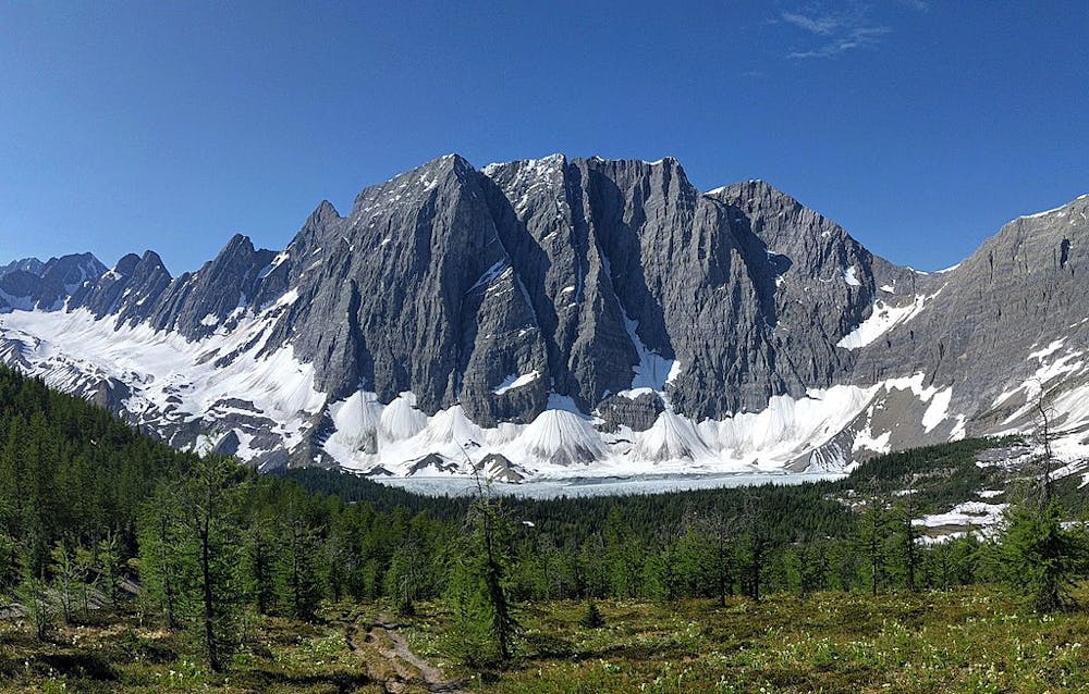
An unassuming start from Numa Creek, on mellow terrain through the forest, soon transitions to a grueling climb. It’s gradual for a while, but steepens dramatically before breaking above the treeline. A final push on a worn path on a scree slope reaches the pass, and the reward. It’s a barren ridgeline bowing gracefully between two peaks, with the Rockwall and countless summits stretching away on either side. Floe Lake is even visible, beneath the massive face of Floe Peak. From the pass, it’s all downhill, and a relatively quick descent to the lake.
Sources: https://www.pc.gc.ca/en/pn-np/bc/kootenay/activ/arrierepays-backcountry https://peanutbutterkait.wordpress.com/2017/09/11/hike-rockwall-trail-day-3/ https://www.inafarawayland.com/rockwall-trail-guide/
Difficult
Hiking trails where obstacles such as rocks or roots are prevalent. Some obstacles can require care to step over or around. At times, the trail can be worn and eroded. The grade of the trail is generally quite steep, and can often lead to strenuous hiking.

The trail contains some obstacles such as outcroppings and rock which could cause injury.

Little chance of being seen or helped in case of an accident.
4.9 km away
Between Tumbling and Numa Creek camps you’ll cross steep avalanche slopes and a high pass with breathtaking views of the Rockwall.
Difficult Hiking
7 km away
The southern terminus of the Rockwall trek, or an excellent overnight backpacking trip with a lakeside campground.
Difficult Hiking
7.1 km away
An easy overnight backpacking trip, or one end of the difficult Rockwall trek.
Moderate Hiking
9.4 km away
Hike to a backcountry campground near a huge, double-forked waterfall along The Rockwall trek.
Moderate Hiking
9.5 km away
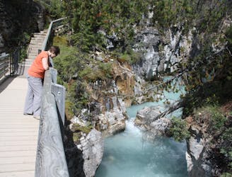
Walk along a remarkably narrow gorge flowing with water.
Easy Hiking
6 routes · Hiking
5 routes · Hiking