1 m away
Mt Harvey - Southwest Ridge
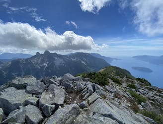
A steep hike, with an easy scramble to the summit
Severe Hiking
- Distance
- 13 km
- Ascent
- 1.6 km
- Descent
- 1.6 km
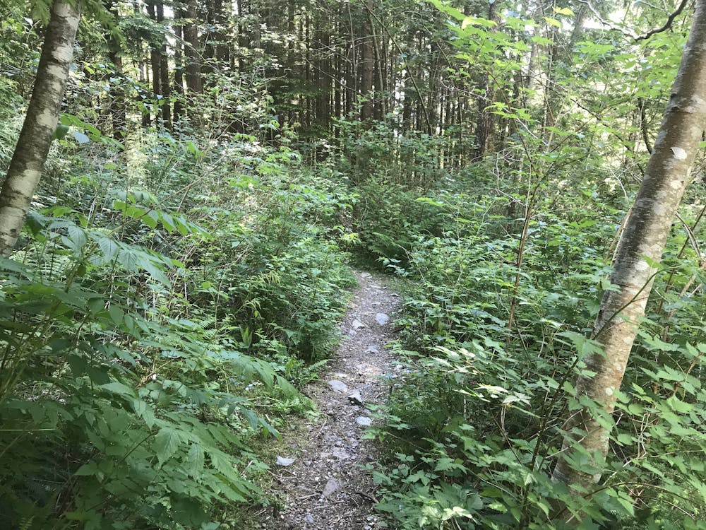
The safe and legal option for hiking Tunnel Bluffs.
Hiking Easy

With the small Tunnel Point parking lot being either overwhelmed or closed, this has become the main alternate route to access Tunnel Bluffs.
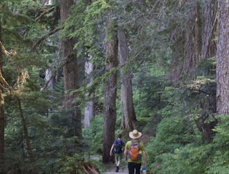
The route starts at the parking lot that is located on the Northern edge of Lions Bay. Please don't park near the residences up the hill. The routes on average 3 hours. Be sure to leave an extra hour prior to sunset to ensure you don't have to navigate in the dark.
The trail begins up the steep paved hill on the north end of the road. It climbs up to a gravel parking lot, and becomes a narrow service road that connects to the Mt Harvey/Lion's access road. The road is steep and graveled with big stones. Proper hiking footwear is a good call if you want to avoid a sprained ankle.
The road switchbacks six times. At the final sixth curve, a narrower trail heads northward on a flatter angle. Take this path as it curves along the flank of the mountain past several creeks. Do not take the trails heading upwards. E
After about 40min to 1.5hr you will get to a short turn off for the actual Tunnel Bluff. Return the way you came.
Taking the Ten Essentials is highly recommended on this hike as it is quite common for parties to take longer than expected and get lost on the network of trails in the dark. Black Bears are also common. Negative incidents are rare, though. If you are nervous, travel in groups of four or more and make lots of noise. Bear Spray is not really necessary but can provide a great deal of comfort.
Easy
Walking along a well-kept trail that’s mostly flat. No obstacles are present.

The trail contains some obstacles such as outcroppings and rock which could cause injury.
Away from help but easily accessed.
1 m away
A steep hike, with an easy scramble to the summit
Severe Hiking
196 m away
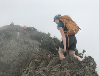
A steep climb with an short, but thrilling narrow exposed ridge to a beautiful summit.
Extreme Hiking
565 m away
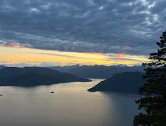
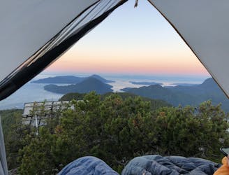
Beautiful Howe Sound sunset with a sneaky peak of Tantalus
Moderate Hiking
6.5 km away
Enjoy fabulous 360° views of Howe Sound
Difficult Hiking
8.9 km away
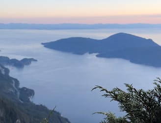
Local classic to take in a beautiful Howe Sound sunset
Moderate Hiking
9.1 km away
Popular hike with scenic views over Howe Sound
Moderate Hiking

7 routes · Hiking · Trail Running

6 routes · Hiking

3 routes · Hiking