1 m away
McDougall Rim
Rose Valley's classic long ride is well worth the hype!
Difficult Mountain Biking
- Distance
- 20 km
- Ascent
- 844 m
- Descent
- 844 m
A wild, scenic and challenging ride into one of the finest parts of the Okanagan Valley.
Mountain Biking Difficult

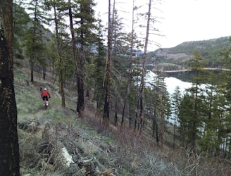
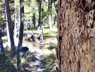
Sharing its ascent with the classic Mcdougall Rim trail, this route offers some fabulous riding for those willing to earn it! Despite being pretty close to West Kelowna, this is not a trail you're likely to share; be well equipped and autonomous if you're going to do this route.
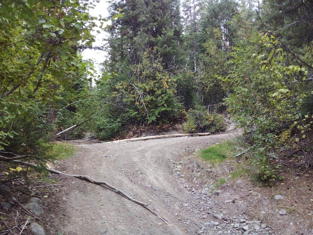
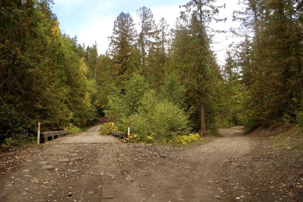
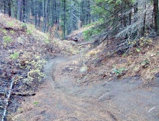
Park in the forested parking lot at the northernmost end of Bartley Road, and begin the route by riding up a gentle and straightforward fire road which heads north into the wilderness. After a couple of kilometres you'll reach a wooden bridge and a split in the road. Turn right and don't cross the bridge - there's a photo on this route showing the junction.
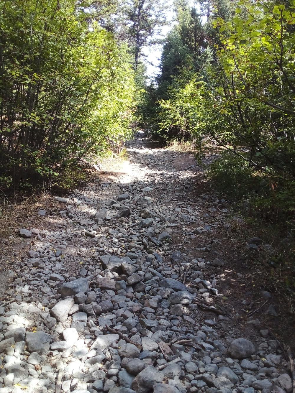
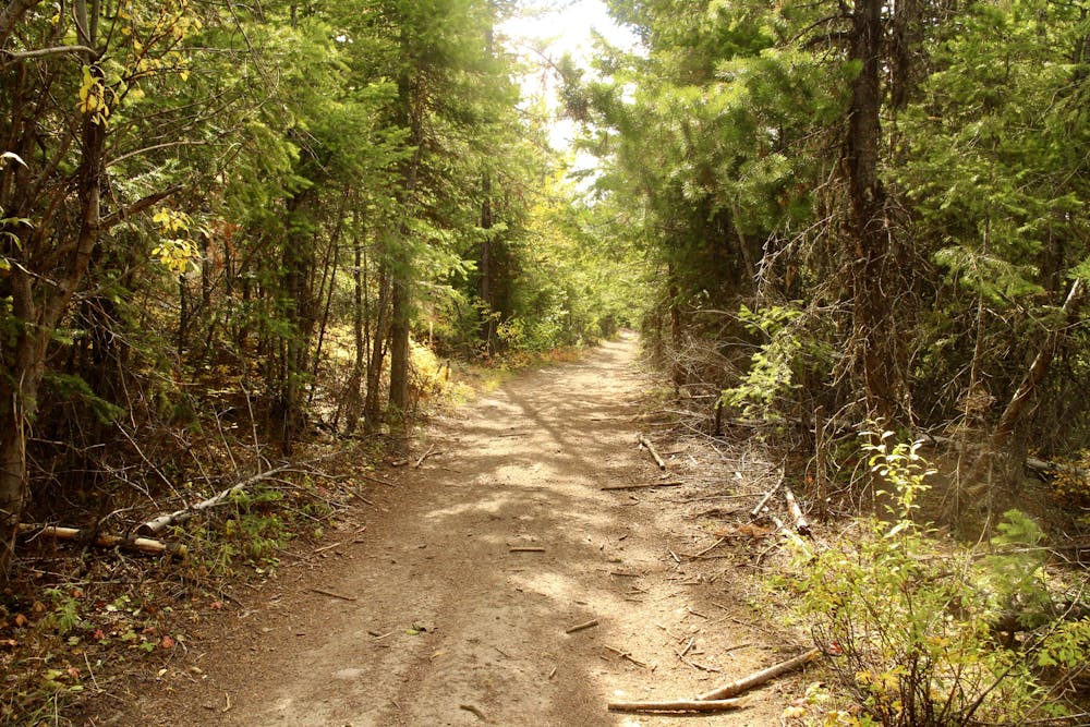
Climb up the increasingly rough and challenging fire road, keeping right at every opportunity. There are times at which the track gets too steep and loose to be rideable, but you should still be able to stay in the saddle for the vast majority of the climb.
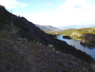
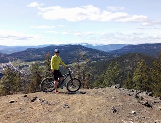
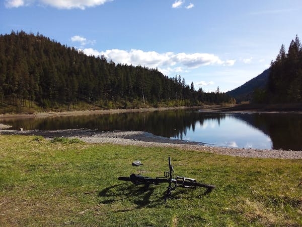
Eventually - at 1200m altitude - turn right (there's a photo of the junction attached to this route) and head up an even rougher track which leads (via some more unrideable sections) to an undulating traverse over to Hayman Lake. After a tough climb, the cruise over to the lake comes as a welcome change, and while it does involve some ascent, the serious hard work is done by now.
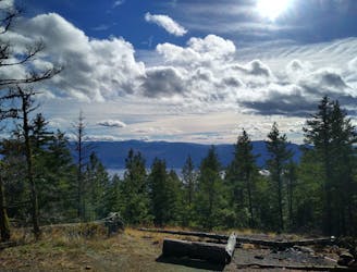
Hayman Lake itself is stunning, but it's full of leeches and therefore distinctly unsuitable for a cooling swim!
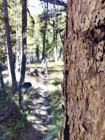
Head south from the lake and bike down a track similar to the one you climbed up. The riding is bumpy and varied but all pretty fast if you keep charging!
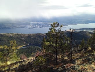
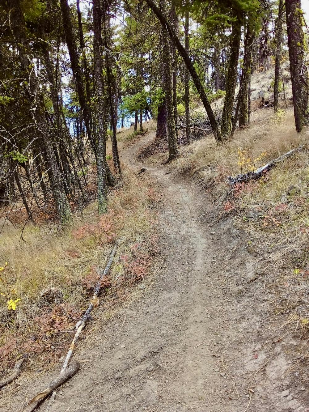
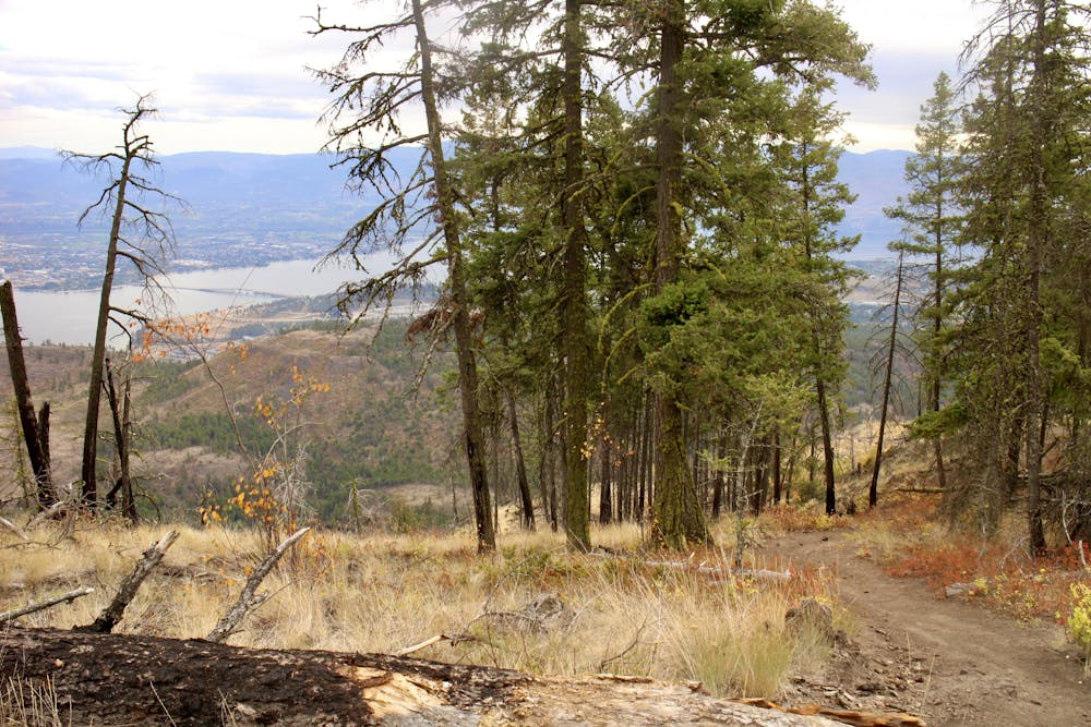
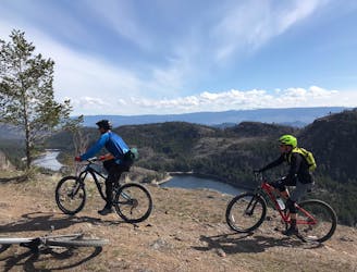
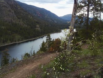
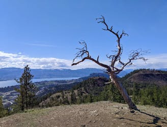
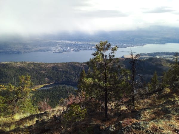
Turn left at a junction at 1050m and join the Mcdougall Rim trail. The nature of the riding really changes here, and the quality increases. Winding through trees and linking a series of clearings - all of which provide huge views across Rose Valley Lake and the Okanagan Valley - the trail is always interesting without ever being overly difficult. Much of it is wonderfully flowy and the technical sections are usually pretty brief. Keep on charging all the way down to the parking lot!
By the time you get down you'll likely be tired, pumping with adrenaline, and thirsty! Cruise into town for a celebratory - and well earned - drink.
Difficult
Mostly stable trail tread with some variability featuring larger and more unavoidable obstacles that may include, but not be limited to: bigger stones, roots, steps, and narrow curves. Compared to lower intermediate, technical difficulty is more advanced and grades of slopes are steeper. Ideal for upper intermediate riders.

The trail contains some obstacles such as outcroppings and rock which could cause injury.

Little chance of being seen or helped in case of an accident.
1 m away
Rose Valley's classic long ride is well worth the hype!
Difficult Mountain Biking
1.2 km away
A scenic trip around a beautiful and wild-feeling lake
Difficult Mountain Biking
1.2 km away
Link 2 of Rose Valley's best trails and enjoy some epic scenery en route.
Difficult Mountain Biking
1.9 km away
A nice way to link a couple of Rose Valley's lesser known trails
Severe Mountain Biking
1.9 km away
2 Rose Valley classics which offer solitude, scenery and speed!
Severe Mountain Biking
2.6 km away
A wonderful quick hit which feels much more remote than it really is.
Difficult Mountain Biking
5.2 km away
A fun and logical extension to the Smith Creek classics
Difficult Mountain Biking
6.3 km away
A Smith Creek classic which has some great northshore features.
Difficult Mountain Biking
6.3 km away
Explore a remote part of Smith Creek on a narrow and challenging trail
Difficult Mountain Biking
6.3 km away
Smith Creek's best known trail is pure Type 1 fun! The views aren't bad either....
Difficult Mountain Biking
5 routes · Mountain Biking

7 routes · Mountain Biking · Hiking
4 routes · Mountain Biking
7 routes · Mountain Biking