6.3 km away
Via Alpina: Castérino to Refuge des Merveilles
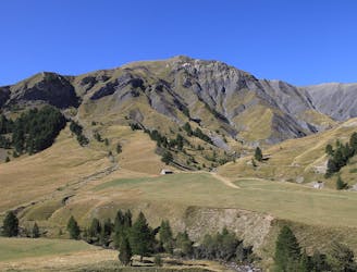
Day 3 of the Via Alpina Red hiking itinerary takes you into Mercantour National Park and through the famous Vallée des Merveilles.
Difficult Hiking
- Distance
- 16 km
- Ascent
- 1.1 km
- Descent
- 496 m
Day 4 of the Via Alpina Red itinerary from the Italian Alps to the Mediterranean.
Hiking Difficult

This is perhaps the toughest hiking day of the trail, but it's not without its rewards, of which there are many! You start by leaving the Mercantour National Park via the GR52 into the beautiful Nice foothills, often carpeted with wildflowers and alive with the sound of crickets, floral scents, and wonderful panoramic views!
Leaving the Refuge des Merveilles, follow the GR52 up to the Muta Lake and on to the Pas du Diable Pass. Descend to the bottom of the valley and follow the Ciantasque stream along to the Baisse Cavaline. Cross over to the other side of the stream and continue along the path which takes you around the base of the Raus summit and the Raus Pass and the Tuor summit before reaching the Baisse de St Veran. From here, begin to ascend up to the Pointe des Trois Communes Peak, your resting place for the night! A good place to stay is the Baisse de Camp d’Argent.
Sources http://www.mercantour-parcnational.fr/en http://www.via-alpina.org/en/stage/328
Difficult
Hiking trails where obstacles such as rocks or roots are prevalent. Some obstacles can require care to step over or around. At times, the trail can be worn and eroded. The grade of the trail is generally quite steep, and can often lead to strenuous hiking.
6.3 km away
Day 3 of the Via Alpina Red hiking itinerary takes you into Mercantour National Park and through the famous Vallée des Merveilles.
Difficult Hiking
7 routes · Hiking