1.3 km away
Christ-Roi
Easy hike to the statue du Christ-Roi.
Moderate Hiking
- Distance
- 2.4 km
- Ascent
- 197 m
- Descent
- 197 m
A fabulous circular hike taking in one of the best viewpoints in Chamonix Valley.
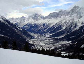
Hiking Severe

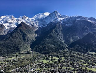
This is a great full day out with some of the best views of Mont Blanc and the glaciers. Starting from the characterful hamlet of Le Bettey you will hike through the ancient houses, and up through forests of pine and spruce.
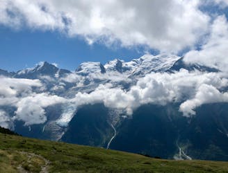
The trail is easy enough, and climbs steadily zig-zagging up the mountainside until eventually you are above the treelike and greeted by fabulous views. It feels as though you are exactly opposite the glaciers, and you can see all the detail and features on a good weather day.
It gives great photo opportunities of the most famous summit in Western Europe, Mont Blanc. After a snack stop at the Chalets de Chailloux you can make this day shorter by traversing back left at this point to join your descent route. However, if you have the energy we recommend you head for the summit of the Aiguillette des Houches which sits at 2285m.
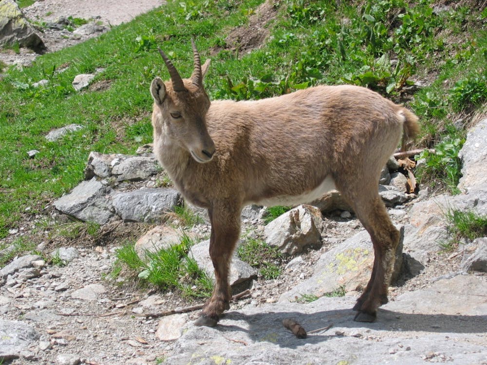
From the Chalets de Chailloux you are in the open above the trees and the views continue. Hiking up through Alpenrose and heather you will eventually reach the summit where the views are 360 degrees. A really great spot for lunch and to reflect on the climb.
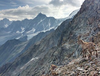
For the descent you can take the ridge line which is quite spectacular with drops to the right hand side into the valley above the village of Servoz and with views to the cliffs of the Fiz.
After leaving the ridge line the descent trail heads back into the forest, and zig-zags down the mountain until you arrive at the tiny hamlet of La Flatiere and then on to Le Bettey where you began. Enjoy!
Severe
Hiking challenging trails where simple scrambling, with the occasional use of the hands, is a distinct possibility. The trails are often filled with all manner of obstacles both small and large, and the hills are very steep. Obstacles and challenges are often unexpected and can be unpredictable.

The trail contains some obstacles such as outcroppings and rock which could cause injury.
Away from help but easily accessed.
1.3 km away
Easy hike to the statue du Christ-Roi.
Moderate Hiking
1.6 km away
A pleasant hike with views of the Mont Blanc Massif
Moderate Hiking
2 km away
A challenging loop showcasing the diversity of the Mont Blanc mountain range.
Severe Hiking
2.4 km away

While one of the less interesting sections of the TMB, this stretch still offers a few hidden trail gems.
Moderate Hiking
3.7 km away
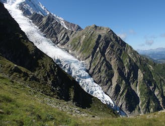
Day 2: An excellent day taking in a huge variety of views, from alpine meadows to hanging glaciers and rocky ridges.
Difficult Hiking
4.7 km away
A famous hike which was the starting point for Jacques Balmat and Michel Paccard when they made the first ascent of Mont Blanc in 1786.
Difficult Hiking
4.8 km away

Day 1: A gentle downhill day on the sun-kissed south-facing slopes of the Brévent peak.
Moderate Hiking
4.8 km away

Circumnavigate the iconic Mont Blanc massif on this epic multi-day route.
Severe Hiking
5.8 km away

Escape the crowds at Lac Blanc by hiking to Lac Cornu instead.
Severe Hiking
6.4 km away
Beautiful loop with enough alternatives to fit any hiker's taste and endurance
Severe Hiking

6 routes · Hiking

14 routes · Hiking

5 routes · Hiking

12 routes · Hiking