7.2 km away
Monts Veyrier and Baron Traverse
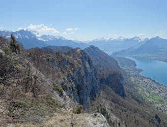
A classic ridge traverse along 2 prominent and famous peaks.
Difficult Hiking
- Distance
- 12 km
- Ascent
- 1 km
- Descent
- 1 km
Raphaël Garagnon hike & fly
Hiking Moderate

The Col des Frêtes is one of the best site for hike & fly around Annecy. It is located at the south of the Dents de Lanfon above Talloires and the famous paragliding site of Planfait. It's a superb and large take-off on a beautiful grassy slope, at an altitude of 1645 meters.
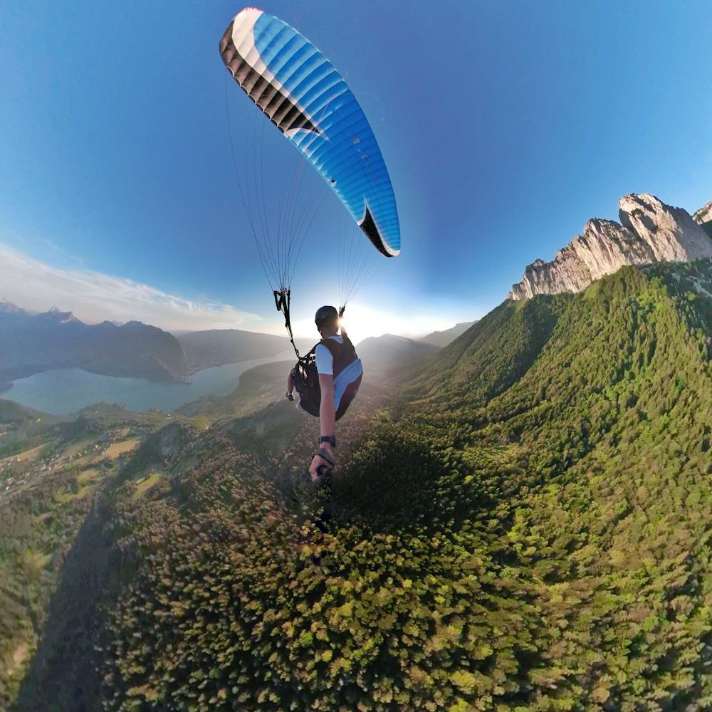
You can either start from the landing of Perroix (1100 m of elevation gain), or start from Planfait's takeoff (700 meters of elevation gain). Once you get to the take-off keep going on a logging road. When you arrive at a large beech tree bearing several wooden signposts: follow the direction of the Col des Frêtes, and start a steep ascent in the forest. Once you go out from the forest, the path gets quite steep on grassy slopes as you arrive below the Dents de Lanfon. Please note that this final part to reach the Col becomes very muddy and slippery in case of rain/wet conditions. At the top, you can enjoy a breathtaking view of the lake, the Dents de Lanfon and the surrounding area. The take-off is south-west
Moderate
Hiking along trails with some uneven terrain and small hills. Small rocks and roots may be present.

Some trail sections have exposed ledges or steep ascents/descents where falling could cause serious injury.

Away from help but easily accessed.
7.2 km away
A classic ridge traverse along 2 prominent and famous peaks.
Difficult Hiking
7.3 km away

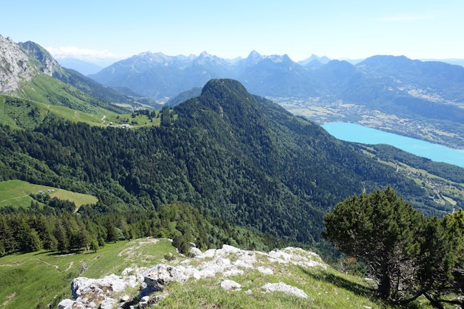
La vue mythique qu'offre ce col a une autre saveur lorsque que l'on vient d'en bas
Moderate Hiking
1 routes · Hiking

15 routes · Hiking · Trail Running