20 m away
Kv du Mont-Blanc

le kilomètre vertical de Chamonix
Difficult Trail Running
- Distance
- 3.9 km
- Ascent
- 1 km
- Descent
- 0 m
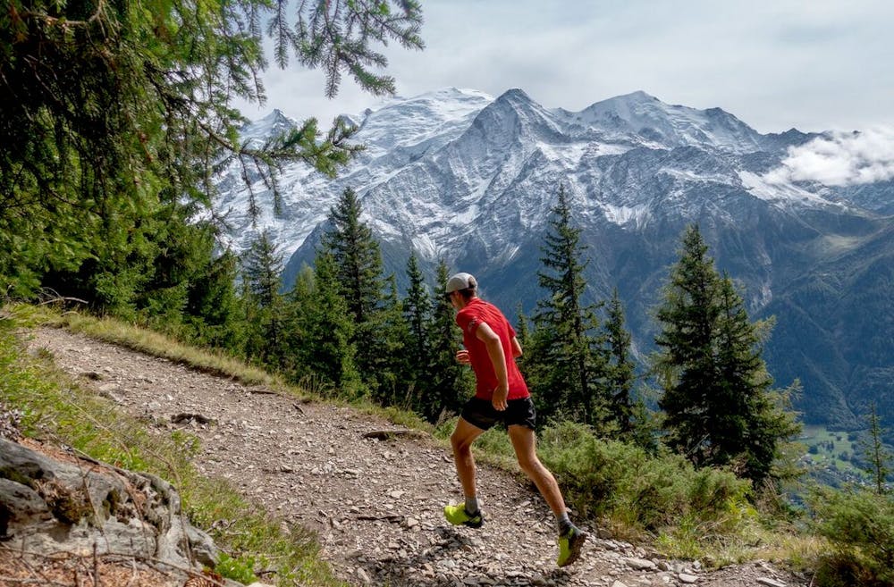
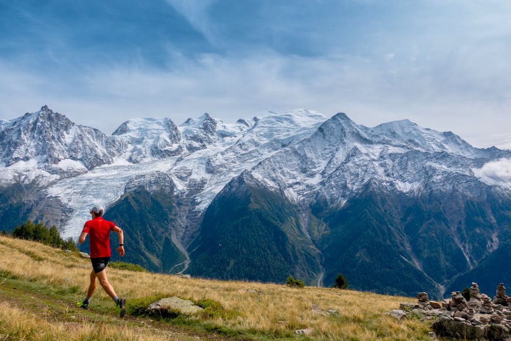
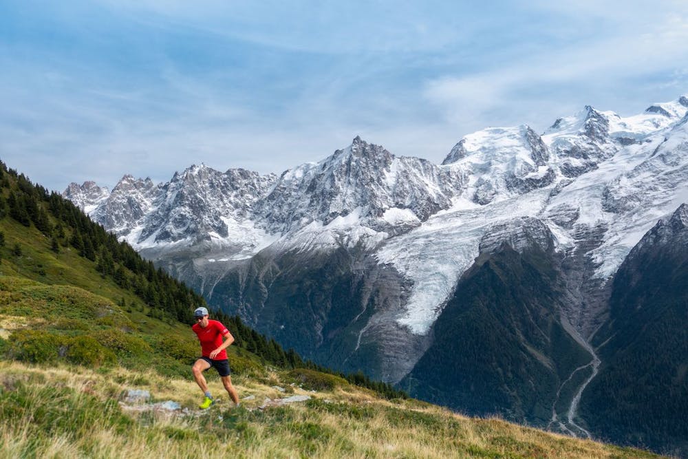
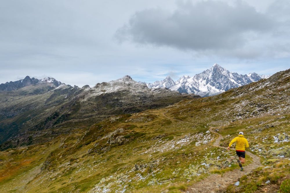
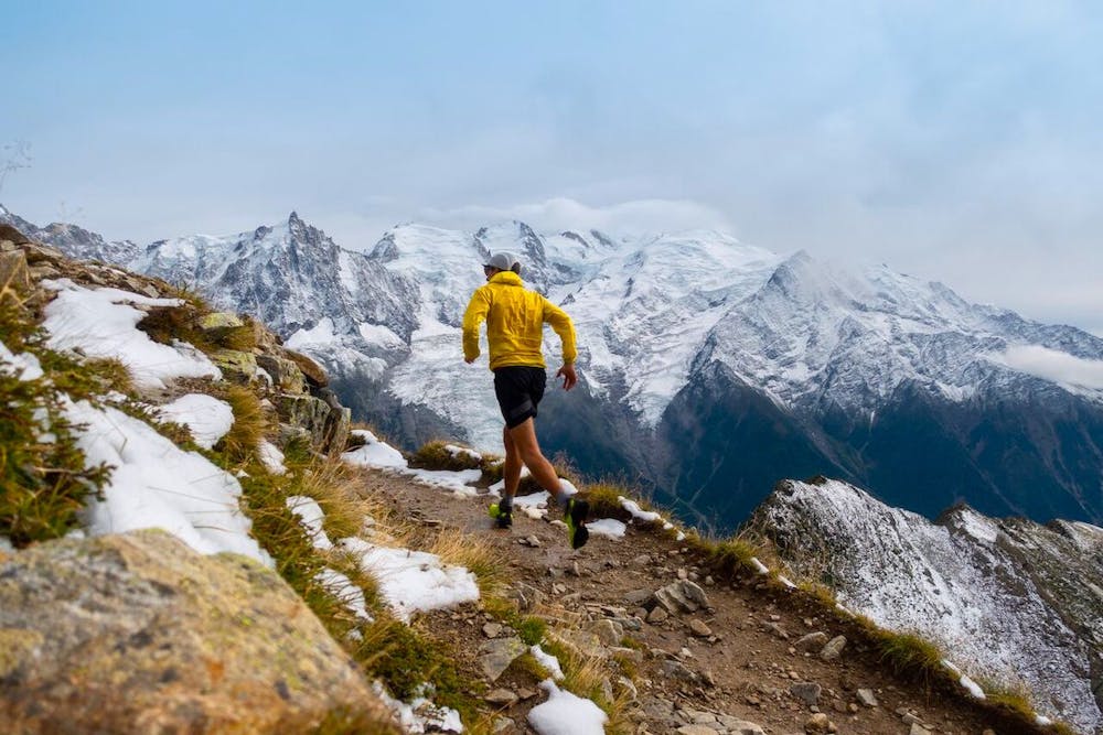
A stunning ridgeline run opposite Mont Blanc
Trail Running Difficult

This route, on the sunnier side of the valley, travels through forest and high meadows to a dramatic traverse between the Aiguillette des Houches and Brévent, opposite Mont Blanc. But make sure you look the other way too — the views are panoramic, stretching to the jagged Fiz and Aravis mountain ranges. At the finish of the run, you can take the Brévent cable-car down to Chamonix. You could also run trails down to town if you like.
Check out Run the Alps trip options here: https://runthealps.com
Difficult

Away from help but easily accessed.
20 m away
le kilomètre vertical de Chamonix
Difficult Trail Running
41 m away

Epreuve reine de l'événement
Severe Trail Running
52 m away

La course nocturne en binome
Difficult Trail Running
59 m away

La plus longue coure du Marathon
Extreme Trail Running
229 m away
An amazing way to see some of the best view in Chamonix on foot.
Moderate Trail Running
730 m away

A classic loop around the Chamonix Valley.
Easy Trail Running
872 m away

La course format 10k de l'événement
Moderate Trail Running
892 m away

le cross du Mont-blanc
Difficult Trail Running
906 m away

Le mini cross est un petit trail pour les plus jeunes, de 800m à 3km en fonction des catégories.
Easy Trail Running
921 m away
Enjoy the open vistas of the north balcony between Montenvers and Plan de l'Aiguille on vintage Chamonix trails.
Moderate Trail Running

8 routes · Trail Running