3.8 km away
Lavoir to the Refuge du Mont Thabor
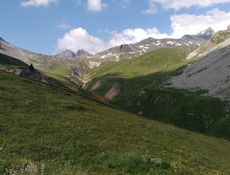
A lovely day trip on its own, or a positioning day ahead of summiting Mont Thabor
Moderate Hiking
- Distance
- 5.2 km
- Ascent
- 597 m
- Descent
- 11 m
A wild mountain day taking you to one of France's best known summits
Hiking Difficult

This is a frankly brilliant mountain day but don't underestimate it because it takes you above 3000 metres and involves a long, tough climb which is harder than it might initially appear.
Although today is a long one, it's not long enough that you need a pre-dawn start so wait until the sun is up before leaving the hut behind. It's actually not much of a detour if you want to return to the hut on the way down from the summit so feel free to leave a few things at the hut and only take what you really need to Mont Thabor.
Start out by hiking back to the col overlooking Névache village and then make a long, ascending traverse around a bowl to the northern side of Le Grand Séru peak. Climb westwards beneath Le Grand Séru's north face across rocky terrain to the final summit slope of Mont Thabor.
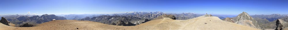
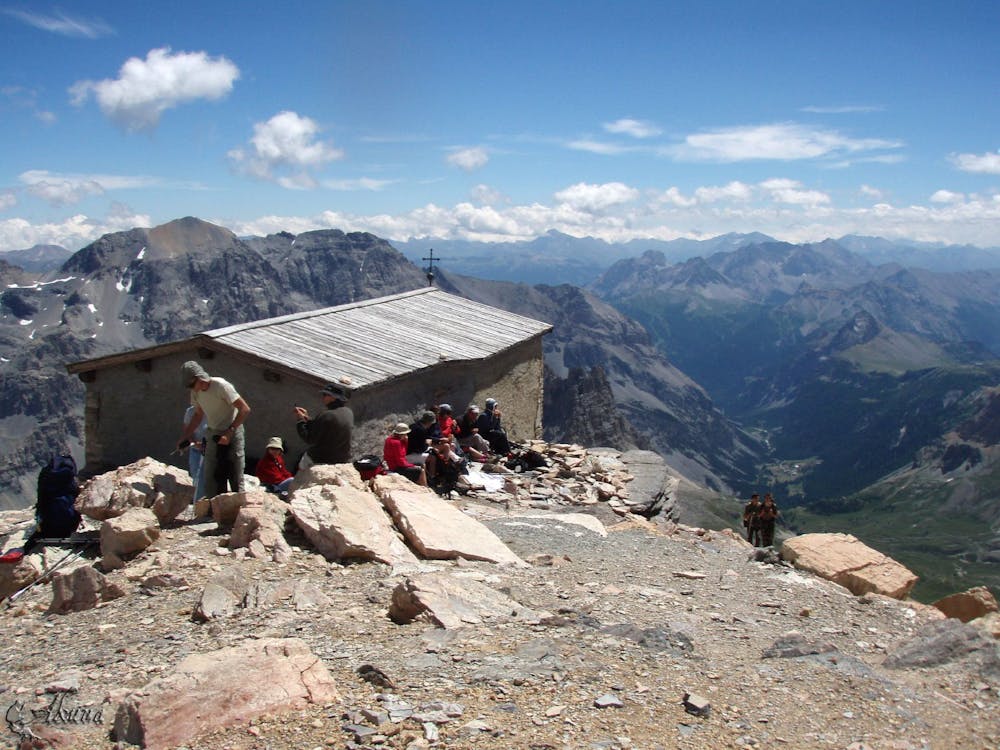
The slope is deceptively long and even though it looks like you'll be up it quickly, you'll find yourself climbing it for much longer than you might have expected! Just keep plodding up and eventually you will reach the incredible Mont Thabor chapel, which sits high on the peak in a scarcely believable position. The chapel is not open to the public but it does provide some shelter from any wind, and also makes a perfect subject for a photo. From the chapel it's only a very short climb to the summit of Mont Thabor itself. The views are absolutely incredible, with the Ecrins dominating the panorama to the south-west and to the north lies the Vanoise national park and the southern end of the 3 valleys.
Snap plenty of photos and then retrace your steps all the way back down to the Refuge du Mont Thabor. From there descend all the way down to the large parking area above Valfréjus.
Difficult
Hiking trails where obstacles such as rocks or roots are prevalent. Some obstacles can require care to step over or around. At times, the trail can be worn and eroded. The grade of the trail is generally quite steep, and can often lead to strenuous hiking.

The trail contains some obstacles such as outcroppings and rock which could cause injury.

Little chance of being seen or helped in case of an accident.
3.8 km away
A lovely day trip on its own, or a positioning day ahead of summiting Mont Thabor
Moderate Hiking
9.5 km away
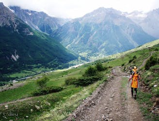
Follow the Via Alpina from Savoy to the Hautes Alps.
Moderate Hiking

3 routes · Hiking