Grand Arc Loop
Lauziér
Saint-Jean-de-Maurienne
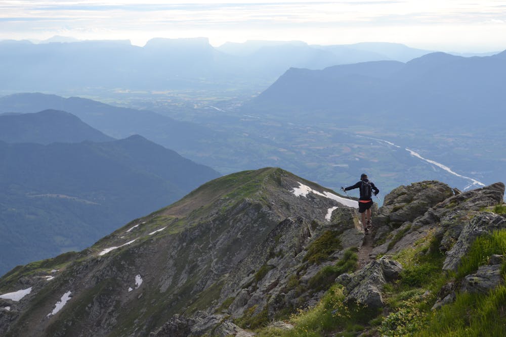
Overlooking Albertville
Trail Running Difficult
- Distance
- 25 km
- Ascent
- 2.1 km
- Descent
- 2.1 km
- Duration
- 5-6 hrs
- Low Point
- 1.3 km
- High Point
- 2.5 km
- Gradient
- 19˚

Stunning 360 degree views from the Grand Arc giving a great perspective over the surrounding 6 National Parks.
Description
Starting in Tiouleve, Montsapey, taking in the Grand Arc Ridge to the Chalet de la Thuile, returning on the lower trails.
The Chalet de la Thuile provides a perfect mid-route coffee stop or even lunch (phone ahead for food).
Great bar/restaurant at the parking in Tiouleve, Montsapey.
Travelling anti-clockwise, on reaching the 2034m mark on the Petit Arc shoulder (after passing the Marret hut). Be sure to drop down past the Chalet de la Platiere. It is tempting to traverse across and take a shortcut. This is 'do-able', but beware, the trail is un-used and disappears into a bog. Therefore not a great 'short-cut'!
www.thealplife.com
Difficulty
Difficult
Medium Exposure

The trail contains some obstacles such as outcroppings and rock which could cause injury.
Remoteness
Away from help but easily accessed.