99 m away
Bush Key
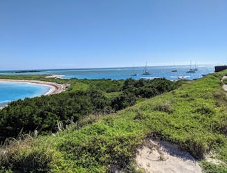
Walk along white-sand beaches among abundant bird and sea life.
Easy Hiking
- Distance
- 1.3 km
- Ascent
- 2 m
- Descent
- 2 m
Walk the walls of a massive old fort that juts into the sea.
Hiking Easy

In most photos from Dry Tortugas National Park, you’ll see Fort Jefferson, unmistakable with its brick walls rising starkly from the placid blue-green water. The fort was built here in the 19th century to guard crucial shipping routes, though it was never completed or fully armed.
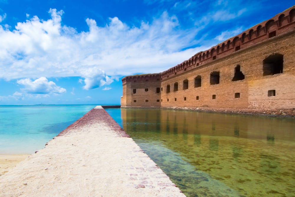
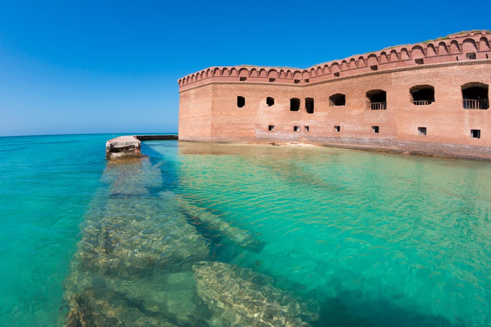
The fort and the island on which it stands, Garden Key, have served various human purposes over the years, including a coal supply station for ships. But the island has always been crucial bird habitat and a foundation for reefs in the surrounding shallow waters. Today, the national park protects the historic relic of the fort, and more importantly, preserves the colorful natural ecosystem. The best activity on Garden Key has to be snorkeling among the fish and corals, but walking around the island and the fort shouldn’t be missed, either.
The route mapped here goes to a beach and dock ruins on the north side of the island, and also makes a loop around the inside of the fort. You’ll likely cover much more distance than what’s mapped, however, if you explore the various rooms and grounds. Fort Jefferson is open every day from sunrise to sunset, and you are free to roam on your own within. Ranger-led tours may also be available on certain days.
Sources: https://www.nps.gov/drto/learn/historyculture/fort-jefferson.htm
Easy
Walking along a well-kept trail that’s mostly flat. No obstacles are present.

The trail contains some obstacles such as outcroppings and rock which could cause injury.

Close to help in case of emergency.
99 m away
Walk along white-sand beaches among abundant bird and sea life.
Easy Hiking

5 routes · Hiking · Sailing

63 routes · Alpine Climbing · Hiking