2.7 km away
Lantau Peak
Head up Hong Kong's second tallest peak for a heart-thumping, extremely scenic hike.
Difficult Hiking
- Distance
- 5.3 km
- Ascent
- 562 m
- Descent
- 465 m
Sunset Peak hike on Lantau Island is a heroic stairway climbing challenge to one of the best viewpoints in Hong Kong.
Hiking Difficult

One of the most popular hikes in Hong Kong is also one of its most challenging. Sunset Peak is the third tallest mountain in the Territory and is easily accessible from the city centre from the many public transportation options available.
The start and end points are reversible, but the most common option is to start from Tung Chung, as Pak Kung Au’s start is more challenging.
There isn’t much tree cover during this hike, giving you incredible views, but also giving you little shade, so make sure to bring plenty of water and a hat.
Reach the trailhead by walking or taking a minibus from Tung Chung Railway Station to Wong Lung Hang Picnic Site. The sign for Sunset Peak is clearly marked just past the picnic site. From there, kick-start your hike with a challenging 400-metre stair climb.
After the initial steep start, meander on earth trails through the rugged mountainside, working your way higher and higher.
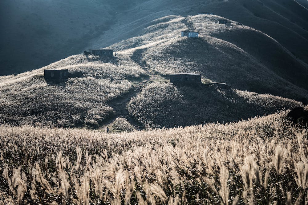
Near the top, 20 stone huts dot the trail. Some say these huts were built by local stone cutters in the 1920s as summer retreats, while others say British missionaries built them. Today, they're privately owned and can sometimes be rented for remote overnight stays.
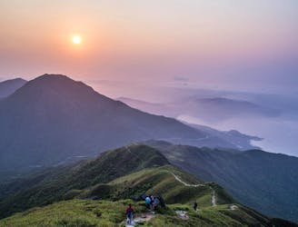
Here, take a break from the near-continuous ascent and have fun scrambling up the nearby boulders, striking a pose with an epic backdrop of the sea, surrounding islands, and rolling hills.
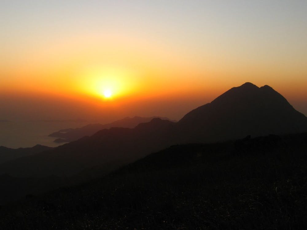
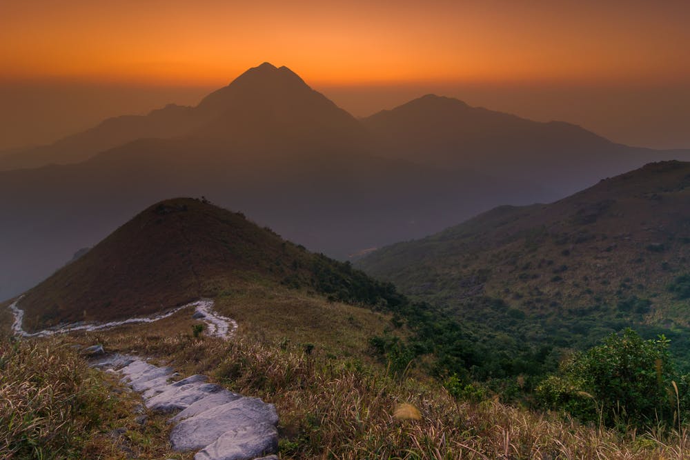
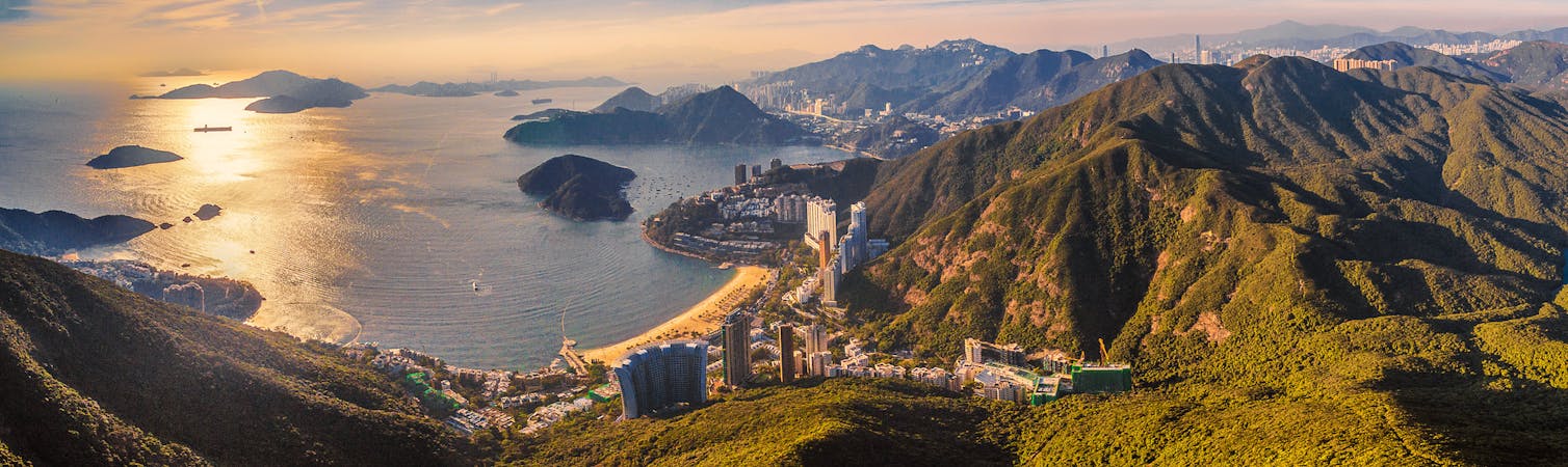
Once you’ve reached Sunset Peak, you’ll be rewarded with amazing 360-degree views. If you have time, try and stay for the sunset, its vibrant orange and red hues shimmering off the sea below are enchanting.
The descent is fast and fun along stone rocks, and once you’ve completed the hike, you can hop on a bus to one of the nearby beaches and their restaurants, to Mui Wo for a refreshing drink and a ferry trip back to Central, or to Tung Chung to catch the MTR.
Difficult
Hiking trails where obstacles such as rocks or roots are prevalent. Some obstacles can require care to step over or around. At times, the trail can be worn and eroded. The grade of the trail is generally quite steep, and can often lead to strenuous hiking.

Some trail sections have exposed ledges or steep ascents/descents where falling could cause serious injury.

Away from help but easily accessed.
2.7 km away
Head up Hong Kong's second tallest peak for a heart-thumping, extremely scenic hike.
Difficult Hiking
6 routes · Hiking