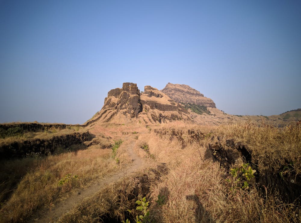
Torna to Rajgad
Adventurous hiking route
Hiking Extreme
- Distance
- 16 km
- Ascent
- 928 m
- Descent
- 1.2 km
- Duration
- 4-5 hrs
- Low Point
- 710 m
- High Point
- 1.4 km
- Gradient
- 20˚

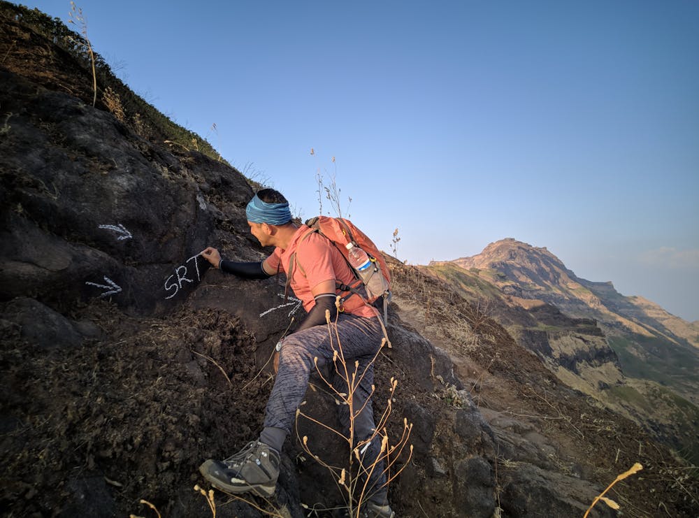
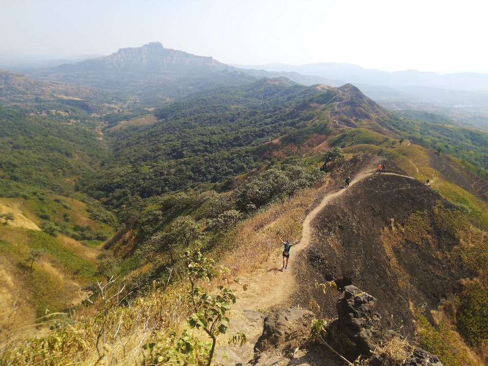
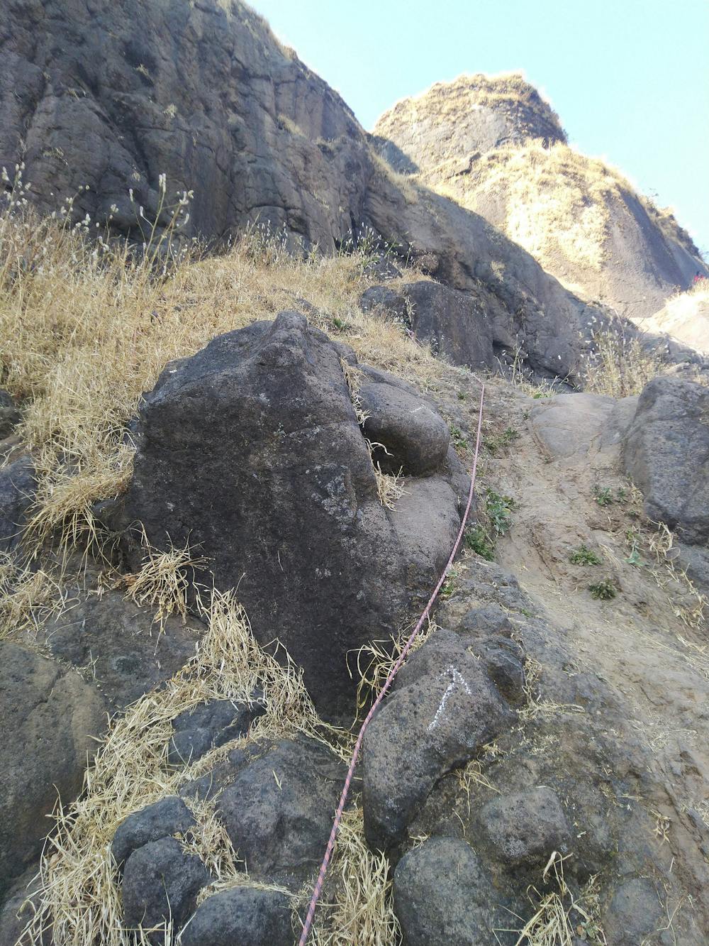
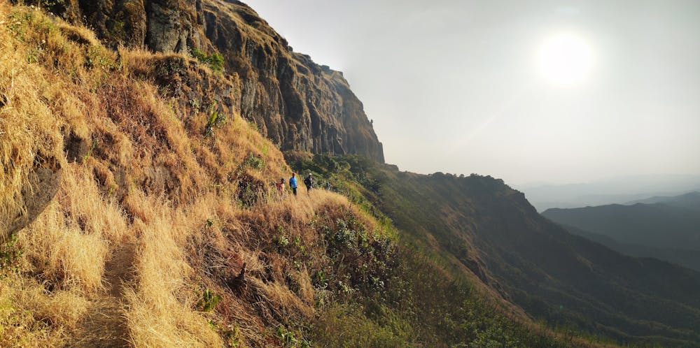
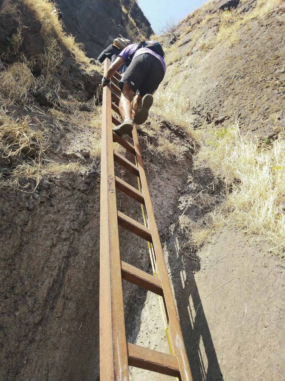
One of the famous trek routes both from either of the exit points.The route from Rajgad goes from 'cheetah darwaja' to 'bhutonde khind' a very scenic ridge.Upwards from Bhutonde Khind to Budhla Machi is a continuous ascending ascend with difficulty also soaring with the ladder to climb across to the climax. Adrenaline rush reaching Torna Fort from 'Hatticha Mal'(Elephants Plateau) slowly towards the Kokan Darwaja studded with railings to cling even in the windiest part of the climb. The route is a adventurous heritage hike and for beginners trek a whole day shall be much needed while for running goliaths a blitz krieg of 6-7hours. Summers Apr-Jun shall be dehydrating while the heavy rainfall months of Jul-Sep shall be slippery algae trodden. Besides the exit points there is very rare possibility enroute you could avail any refreshments though there is habitation in between near the road exit at Bhutonde. The route is narrated from Rajgad to Torna and in instance of the the other way round climb just mirror the description,elevation,gradient.The hard work committed is a double edged sword for any start and exit point here.
- •
- •
- •
- •
- •
- •
Difficulty
Extreme
Scrambling up mountains and along technical trails with moderate fall exposure. Handholds are necessary to navigate the trail in its entirety, although they are not necessary at all times. Some obstacles can be very large and difficult to navigate, and the grades can often be near-vertical. The challenge of the trail and the steepness of the grade results in very strenuous hiking. Hikes of this difficulty blur the lines between "hiking" and "climbing".
High Exposure

Some trail sections have exposed ledges or steep ascents/descents where falling could cause serious injury.
Remoteness

Away from help but easily accessed.
Best time to visit
Features
- Wildlife
- Historical
- Picturesque
- Summit Hike
- Wild flowers
- Water features
- Forestry or heavy vegetation