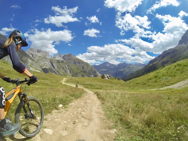
Aiguille de la Grande Sassière to Le Chevril
An extended challenging route and descent from the epic summit route.
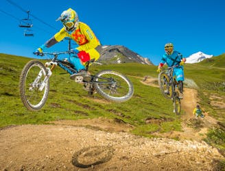
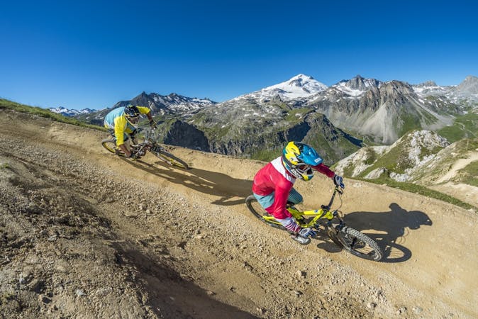
Difficult Mountain Biking
- Distance
- 16 km
- Ascent
- 1.5 km
- Descent
- 1.9 km
The highest, rideable, French Alps trail that's not protected by a National Park—extreme and very challenging!
Mountain Biking Extreme

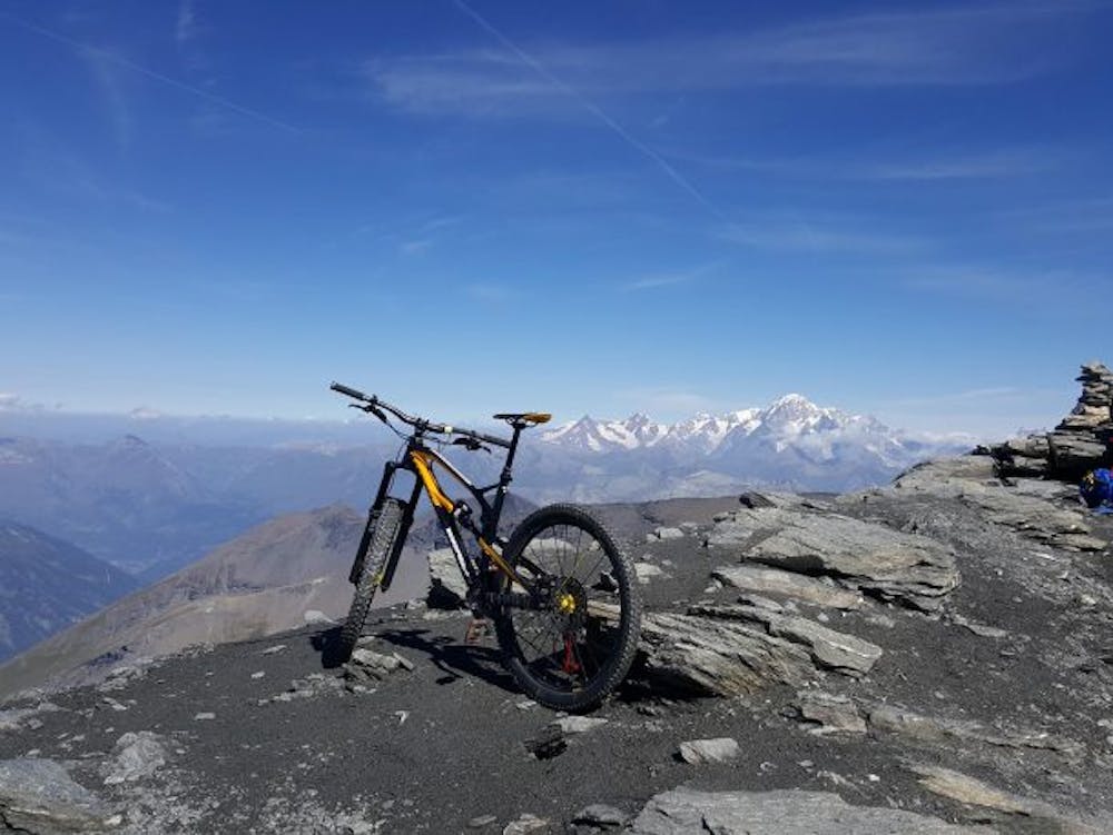
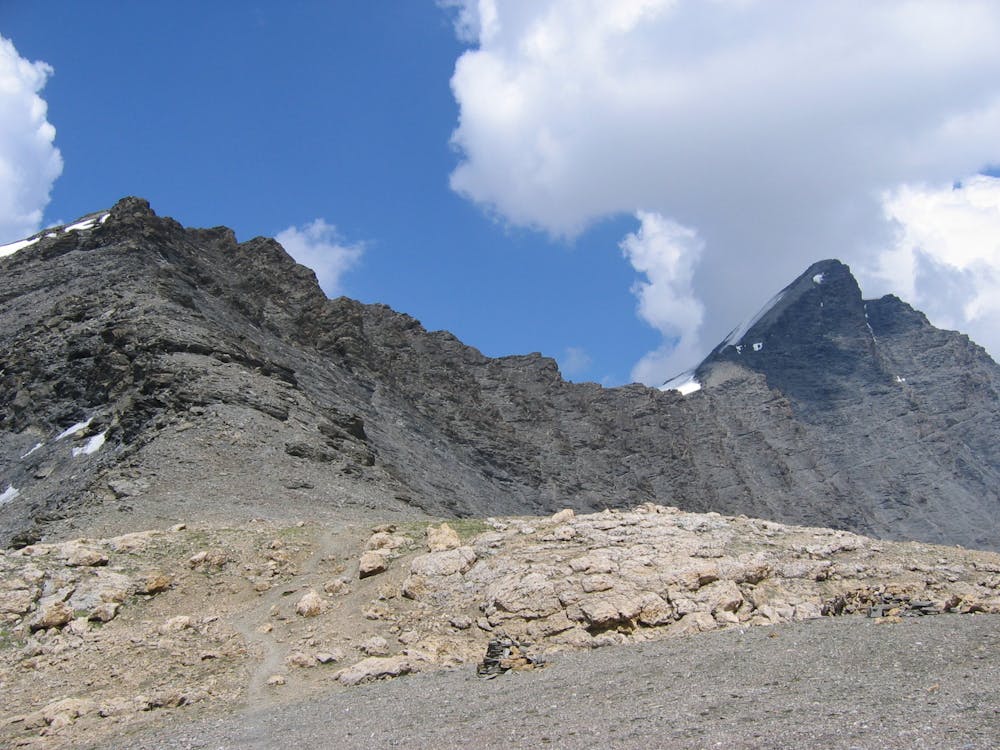
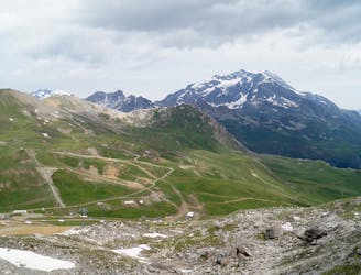
Aiguille de la Grande Sassière is a mountain in the Graian Alps, on the boundary between the Aosta Valley (northern Italy) and the French department of Savoie in the Tarentaise Valley. This route to aiguille de la Grande Sassière summit (3,747m) is a high alpine challenge, with the final third being along a ridgeline beside Sassière glacier. You'll enjoy stunning views the entire route!
It is the highest and longest trail that is rideable in the French Alps that isn't protected by a National Park.
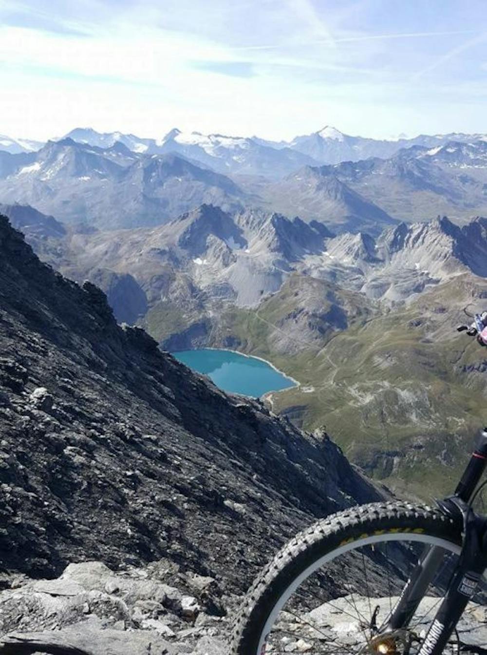
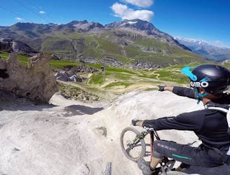
Highlights include views of the nearby Grande Sassière, multiple lakes, Sassière glacier, and down the Aosta Valley from the summit. There’s only about a 6-week window every summer where the snow on the glacier has melted from the West Ridge trail and it’s actually possible to ride all the way down without needing to walk. This route also provides details of the only possible way to get to the summit with a bike and the start of the trail descent.
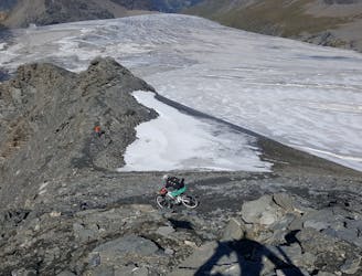
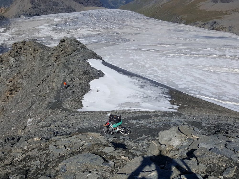
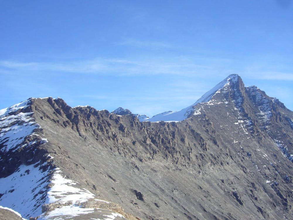
Start from the parking at Lac du Saut and be prepared for a strenuous 5+ hour climb to the summit, with a combination of carrying and pushing your bike most of the way. Take the time to enjoy the stunning views—particularly as the path comes around the back of the Grande Sassière, looking down on Sainte Foy and Tignes. The final third of the ascent is straight up a 45° rocky shale slope on the west ridge.
The shale is difficult to get a good grip on as it moves below your feet, and black ice is highly possible, so extreme caution is required here. There will be an overwhelming sense of triumph once the summit is reached—take in the amazing views over the Western Alps.
Avoiding stopping too long at the summit, as the altitude dictates very chilly temperatures.
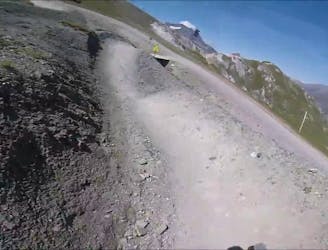
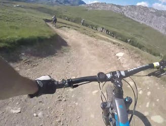
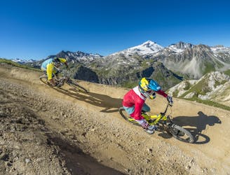
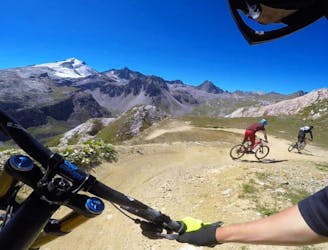
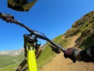
The descent is the reverse of the route to the summit, but this time you'll be riding your bike! It’s a very technical descent that will take over two hours to complete and is definitely for experienced and advanced riders.
There are some very steep parts with almost vertical drops off the side.
As parts of the trail are shale, beware of the earth moving beneath your wheels, and of the sharp stones—falling off will hurt! There are lots of turns and steep, tight switchbacks.
This is an incredible, epic ride and should be undertaken seriously and responsibly, but it's well-worth the arduous effort.
For an extended challenge and descent, continue following the route described under "Alternative Descent from Aiguille de la Grande Sassière to le Chevril."
Alternatively, continue following the "Sassière to Séez" route for an extra long, epic day on the bike. Either way, if you take one of the other two route options, shuttling to return to the start will be required.
Extreme
Very steep, difficult, narrow singletrack with widely variable and unpredictable trail conditions. Unavoidable obstacles could be 15in/38cm tall or greater, and unavoidable obstacles with serious consequences are likely to be present. Obstacles could include big rocks, difficult root sections, drops, jumps, sharp switchbacks, and more. Ideal for expert-level riders.

Some trail sections are extremely exposed where falling will almost certainly result in serious injury or death.
In the high mountains or remote conditions, all individuals must be completely autonomous in every situation.
An extended challenging route and descent from the epic summit route.
Difficult Mountain Biking
3.7 km away
Alternative, technical descent for the final third of Fast Wood.
Severe Mountain Biking
5 km away
Big jumps and turns make this trail a "Toboggan for MTB."
Moderate Mountain Biking
5 km away
This trail features a mix of machine-groomed and natural—it's a fast, flowy and super fun track with a big gap jump.
Difficult Mountain Biking
5 km away
An alternative, technical descent to the first part of Fast Wood.
Severe Mountain Biking
5 km away
An easy top to bottom, fast, fun, and flowy trail.
Easy Mountain Biking
5.1 km away
The longest trail in the Tovière area of the bike park, this is a flowy and playful track with lots of berms and jumps
Moderate Mountain Biking
5.3 km away
A Tignes Bike Park classic—as hard as you want it to be.
Moderate Mountain Biking
5.3 km away
An alternative, more challenging descent section near "Gunpowder."
Difficult Mountain Biking
5.9 km away
New for 2017, this is an easy, fun, and flowy trail.
Easy Mountain Biking
11 routes · Mountain Biking
12 routes · Mountain Biking