6.9 km away
Habicht
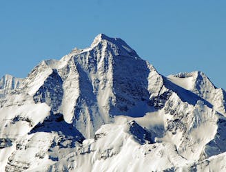
A long tour which takes you onto one of the Tirol's most famous peaks.
Difficult Ski Touring
- Distance
- 12 km
- Ascent
- 2 km
- Descent
- 2 km
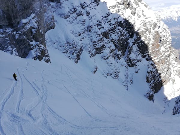
Moderate Skitour that needs stable conditions. Less traffic than the Maurerspitze
Ski Touring Moderate

This is a popular ski touring route which is generally considered to be moderate. It's not remote, it features medium exposure (e2) and is typically done between December and April. From a low point of 1.4 km to the maximum altitude of 2.7 km, the route covers 6.2 km, 1285 vertical metres of ascent and 6 vertical metres of descent. It's graded 2.2 and Labande grade 1.
Alternative to the Maurerspitze with a lot of interesting descent variants that need stable conditions
Moderate
Slopes become slightly steeper at around 25-30 degrees.

As well as the slope itself, there are some obstacles (such as rock outcrops) which could aggravate injury.

Close to help in case of emergency.
6.9 km away
A long tour which takes you onto one of the Tirol's most famous peaks.
Difficult Ski Touring

25 routes · Ski Touring
6 routes · Ski Touring