I Vicini di Fronte
Hike itinerary that embraces Monte Ocre with the Corno Grande del Gran Sasso.
Hiking Difficult
- Distance
- 99 km
- Ascent
- 6.3 km
- Descent
- 6.4 km
- Duration
- 1 day +
- Low Point
- 613 m
- High Point
- 2.9 km
- Gradient
- 19˚

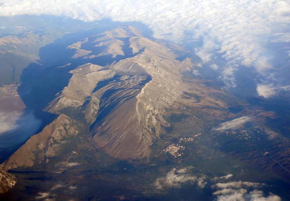
Partenza da San Felice d'Ocre, per poter salire sulla cime del Monte Ocre (2202 m slm). Attraversata tutta la catena si scende verso la valle per tornare verso l'Aquila. Una volta arrivati in città, basterà prendere il sentiero che porta alla chiesa di Madonna Fore (punto acqua potabile) per poi proseguire verso Collebrincioni, da lì dirigersi verso San Pietro della Lenca (punto acqua potabile). Salito il costone si scenderà verso il rifugio Franchetti (punto acqua potabile) per poi percorrere il sentiero CAI in direzione Corno Grande del Gran Sasso. Una volta arrivati in cima si tornerà all'Aquila passando per il sentiero che affianca la funivia arrivando ad Assergi. Successivamente, riunirsi con il sentiero fatto in precedenza per l'arrivo dell'itinerario.

- •
- •
Difficulty
Difficult
Hiking trails where obstacles such as rocks or roots are prevalent. Some obstacles can require care to step over or around. At times, the trail can be worn and eroded. The grade of the trail is generally quite steep, and can often lead to strenuous hiking.
High Exposure

Some trail sections have exposed ledges or steep ascents/descents where falling could cause serious injury.
Remoteness
Little chance of being seen or helped in case of an accident.
Best time to visit
Features
- Alpine
- Wildlife
- Picturesque
- Summit Hike