59 m away
Manie Loop
A long loop incorporating some of the most beautiful trails in Finale Ligure!
Moderate Trail Running
- Distance
- 25 km
- Ascent
- 742 m
- Descent
- 742 m
Maximize the best trails on Monte Caprazoppa with this recommended loop.
Trail Running Difficult

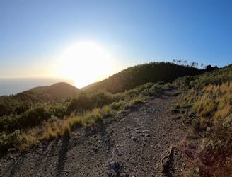
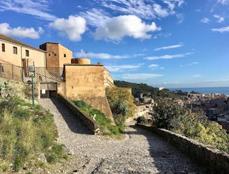
Monte Caprazoppa rises sharply above the town of Finale Ligure, forming an imposing ridge that divides Finale Ligure from nearby Pietra Ligure. While you might have a hard time imagining it when looking up at the steep mountainside, the entire ridge is covered in a dense network of singletrack trails that's perfect for trail running!
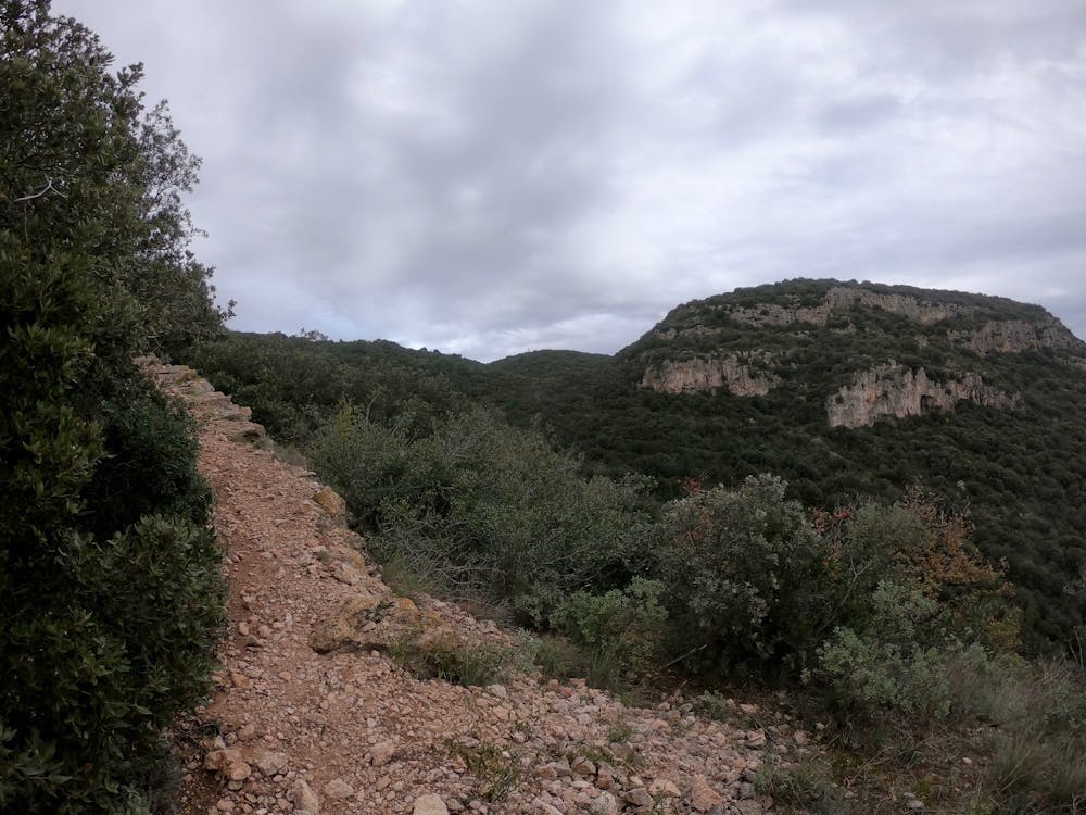
The route mapped here is one just one loop through this trail system, and as you can from the map, it’s easy to cut it shorter if you so desire. That said, this twisty loop makes use of the best and most scenic trails in the network, such as Bondi and Xmen.
After climbing steeply up the mountainside on the Sentiero via Degli Alpini, the route joins the mellow Bondi Trail to drop slowly down the ridge. After turning back up the ridge and maximizing trail time up top, this run passes by the picturesque Santa Maria Maddalena church. Thanks to the Osteria Bar la Rosa Dei Venti, this is a great spot to refuel if you need to, before continuing your run.
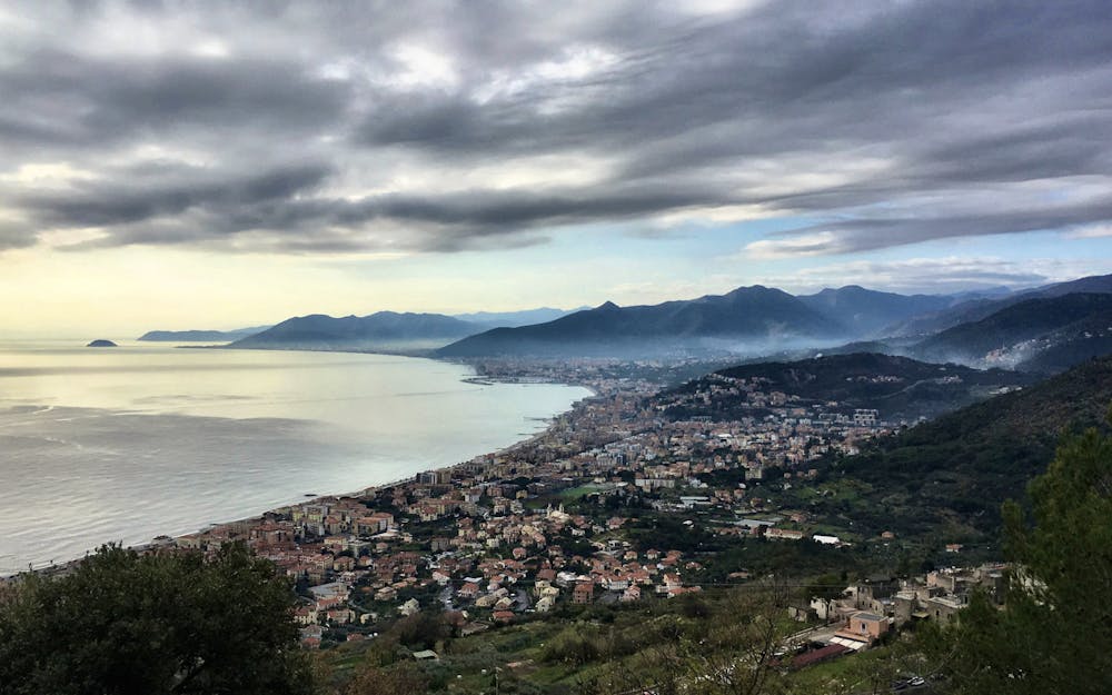
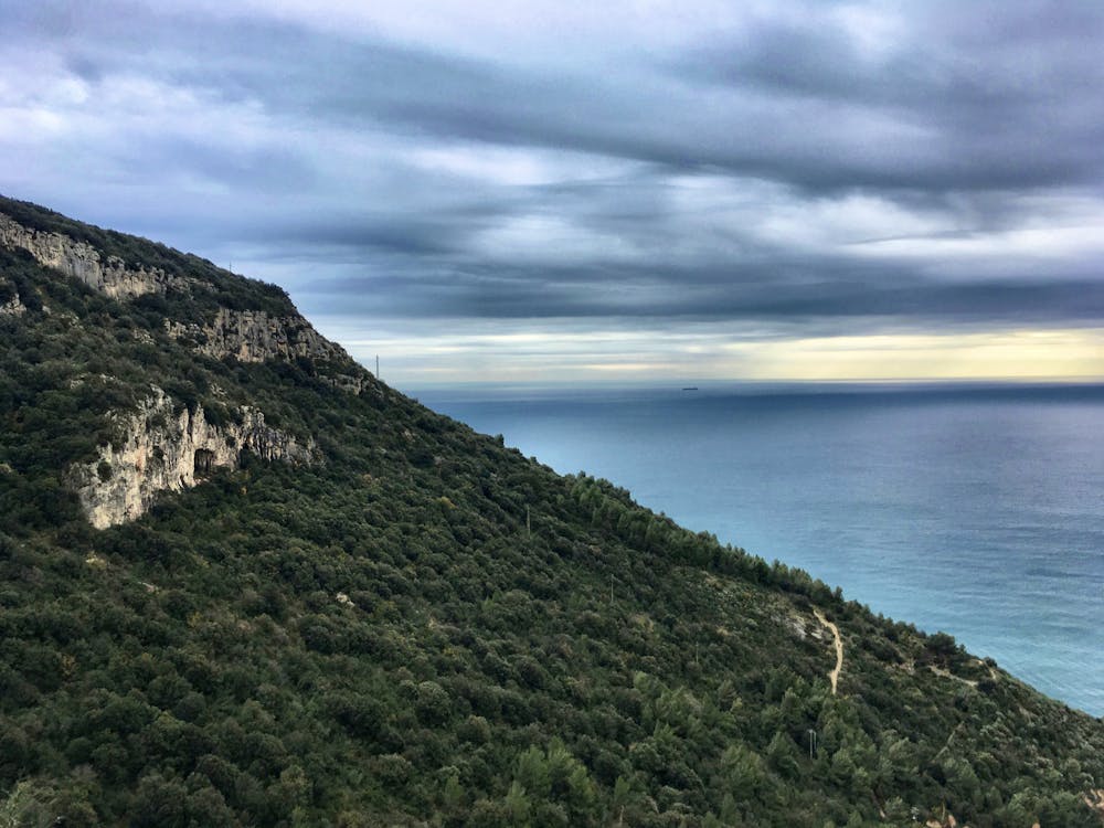
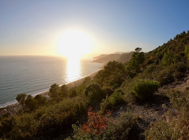
From here, the route reaches the very edge of the ridge, and essentially the end of the mountain range before it plummets into the sea. As the trail winds its way along the end of the mountains, you’ll be rewarded with never-ending views of the sea and the Italian coastline. Be sure to stop and snap a few photos!
After traversing along the edge of the ridge, this route finishes with a steep drop down the final stretches of the stair-filled Xmen Trail, ending on the edge of Finale Ligure.
Source: https://www.wikiloc.com/trail-running-trails/trail-della-polveriera-finalborgo-32113106
Difficult

Some trail sections have exposed ledges or steep ascents/descents where falling could cause serious injury.

Away from help but easily accessed.
59 m away
A long loop incorporating some of the most beautiful trails in Finale Ligure!
Moderate Trail Running
1.7 km away
A steep run to the north of Finale Ligure.
Difficult Trail Running
3 routes · Trail Running