6.8 km away
Alta Via 2 – Rifugio Viel dal Pan to Rifugio Contrin including Monte Colac (2,715m) Summit via Dei Finanzien Via Ferrata
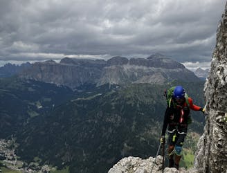
A big day for those chasing another vertical via ferrata!
Extreme Hiking
- Distance
- 19 km
- Ascent
- 1.6 km
- Descent
- 2 km
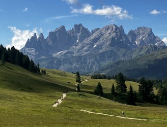
Infamous walking passing through Val Duron to reach the Lago D'Antermoia, one of the most well know Lakes of the Alpine chain. Very popular, it require a perfect weather to perform. Avoid it with rain or possible rain in the afternoon. It can be dangerous in the descent, with slippery terrain.
Hiking Difficult

This is a popular hiking route which is generally considered to be difficult. It's remote, it features high exposure and is typically done between July and September. From a low point of 1.4 km to the maximum altitude of 2.5 km, the route covers 20 km, 1182 vertical metres of ascent and 1184 vertical metres of descent.
2:30 of walking from the Campitello di Fassa village to the Antermoia, starting from around 1400m to 2497m Slm.
Difficult
Hiking trails where obstacles such as rocks or roots are prevalent. Some obstacles can require care to step over or around. At times, the trail can be worn and eroded. The grade of the trail is generally quite steep, and can often lead to strenuous hiking.

Some trail sections have exposed ledges or steep ascents/descents where falling could cause serious injury.

Away from help but easily accessed.
6.8 km away
A big day for those chasing another vertical via ferrata!
Extreme Hiking
7.3 km away
Another long day out on the AV2 trail!
Severe Hiking
7.4 km away
A good day of hiking with an incredible viewpoint!
Severe Hiking
9 km away
A shorter day for those heading to Rifugio Boe and Piz Boe summit. A mega day for those wanting some vertical action!
Extreme Hiking

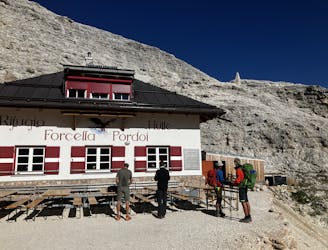
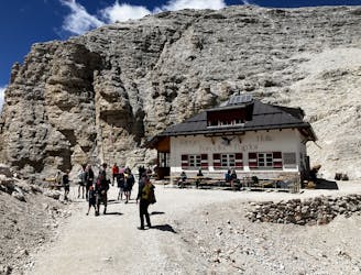
11 routes · Hiking