2a tappa - dal Rifugio Jervis al Rifugio Granero #backtopuremountain
By Davide Cirioni
Hiking Moderate
- Distance
- 6.7 km
- Ascent
- 668 m
- Descent
- 24 m
- Duration
- 2-3 hrs
- Low Point
- 1.7 km
- High Point
- 2.4 km
- Gradient
- 21˚

This is a popular hiking route which is generally considered to be moderate. It's an unknown remoteness, it features unknown exposure and is typically done in an unknown time of year. From a low point of 1.7 km to the maximum altitude of 2.4 km, the route covers 6.7 km, 668 vertical metres of ascent and 24 vertical metres of descent.
Description
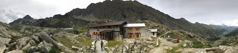
Si parte dal Jervis a 1732 m slm nella Conca del Prà per arrivare dopo 4 km ed una leggera pendenza alla salita di 4 km circa che porta al Granero (2377 m slm). Bellissimo paesaggio!
Difficulty
Moderate
Hiking along trails with some uneven terrain and small hills. Small rocks and roots may be present.