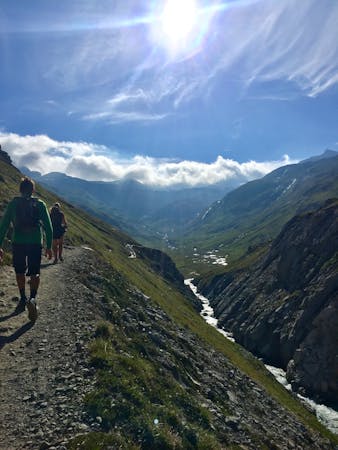
Le Vallon du Prariond
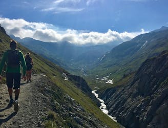
A medium length hike through gorges past grazing animals and leading towards a Col at 2957m.
Moderate Hiking
- Distance
- 11 km
- Ascent
- 955 m
- Descent
- 955 m
Alternative Col hike from Vallon du Prariond
Hiking Moderate

Escape into the realm of ibex, chamois, and marmots where the peace and tranquility will leave you wanting to stay the night at the nearby refuge.
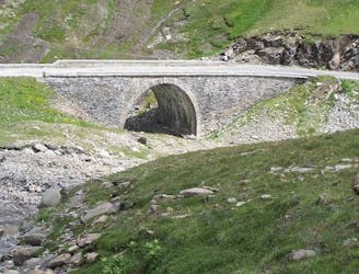
The route starts near the bridge at the first hairpin of the Col de l'Iseran, after Val d'Isere.
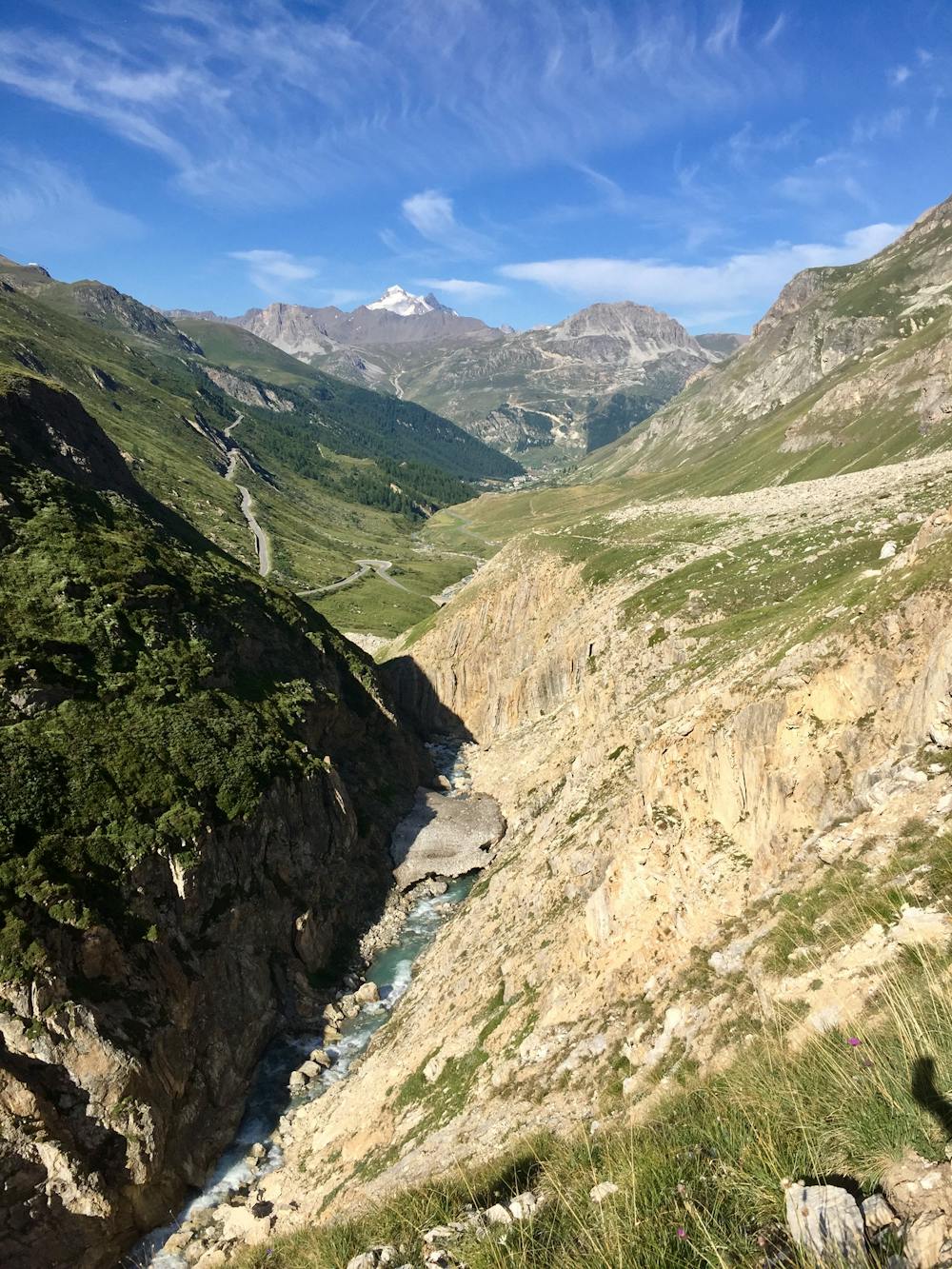
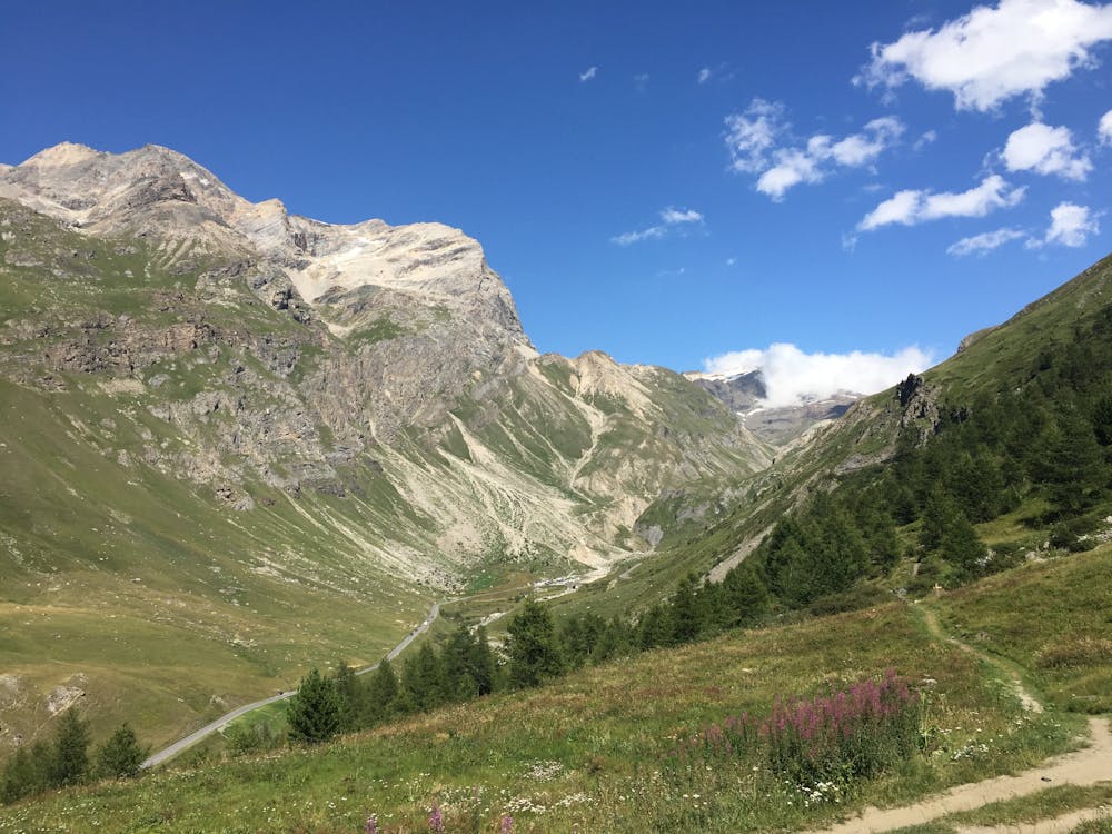
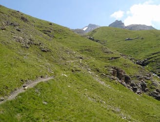
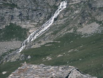
It begins with a steep climb on a well-laid-out path overlooking an impressive gorge. Climbing a few hundred meters, the valley opens and you are greeted with a green lake, high mountains, and tame marmots. You will soon arrive at the Refuge du Prariond where you can stop for a coffee or lunch.
You can return to the car at this point or continue on towards the Col de la Lose. Alternatively, at the intersection, you can head toward the alternative Col by taking the right-hand trail heading to Col de la Galise (2987m). The route shown here climes to Col de la Galise.
Once at the top, you can look far down into the Italian Vallee de Cenesole. After taking in the view, follow the same path back to the car.
Dogs are not permitted on this trail.
Moderate
Hiking along trails with some uneven terrain and small hills. Small rocks and roots may be present.

The trail contains some obstacles such as outcroppings and rock which could cause injury.

Little chance of being seen or helped in case of an accident.
A medium length hike through gorges past grazing animals and leading towards a Col at 2957m.
Moderate Hiking
2.3 km away
A long-distance hike with a rare landscape on arrival.
Moderate Hiking
4.8 km away
Discover Lac d'Ouillette, hidden from view from the Val d'Isere resort and onwards to a remote, rugged Col.
Moderate Hiking
4.8 km away
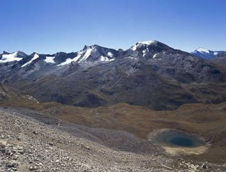
A stunning and strenuous round circuit through the Bailletaz Nature Reserve, passing above the glacial Lac de la Sassière.
Difficult Hiking
5.4 km away
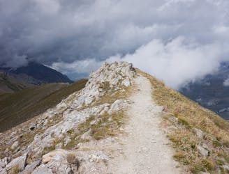
A short, accessible summit hike to the rugged heights of Pointe des Fours from the Snow Bridge close to Col d'Iseran.
Moderate Hiking
6.3 km away
A walk along the rocky alpine pastures, facing the majestic glacial cirques of the Arc springs.
Moderate Hiking
6.3 km away
This hike towards the Col and Lake Grand Fond in Vanoise National Park offers a superb view of the glaciers, the peaks, and a beautiful lake.
Difficult Hiking
9.2 km away
A true alpine experience with high exposure along the Tovière ridge.
Moderate Hiking
9.4 km away
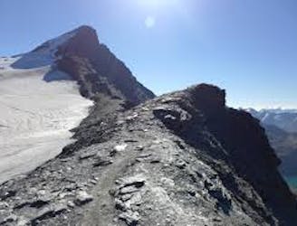
This summit climb provides a high alpine challenge along a ridgeline beside Sassière glacier, with stunning views the entire route.
Difficult Hiking
8 routes · Hiking

14 routes · Hiking