3 km away
Xlendi to San Lawrenz via the Inland Sea
One of the finest hikes on Gozo which passes several of the island's best known landmarks.
Difficult Hiking
- Distance
- 8.2 km
- Ascent
- 370 m
- Descent
- 243 m
Possibly the highlight of the Gozo Coastal Trail - this is a gorgeous hike along a wild coastline.
Also in Għarb, Malta • Għasri, Malta • San Lawrenz, Malta
Hiking Moderate

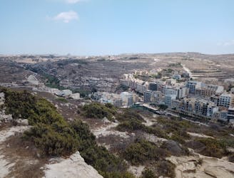
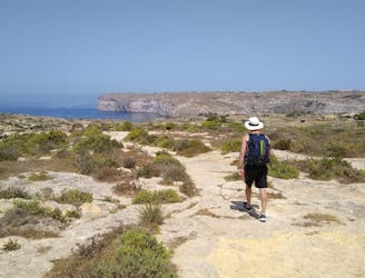
This must surely rank as one of the best hikes in the Mediterranean - it starts from a historical little village, ends at Gozo's busiest seaside resort and passes some huge and imposing cliffs en route.
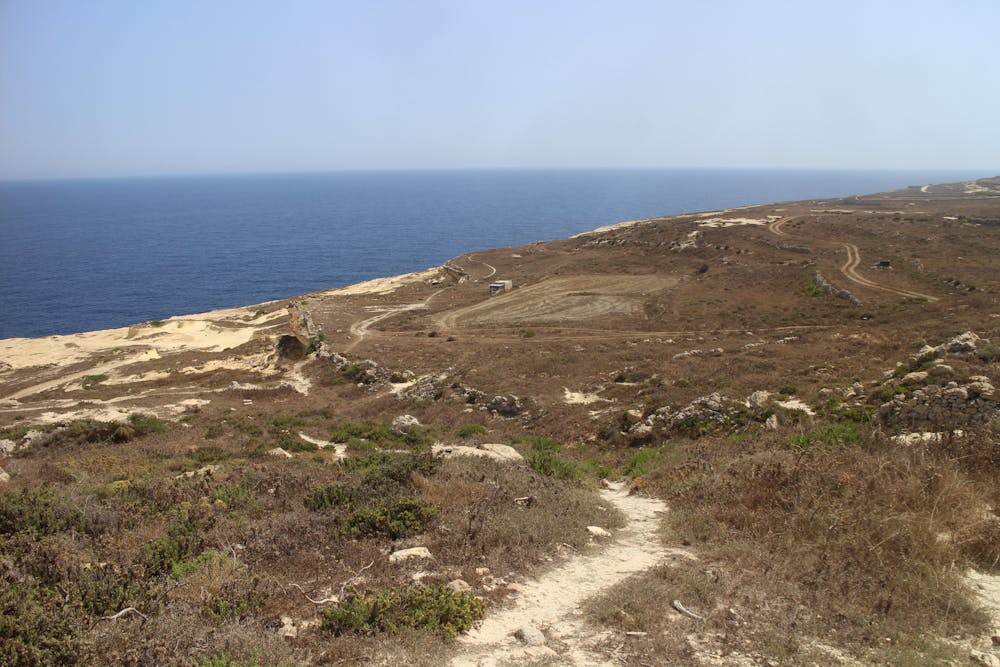
Start by strolling from San Lawrenz to Gharb village and then continue north on quiet roads and tracks to a bumpy path which leads down to Gozo's north coast. Turn right upon reaching the coast and follow lovely little paths to a larger jeep track. Walk along this, deviating off it whenever a more appealing option presents itself. There are tracks everywhere and provided you keep the cliffs on your left (and don't go too close to them!) you shouldn't go too far wrong.
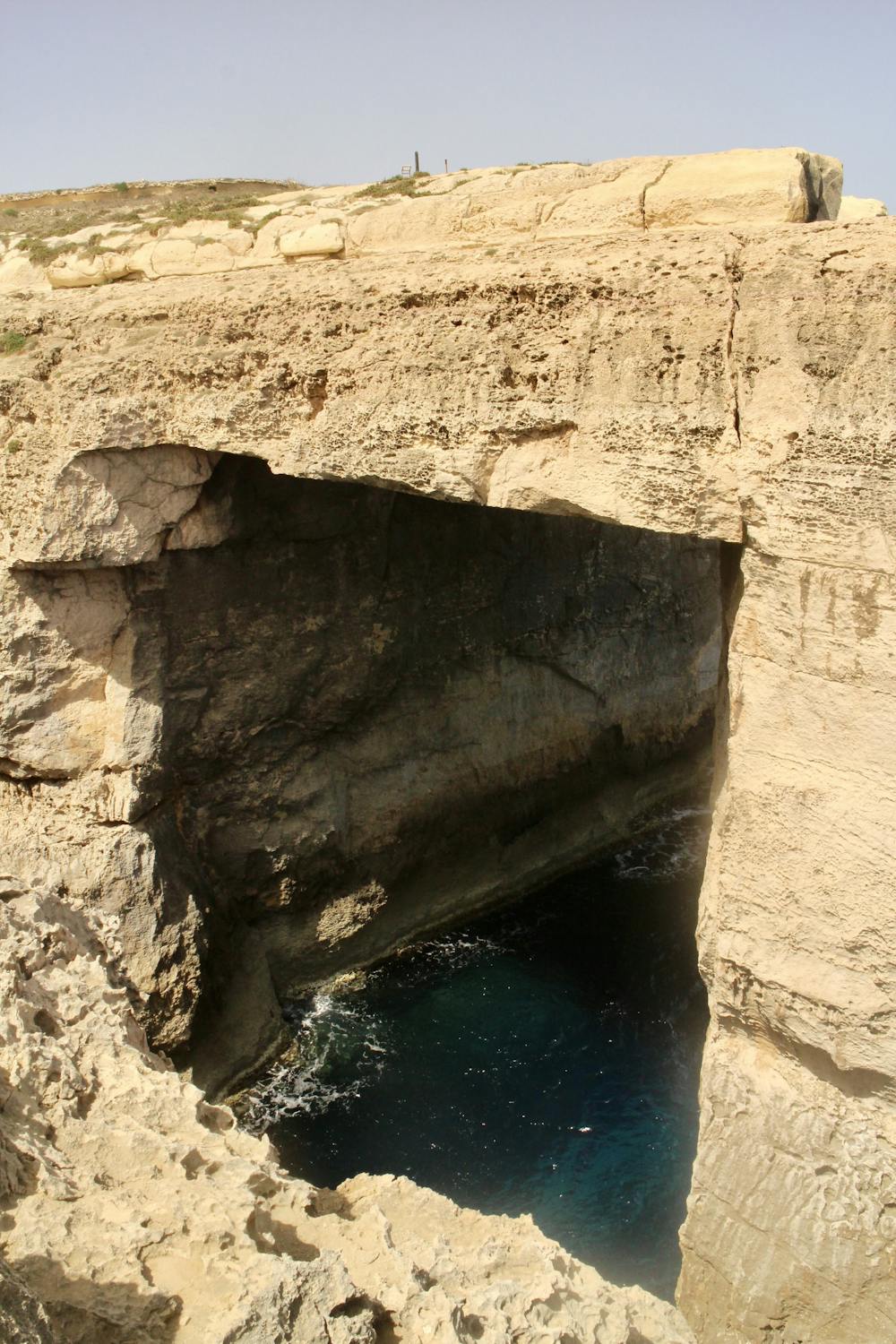
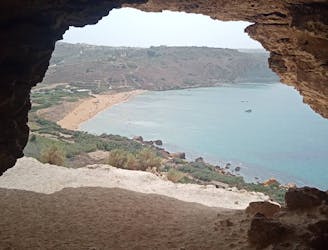
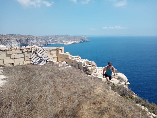
The path leads easily to the spectacular Wied el Mielah arch - a well known feature and the location of some adventurous rock climbing on the rough rock for which Gozo is known. There is a walkway down to sea level and it's worth wandering down to take a closer look at this spectacular natural feature. From the arch you can either get back on the jeep track or follow a path right on the edge of some cliffs which in turn leads back to the jeep track via a couple of easy but exposed scrambling moves.
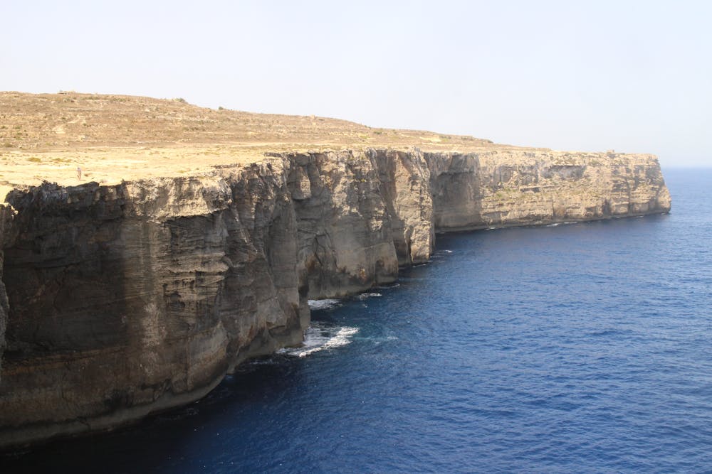
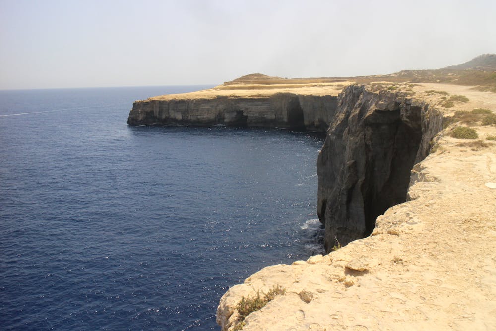
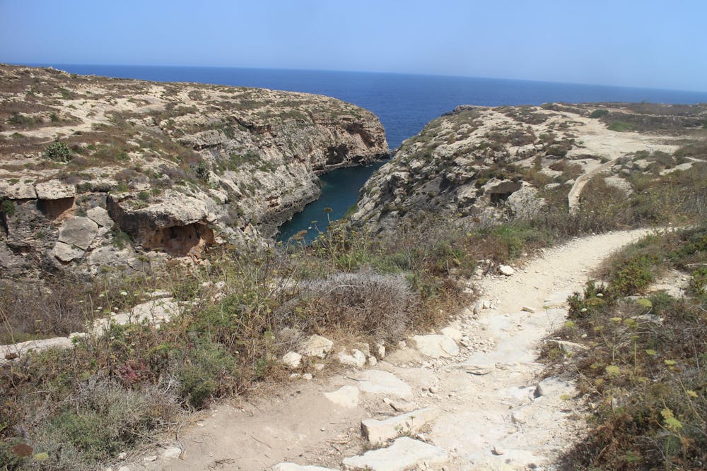
Continue along the coast to reach a huge bay, ringed by 40 metres cliffs. Leave the path and walk across a huge rock slab which leads north and then around to the east, at which point you'll meet another path. Follow this to the entrance of the wonderful Wied el Ghasri inlet - one of Gozo's best swimming and snorkelling spots. Walk all the way along Wied el Ghasri before doubling back to the path which accesses the inlet. A swim is all but compulsory (!) so enjoy the water and then resume your trip along the coast.
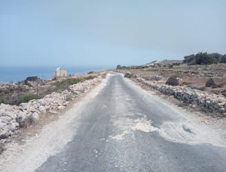
A nice track leads all too soon to a road. Stroll along this through Il-Qbajjar village and then into Marsalforn, where food and drink awaits!
Moderate
Hiking along trails with some uneven terrain and small hills. Small rocks and roots may be present.

The trail contains some obstacles such as outcroppings and rock which could cause injury.
Away from help but easily accessed.
3 km away
One of the finest hikes on Gozo which passes several of the island's best known landmarks.
Difficult Hiking
4.6 km away
A fun little mini-hike to a local landmark
Difficult Hiking
5.2 km away
Go from seaside resort to peaceful village and pass through some fabulous scenery en route.
Difficult Hiking
5.2 km away
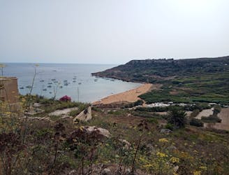
A rugged hike to a gorgeous sandy beach and then back through peaceful dusty streets.
Difficult Hiking
8.7 km away
Travel between 2 of Gozo's main villages and visit 2 of its finest swimming spots.
Moderate Hiking
9.2 km away
Go from Gozo's biggest port to one of its most popular beaches via some breathtaking clifftops.
Moderate Hiking
5 routes · Hiking