2.6 km away
Prutaš Peak
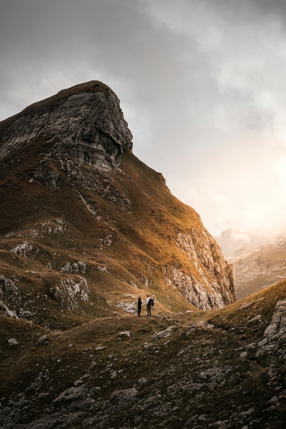
A heroic uphill hike with a thrilling downhill scramble to the best views of the Durmitor Massif.
Severe Hiking
- Distance
- 10 km
- Ascent
- 792 m
- Descent
- 794 m
An absolutely must do in the Durmitor mountains!
Hiking Difficult

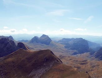
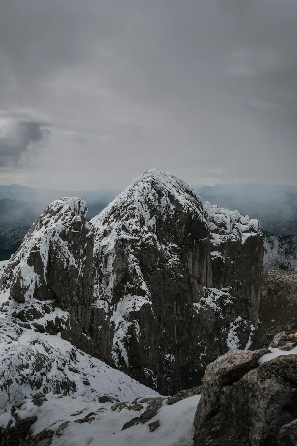
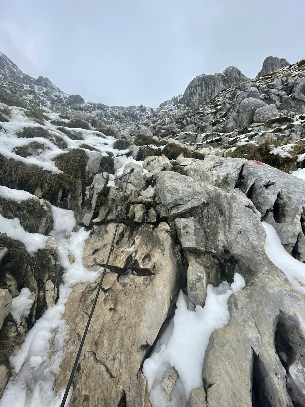
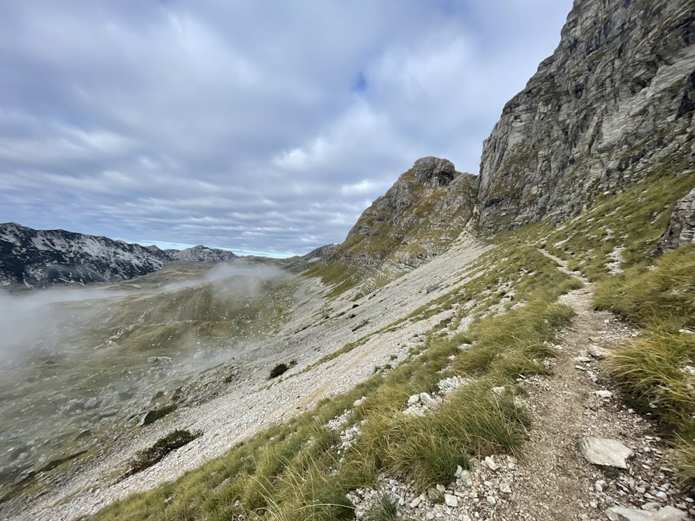
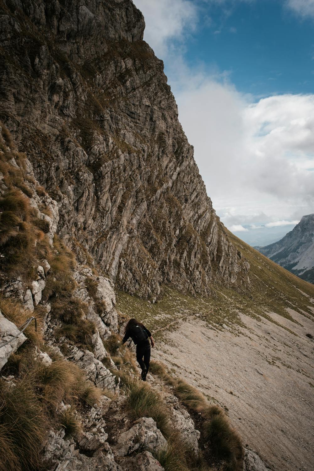
This hike is best done from June until August or September. I did it in the beginning of October and there was already snow, so be aware of that - the gradients are sometimes around 50 percent! But you will be rewarded with an absolutely stunning view of the Durmitor mountains and hike through ridges which are one of a kind. Please wear some proper mountain shoes and take good equipment with you, because the weather can change drastically.
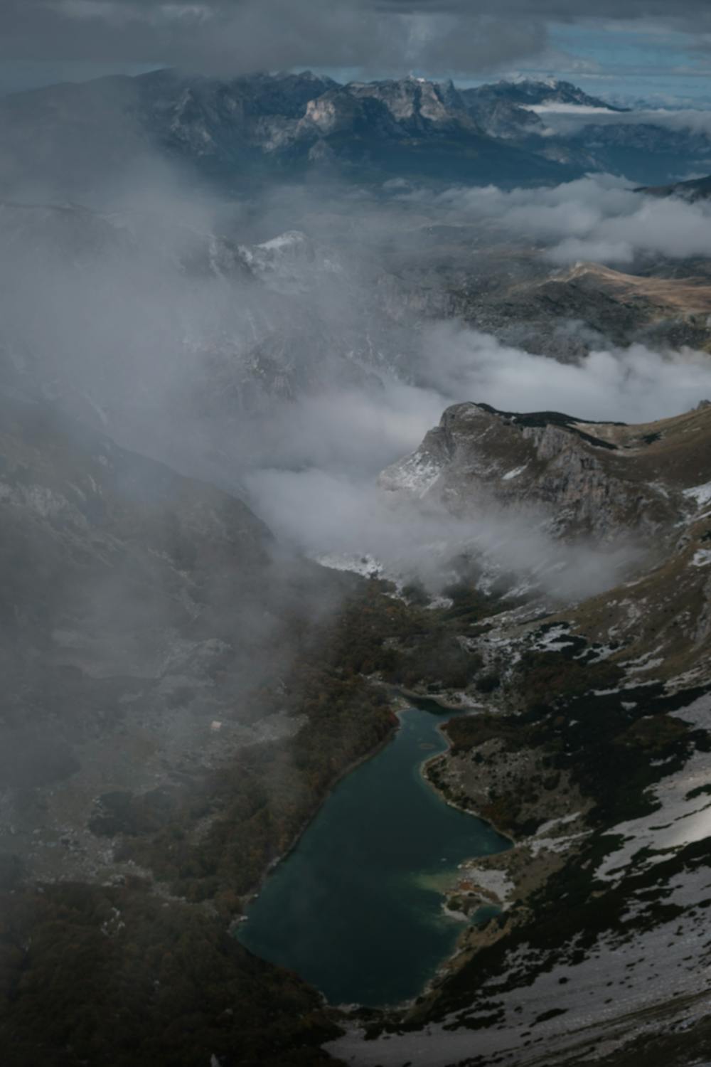
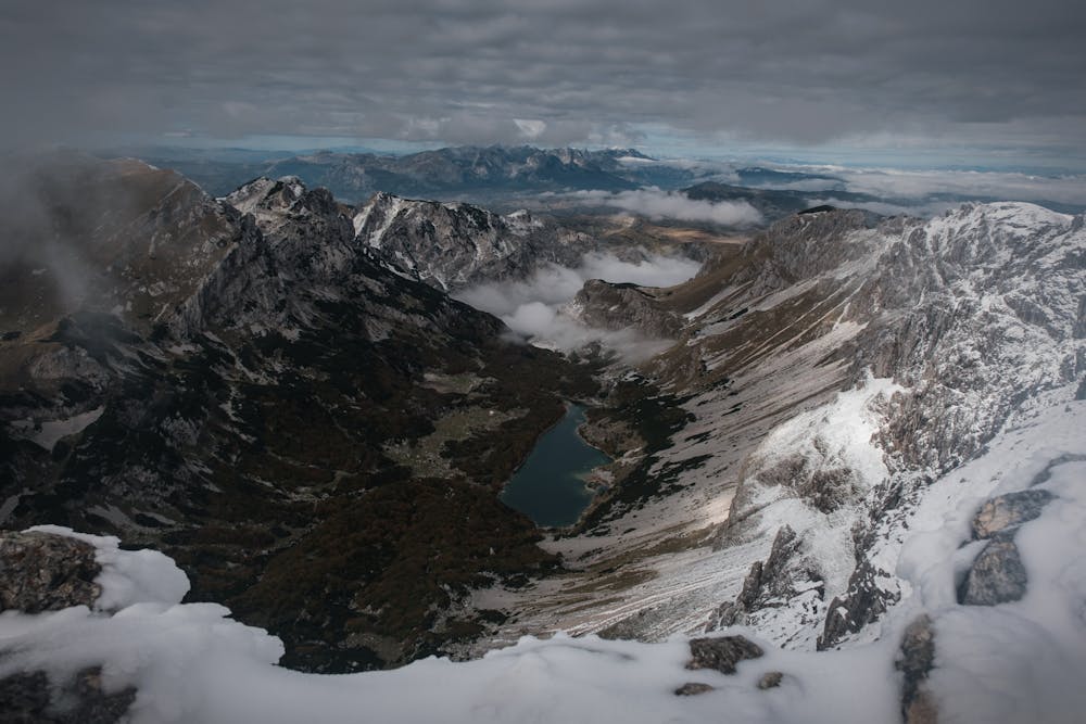
Bobotov Kuk is highest peak of Durmitor mountains and 4th highest peak in Monte Negro, but in many publications you will find info that Bobotov Kuk is the highest in Monte Negro. It is because those 3 peaks that are higher are placed in Prokletije massif and are on the border with Albania while on the other side Durmitor is in central Monte Negro, it is beauty symbol of the country and because of that closest to the heart of Montenegrins.
Position: Its rocky pyramid is placed in the central part of the mountain and roughly in the middle of the main crest which stretches in NW-SE direction. Like a high throne it overlooks magnificent surroundings. From three sides its neighbours are attractive and equally sharp and wild rocky peaks. Two of those three peaks are on the main crest: on the NW is Bezimeni Vrh (2487m), while on the SE is Lucin Vrh (2396m), which is separated from Bobotov Kuk by deep Velika Privija pass (2351m). On the SW, separated by narrow Skrcki Pogled pass, is Soa or Djevojka (2440m), wild rocky peak which stands on the beginning of streak of peaks that are perpendicular on main crest.
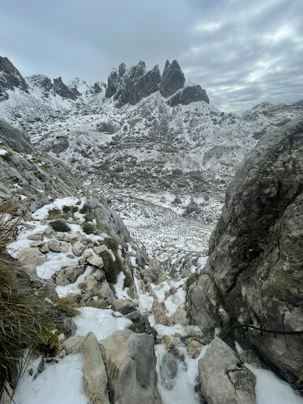
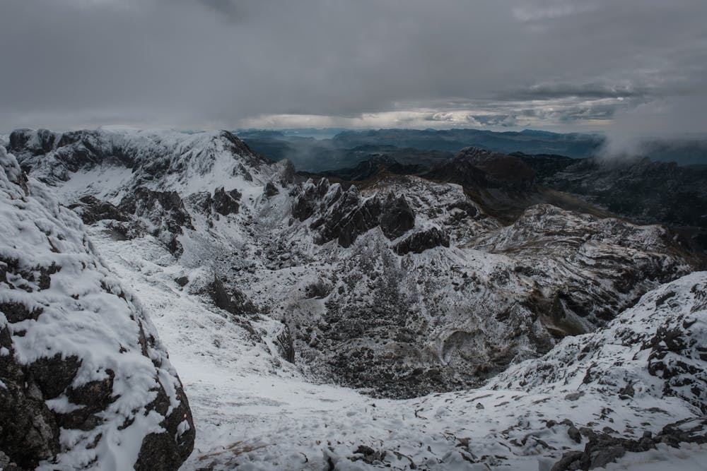
Peak & Surroundings: Northern and eastern sides of here compact summit pyramid, which is around 200m high, rises above steep scree slopes that descent into large rocky basin Valoviti Do (between 2000 and 2100m), which is strewn with huge boulders and partially covered with snow remains whole summer. Western side of Bobotov Kuk is most impressive. Together with Bezimeni Vrh and Djevojka peaks Bobotov Kuk, which is between them, form biggest wall (sort of amphitheater) of Durmitor. It is around 400m high and almost 2km wide. Below the wall are immense scree slopes, equally high, that descent steeply towards the bottom of amazing Skrka valley, which contains Veliko Skrcko Jezero (1686m) and Malo Skrcko Jezero (1711m) lakes. This is most beautiful part of Durmitor! On the south Bobotov Kuk falls steeply towards the basin of Zeleni Vir (2028m) lake, which is placed at the bottom of the beautiful amphitheater above which walls of Bobotov Kuk, Lucin Vrh, Minin Bogaz (2387m) stretch. South of the lake are Zupci (2309m), fantastic string of cliffs that look like teeth of some dangerous dinosaur. Lower 300m of this side of Bobotov Kuk is mix of steep rocky terrain with lot of grass and scree. Above it is summit pyramid.
Short history: Due to isolated position, wild surroundings and volatile history of continued liberation struggle Durmitor and its highest peak were very lately discovered, both scientifically and esthetically. Scientists came first, of course. They were very rare. First of them was Amie Boue who wrote about geology of Durmitor in his book ‘Geological Excursion in Turkish Europe’ in 1840m. In 1883 Bobotov Kuk was first climbed by Dr. O.Baumann. Those were the years of more intensified scientific research of Durmitor. In 1895 German geographer Kurt Hussert wrote first book about physical geography of Durmitor. At the end of 19th century Serbian botanist Josip Pancic discovered many endemic and rare floral species. Extraordinary karts phenomena on Durmitor was first described by Serbian scientist Jovan Cvijic, who was then known in the world after his Das Karstphanomen dissertation from 1893. Then came volatile part of early 20th century and everything was stopped for a while. First organized mountaineering group visited Durmitor in 1926. They were members of Sljeme club from Zagreb, Croatia. In the same year first climbs in the eastern face of Bobotov Kuk were done. In 1931 2 Austrians, Bauer and Obersteiner, did first winter ascent via NW ridge of Bezimeni Vrh and some other peaks. In 1933 group of Slovenian climbers first climbed highest faces of Durmitor, those of Bezimeni Vrh and Bobotov Kuk above Skrka valley. Group of Slovenians also did first winter climbs in the faces of highest peaks of Durmitor in 1940. Only after the II World War Durmitor became well know destination for tourists, hikers, climbers and skiers.
Difficult
Hiking trails where obstacles such as rocks or roots are prevalent. Some obstacles can require care to step over or around. At times, the trail can be worn and eroded. The grade of the trail is generally quite steep, and can often lead to strenuous hiking.

Some trail sections have exposed ledges or steep ascents/descents where falling could cause serious injury.
Little chance of being seen or helped in case of an accident.
2.6 km away
A heroic uphill hike with a thrilling downhill scramble to the best views of the Durmitor Massif.
Severe Hiking
7.2 km away
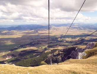
An idyllic forest hike followed by a scenic ski lift ride to Savin Kuk Peak.
Moderate Hiking
7.4 km away
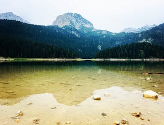
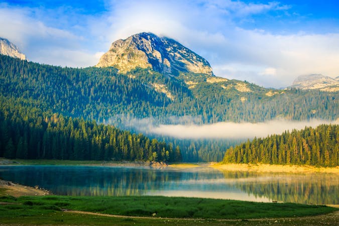
A family-friendly forest walk to Durmitor National Park's highlight.
Moderate Hiking
3 routes · Hiking