Rondeslottet
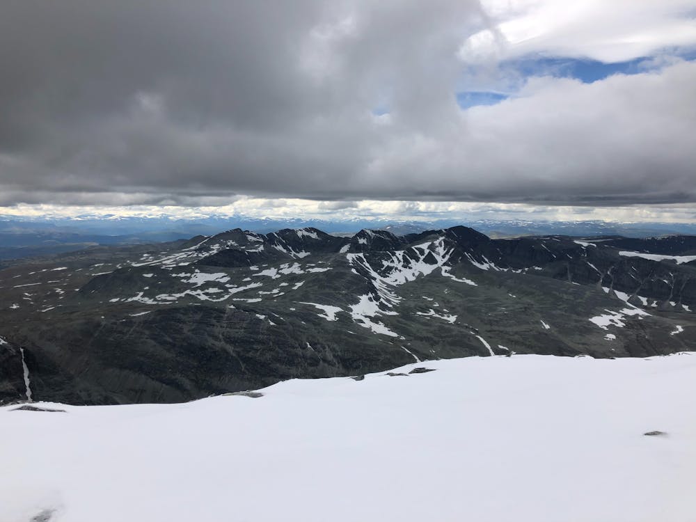
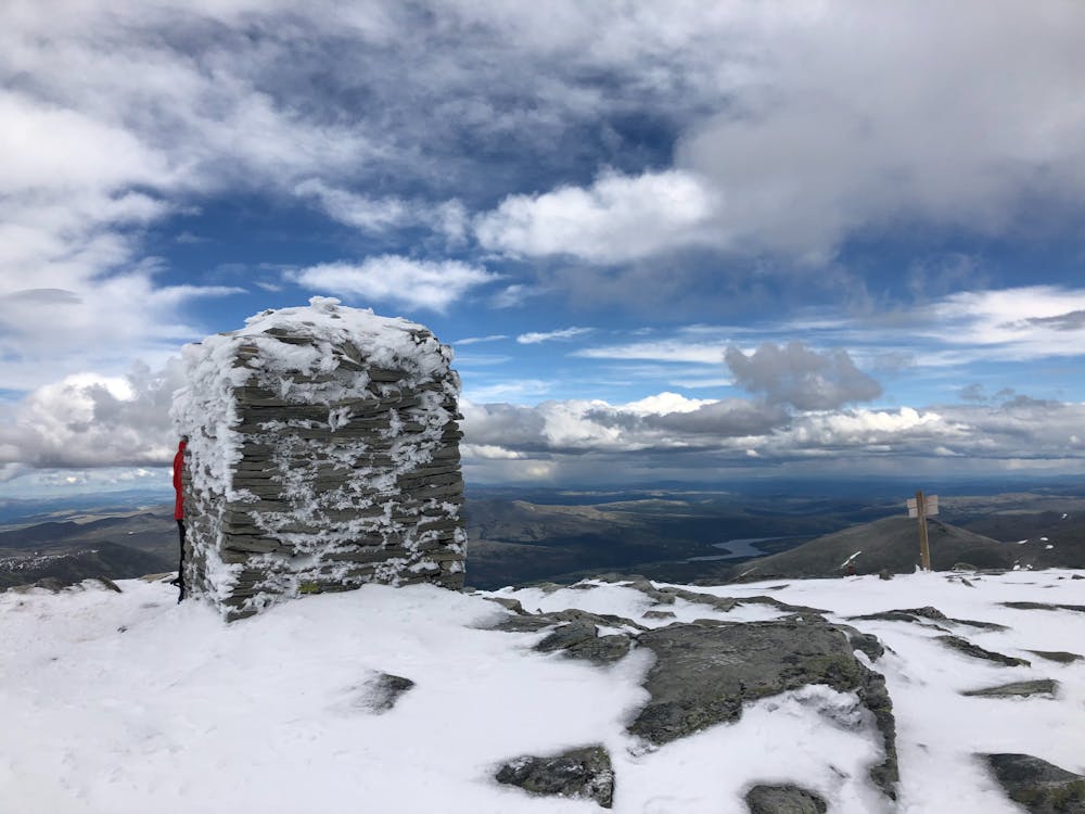
The majesty of Rondane, the highest peak in Norway's oldest natural resort offers great view in all directions
Hiking Severe
- Distance
- 13 km
- Ascent
- 1.3 km
- Descent
- 1.3 km
- Duration
- 4-5 hrs
- Low Point
- 1.2 km
- High Point
- 2.2 km
- Gradient
- 22˚
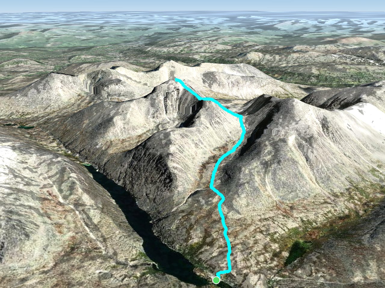
Seen from the west, Rondeslottet's contours draw a picture of a castle. This is the highest peak in the area, and this is the route description from Rondvassbu. The summit is also accessible from the east side with Bjørnhollia as the start point.
- •
- •
- •
Description
The approach to Rondvassbu is done either with a bike or by walking on the dirt road from the "Spranget" parking lot. Preferably this is done the previous day. You can either camp in a tent or book in at the Rondvassbu tourist cabin.
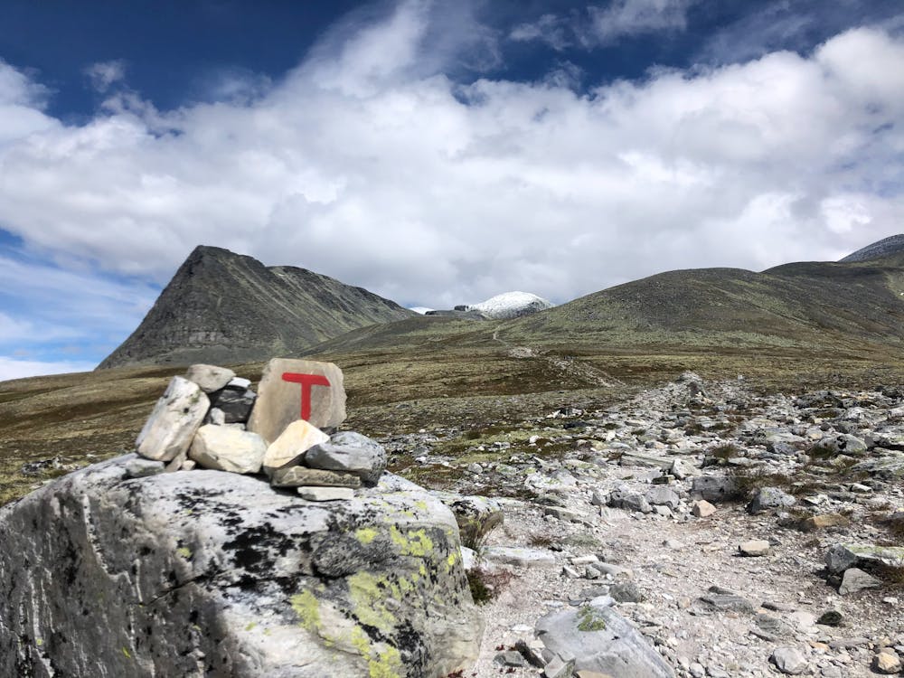
From the yard at Rondvassbu there's a sign to the trail which goes up the hill behind the cabin, starting with stairs of rock. After approximately one kilometre there's a crossroad which splits the trail into the path to Storronden and to Rondeslottet. Take a left and follow the path to Rondslottet into the valley. At the valley floor there's a river with fresh water - this is the last chance to fill up your bottles.
Follow the trail up to the col between Vinjeronden and Storronden, before it turns to the left up the steep hill to Vinjeronden. This is the "little brother" of Rondeslottet. From the summit of Vinjeronden there's a little descent before the final climb up to Rondeslottet.
There is a huge cairn at the relatively flat summit plateau. From the top you can descend the same way as the ascent; back to Rondvassbu. Alternatively you can descent the east side along the marked trail to Bjørnhollia.
Difficulty
Severe
Hiking challenging trails where simple scrambling, with the occasional use of the hands, is a distinct possibility. The trails are often filled with all manner of obstacles both small and large, and the hills are very steep. Obstacles and challenges are often unexpected and can be unpredictable.
Medium Exposure

The trail contains some obstacles such as outcroppings and rock which could cause injury.
Remoteness

Little chance of being seen or helped in case of an accident.
Best time to visit
Features
- Wildlife
- Summit Hike
- Water features