7 m away
Store Dyrhaugstinden
Great skiing with a spectacular view
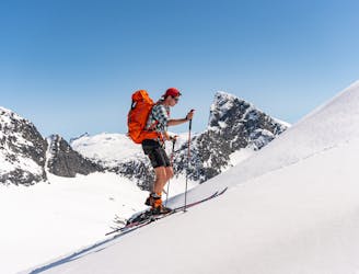
Moderate Ski Touring
- Distance
- 12 km
- Ascent
- 1.3 km
- Descent
- 1.3 km
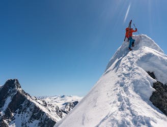
A long and demanding trip for the experienced alpinist
Ski Touring Extreme

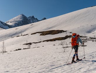
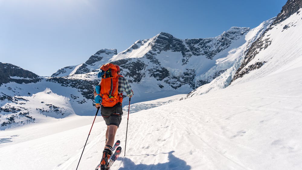
This is a long day out in the most scenic and alpine area of Hurrungane. This route has everything, from surpassing crevasses in the icefall, exposed ridges and steep skiing. The whole experience is overwhelming!
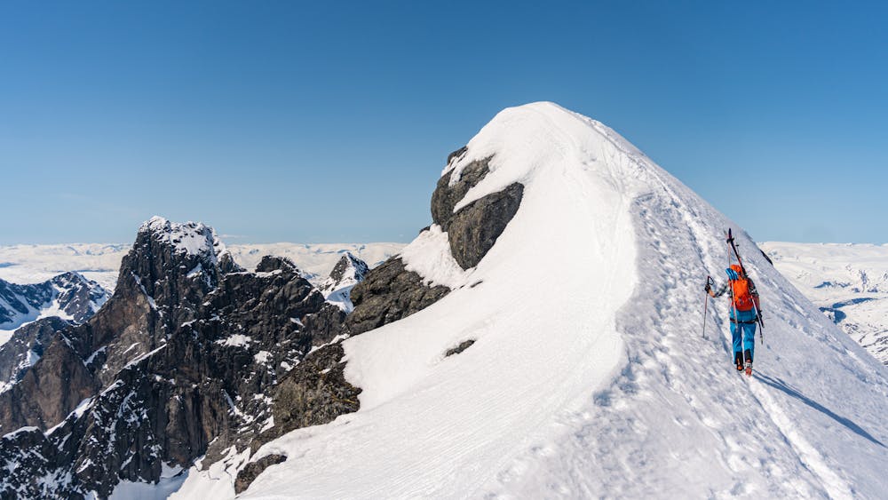
Start from the Turtagrø Hotel, crossing the road and follow the west side of the river from Skagastølsdalen. Pass "Skagastølsknubben" on the east side. Follow the river into Skagastølsdalen and after 2 kilometres you will come to a hill (30-35 degrees), which is best ascended on the east side. Arriving at the hut called "Tindeklubhytta", head up east to the lake at 1584 metres above sea level, between Kolnosi and Nordre Skagastølstind.
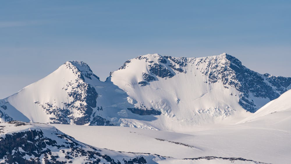
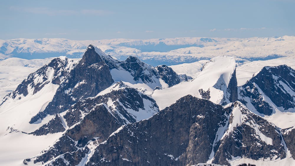
From the lake continue to the east, holding the height and turning southwards. Soon you will see the slope down to Styggedalsbreen Glacier. On the other side of the glacier, to the southeast, you will see the passage to Gjertvassbreen Glacier. This is where you are heading. Cross Styggedalsbreen on the north side of the crevasses and head for the passage.
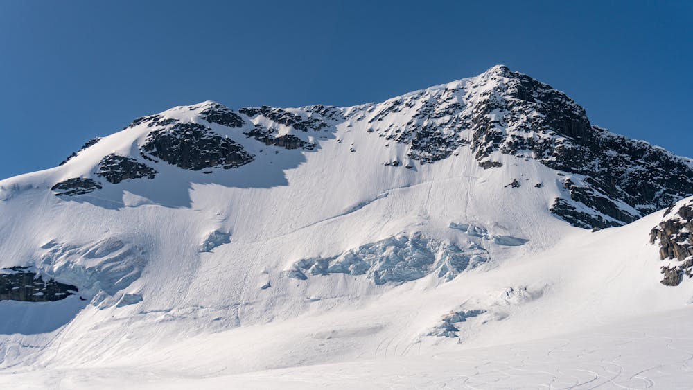
When up on Gjertvassbreen, facing southwards, you will see Styggedalstindane and the north face descending to the right and Gjertvasstind to the left. Head for the col named Gjertvassskaret in between the peaks. Navigate through the icefall. Here it's quite steep (45 degrees) and it may be icy, so it would be wise to use rope and crampons. Up at the col, continue to the west heading for the east summit.
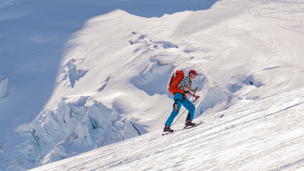
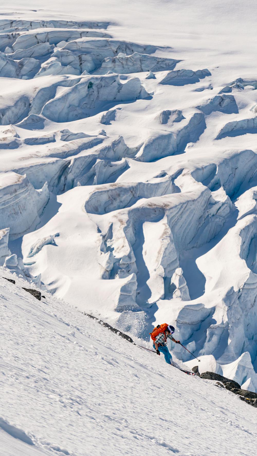
At the summit, there's an exposed ridge leading westwards. It's not necessary to belay, but watch your steps. The crux is a little shelf where you need to push yourself up. At the lowest point on the ridge is the entrance of the north face descent. If you want you can take a detour to the west summit to enjoy the view of Store Skagastølstind and the rest of Hurrungane. For the descend you can either go for the north face or the same way as the ascent. The north face is at its steepest at the top of the line (50 degrees). Depending on the snow conditions you may have both cliffs and crevasses beneath you.
Back at Gjertvassbreen, descend the same route as the ascent. Don't forget to enjoy the amazing view of the Skagastøls Massif and the icefalls!
Extreme
Extreme skiing terrain above 45 degrees. These routes are reserved for experienced experts.

As well as the slope itself, there are some obstacles (such as rock outcrops) which could aggravate injury.

In the high mountains or remote conditions, all individuals must be completely autonomous in every situation.
7 m away
Great skiing with a spectacular view
Moderate Ski Touring
1.8 km away
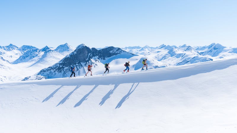
Norway's finest ski trip (!)
Difficult Ski Touring
5 km away
Hard to decide whether the skiing or the view is the best
Severe Ski Touring
4 routes · Ski Touring