Triglav - from Val Vrata
Climb to the highest Slovenian peak, Mount Triglav 2864 m called Tricorno, starting from Val Vrata and climbing the Prag route and then the normal route to the summit.
Also in Bovec, Slovenia
Alpine Climbing Difficult
- Distance
- 8.1 km
- Ascent
- 1.8 km
- Descent
- 36 m
- Low Point
- 992 m
- High Point
- 2.8 km
- Gradient
- 26˚

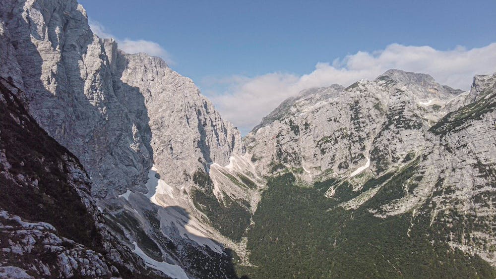
Mount Triglav with 2864 m is the highest peak in the Julian Alps and in Slovenia, of which it is a national monument. The mountain is located in the middle of the national park of the same name. On the summit since 1895 there is a characteristic bivouac called Aljazev stolp (Aljaz tower). The mountain is a symbol of Slovenian identity, it is represented in stylized form in the national coat of arms, in the flag and in the Slovenian 50 cents euro coin; Moreover, according to tradition, every Slovenian at least once in his life should climb to the top of the Tricorno. According to tradition, the name derives precisely from its three-pointed shape (Triglav means three heads).
- •
- •
- •
- •
- •
- •
- •
- •
Description
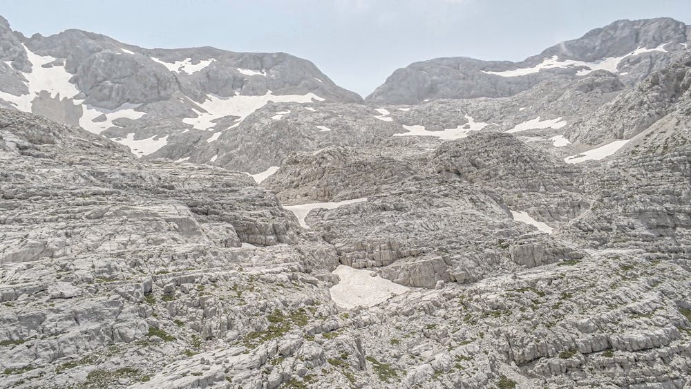
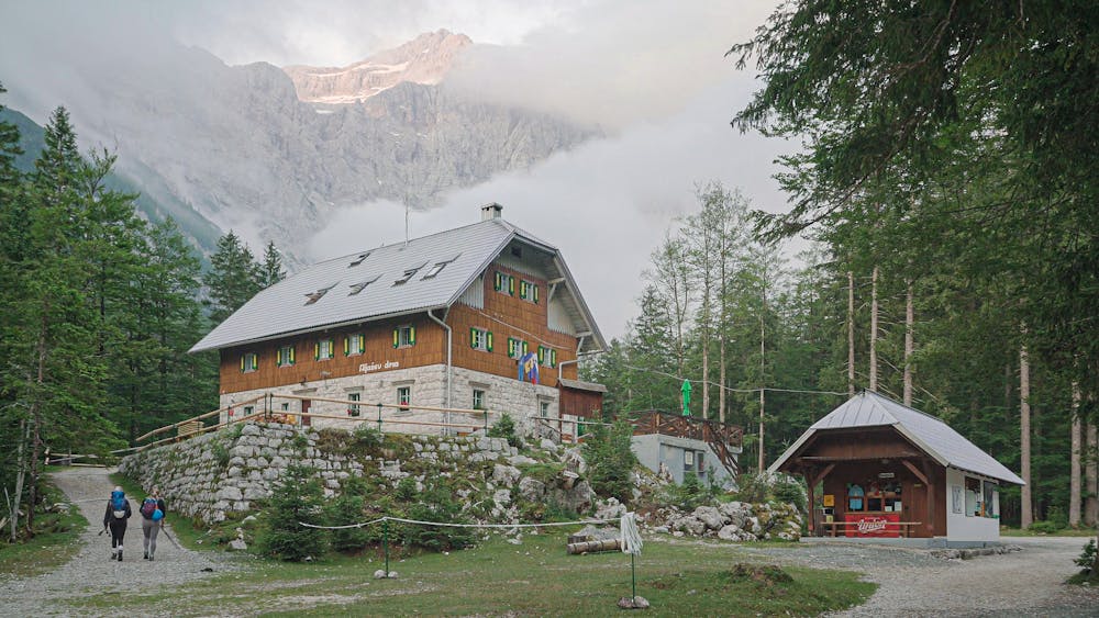
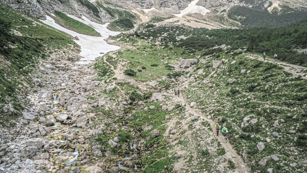
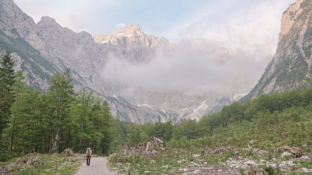
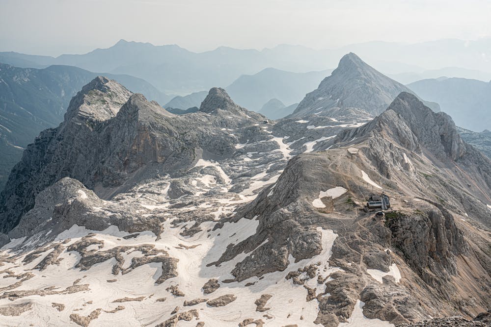
Access: From Tarvisio to the Fusine pass. Continue past Kranjska Gora to reach Mojstrana. From here, entering the town, turn right along the Vrata valley to the square of the Aljazev Dom refuge (1015 m) where you can park. From the refuge, take a flat path that proceeds south on the valley floor approaching the stream. Shortly after we pass by the large and suggestive monument to the fallen partisan mountaineers consisting of a gigantic nail with carabiner. After passing another plaque, continue briefly and then cut to the left (the path to the Luknja fork continues on the right) and cross the stream. We are now at the base of the wall; You pass a ledge (some iron pegs) and then you reach the long green ledge which cuts to the left and which you follow entirely. At the end of the ledge, climb steeply overcoming rocks and detrital sections to reach the compact wall of the Prag which can be overcome thanks to the pegs and on-site insurance. Further on you continue with an implacable climb up to the mouth of a valley (often with snow) which you cross and go up on its right bank. Beyond a last rocky outcrop, turn left and come to a sign under a limestone wall: we are on the edge of the large detrital plateaus of Kredarica whose valleys remain covered with snow for most of the summer season. Leave the signs to the left for Stanicev Dom, go through these desolate lands to the south and with a long and slow climb you get close to the already visible Triglav; Skirting the small perennial glacier of the north wall called Zeleni sneg (green Nevaio) and bypassing a last rocky ridge, the Triglavski Dom refuge (2515 m) appears and can be reached shortly (4 hours from the parking lot).
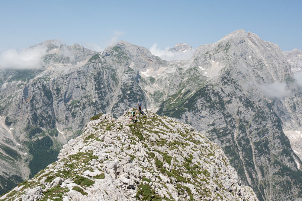
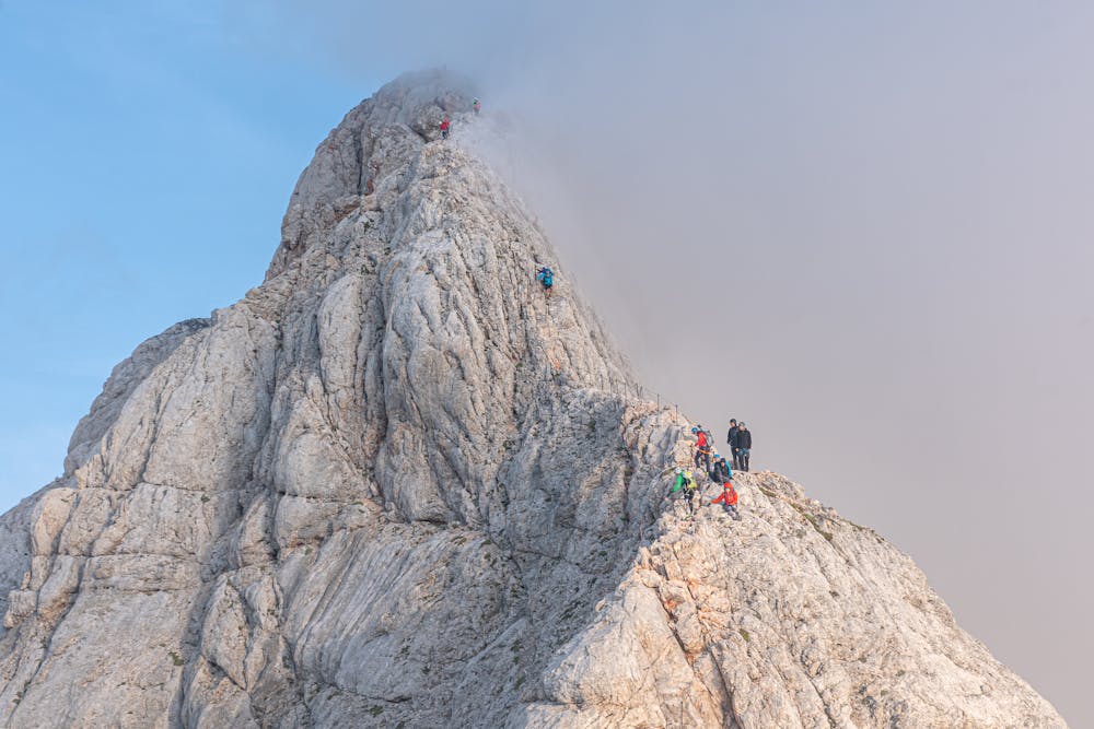
Description of the climb: From the refuge in a few minutes you descend southwards to the saddle below at the foot of Mali Triglav. Now go up a steep detrital slope (snow) up to the first rocks and then follow the path equipped with many metal pegs and some steel ropes up to the summit of Mali Triglav 2725 m. Continue along the panoramic ridge which is almost flat and leads under the summit; The walk is quite easy, but you must always pay the utmost attention, especially if with residues of snow or wet rock. After the plaque dedicated to the painter Marko Pernhart, a last steep stretch leads to the summit where the characteristic red and white metal tower of Aljazev stolp stands (1 hour from the Triglavski Dom refuge).
Descent: As for the climb.
Difficulty
Difficult
The beginning of truly technical terrain which might involve pitched climbing on rock and/or ice, exposed terrain and complex route finding in ascent and descent. Equivalent to AD, AD+
Medium Exposure

The route features some exposed and/or difficult to protect sections.
Remoteness

Close to help in case of emergency.